The Coastal Route of the Portuguese Camino - a 2026 guide
The Coastal Route is one of the trails of the Portuguese Camino from Porto. The total distance of the route is 274 km/170 mi. It starts in Porto and goes along the coast till Vigo. It merges with the Central Route in Redondela. In 2025 a half of pilgrims who completed the Portuguese Camino walked the Coastal Route. The Portuguese Camino is getting increasingly popular, and many pilgrims choose this route as an alternative to the Camino Frances.

Despite the name only 30% of the route (between Porto and Redondela) is along the coast. If you want to walk by the sea as much as possible the Litoral Way (80% along the coast) might be a better option.
Affiliate disclosure. This post contains affiliate links. If you make a purchase or book a place, we may receive a small commission at no extra cost to you. Thank you!
Coastal Route PDFs
To make your planning easier we created downloadable PDF files for the Coastal Route of the Portuguese Camino. One file is with walking stages from Porto to Santiago de Compostela. One has a list of places to stay (municipal and private albergues, hotels, and guesthouses) along the route.
- Portuguese Camino Coastal Route - walking stages PDF Download
- Portuguese Camino Coastal Route - places to stay PDF Download
Portuguese Camino planner
You can use our free Portuguese Camino planning tool. Combine routes, add the Spiritual Variant, choose the daily distance, and a starting point get a customized itinerary with recommended places to stay.
GPX files of the route
If our PDFs and GPX files helped you plan your Camino, consider buying us a coffee ☕ — it’s a small gesture that means a lot and helps us keep creating quality content for fellow pilgrims!

The Coastal Camino - route overview
- Distance – 274 km/170 mi
- Number of days (stages) – 12-15 days
- Starting point – Sé Cathedral, Porto, Portugal
- Finishing point – Santiago de Compostela Cathedral, Spain
- Difficulty level – moderate
- Total ascent – 3990 m
- Total descent – 3716 m
- Walking surface 155 km/96 mi - asphalt/tar; 29 km/18 mi - cobblestones; 65 km/40.3 mi - footpath/gravel road; 24 km/15 mi - boardwalk; 1 km/0.6 mi - beach.
- Walking along the coast - 77.5 km/ out of 274 km/170 mi. The last 86 km/53.4 mi to Santiago are inland on the Central Route.
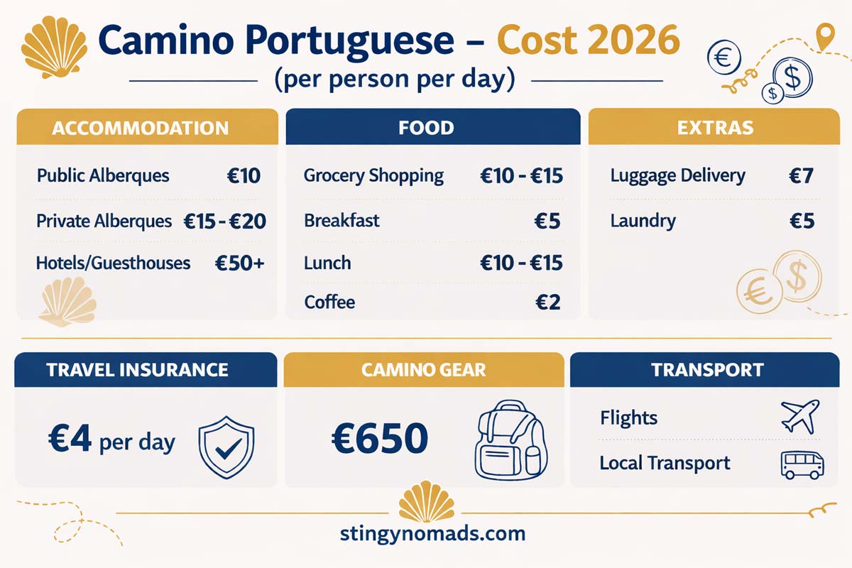
- Average cost – 30 euros per person per day if staying in albergues, from 50 euros pp. if staying in hotels.

Travel Insurance for the Camino
Walking like any other outdoor activity involves a risk of getting an injury or losing some of the gear. The Portuguese Coastal Camino is not a high-altitude hike through remote areas but it's still a physically challenging experience. Light traumas like blisters, knee pain, shin splints, etc. are quite common. Read more about Camino travel insurance or get an instant personalized quote from two companies right here. And decide which one works best for you.
World Nomads offers simple and flexible travel insurance. Buy at home or while traveling and claim online from anywhere in the world.How long is the Coastal Route?
The total distance of the Coastal Route from Porto to Santiago (Porto - Vigo - Redondela - Santiago) is 274 km/170 mi. It takes 12-15 days on average to complete the route. If you incorporate the Litoral Way into your walk the total distance will be around 280 km/173 mi. The stages stay the same but your daily distances might vary.

How to combine the Coastal and Central Route?
You can easily combine the Coastal and Central routes. There are two places along the Coastal Route of the Camino Portugues where pilgrims can switch to the Central Route.
- Vila do Conde - about 30 km from Porto (the second stage for most pilgrims). There is a route from Vila do Conde to Rates, that connects the Coastal Camino/Litoral Way with the Central Route.
- Caminha - about 107 km from Porto (the fifth stage for most pilgrims). The connecting route from Caminha goes along the Minho River to Valença where it merges with the Central Route.
There is another split on the Portuguese Camino after Redondela. From Pontevedra, there are two routes: the Spiritual Way and the main route of the Portuguese Camino.
If you want to know the difference between the two routes you can read our detailed post where we compare the Coastal and Central Route.
What is accommodation like on the route?
Like any other Camino de Santiago route the Coastal Way has public and private albergues, hotels, guesthouses, and a couple of campsites along the route.
Albergues are hostels for pilgrims. They usually have dormitory rooms with bunk beds and shared ablution facilities. Albergues can be public (run by a local municipality) and private.
Comparing public (municipal) and private albergues
| Features | Public albergues | Private albergues |
|---|---|---|
| Only for pilgrims | yes | no |
| Need a credential to stay | yes | no |
| Can be booked ahead | no | yes |
| Can stay as long as you want | only 1 night | yes |
| Price | 10-12 Euro | 20 Euro |
| Accept backpack delivery | usually no | yes |
Public albergues are the cheapest accommodation option on the Camino de Santiago. To stay in public albergues you'll need a Credential.
You can find public (municipal) albergues on the Coastal Route in
- Labruge (1st stage)
- Vila Chã (1st stage)
- Vila do Conde (2nd stage)
- Póvoa de Varzim (2nd stage)
- Aguçadoura (2nd stage)
- Marinhas (3rd stage)
- Castelo do Neiva (4th stage)
- Viana do Castelo (4th stage)
- Caminha (5th stage)
- A Guarda (5th stage)
- Vigo (8th stage)
- Redondela (9th stage)
The campsites on the Coastal Portuguese Camino can be found in
- Labruge
- Vila Cha
- Caminha
- A Guarda
- Baiona
- A Ramallosa
- Vigo

The cost of walking
The Portuguese Camino can be done on a different budget from 30 to 50+ Euros per person per day depending on how much comfort you need. The average cost of walking the Coastal Route is 35-45 Euro per person per day. We have a detailed post on the cost of the Portuguese Camino where you can find a lot of information for planning your estimated Camino budget.
Walking the Camino Portugues with 30, 40, and 50+ Euro per person, per day
| 30 Euro | 40 Euro | 50+ Euro |
|---|---|---|
| Accommodation | ||
| Public albergues, 10 Euro | Private albergues, 15-20 Euro | Private room, from 50 Euro pp. |
| Food | ||
| Cooking, 10 Euro | Eating Menu del Día, 10-12 Euro | Eating out twice a day, 20-25 Euro |
| Backpack delivery (optional) | ||
| 7 Euro | 7 Euro | 7 Euro |
| Extra (entrance fees, coffee, laundry, etc.) | ||
| 8 Euro | 8 Euro | 8 Euro |
What to pack for the Camino?
It's important to remember not to overload your backpack, make sure to bring only the necessary stuff. The two most important items to bring are good walking shoes and a comfortable backpack.
If you're planning on using a backpack delivery service (see the next paragraph) then you can pack as much as you wish.
For more details on what to pack for the Coastal Portuguese Camino for men and women for different seasons read our packing list for the Portuguese Camino post.

Best guidebooks
I believe Camino de Santiago guidebooks by John Brierley are the best. We used his A Pilgrim’s Guide to the Camino Portugués Lisbon – Porto – Santiago: including Camino Central, Variente Espiritual, Camino da Costa, & Senda Litoral on the Coastal Route and it was very helpful.
Looking for some interesting reading on the Camino? See our reviews of some of the Top Novels on the Camino de Santiago.
Coastal Route apps
- Camino Ninja. One of the pilgrims' favorite apps. Free. Available for Android and Apple
- Portuguese Way Premium. Free. Available for Android and Apple.
- Buen Camino de Santiago. Free. Available for Android and Apple.
Luggage transfer
If you don't want to walk with a heavy backpack you can use one of the luggage transfer services on the Camino. Tuitrans, Correos, and Pilbeo offer luggage delivery on the Coastal Route of the Portuguese Camino.
It works very easily a car picks up your backpack at your hotel or albergue in the morning and drops it off at your next accommodation place by lunchtime. The service costs 7 Euros per backpack per stage. If you decide to use the delivery service keep in mind that you'll have to stay in private albergues or hotels. Public albergues usually don't accept backpack delivery.
If you have some extra luggage that you won't need on the Camino you can send it directly to Santiago de Compostela using one of the above companies.

Porto, the beginning of the route
Porto is an amazing place to reserve a couple of days before or after the Camino to explore the city.
Tours & Activities in Porto
If you have extra time to stay in Porto before you start walking the Camino you can do a tour or a guided walk to discover this beautiful city.
- Porto Historic City Center walking tour
- Fado Show with Port Wine
- Douro Valley Wine Tour Including Lunch and River Cruise
- Half Day - Private TukTuk All Around Porto
Places to stay in Porto
There are many albergues in the city including one municipal albergue N.S. do Rosario de Vilar and one private albergue Albergue de Peregrinos do Porto.
If you rather stay in the center there are several options from hostels to luxury hotels depending on your budget.
- Low-end | CATS Porto Hostel | Onefam Ribeira |
- Mid-range | Portuense Alojamento Local | A Portuguesa Guest House |
- High-end | Maria da SÉ Historic House |

How to walk out of Porto: Coastal vs Litoral route?
You can walk out of Porto following the Litoral Way or the Coastal Route. Both routes start from Se Cathedral. The main difference is that the Litoral Way follows the coast from the beginning when the Coastal Route goes inland till Vila do Conde. Both routes merge in Vila do Conde and from there continue along the coast.
I've walked both routes and prefer walking out of Porto following the Litoral Way. It's a lot more scenic than the first stage of the Coastal Route. We have a detailed post on the 3 different routes of the Portuguese Camino from Porto.
The distance on the Litoral Way to Vila do Conde is longer than on the Coastal Route; 33 km/20.5 mi vs 29 km/18 mi. I'd suggest stopping in Labruge (24 km/15 mi) or Vila Cha (26 km/16 mi) instead of walking to Vila do Conde.
We have a detailed post comparing the Litoral Way and Coastal Route.

Coastal Route walking stages
Stage 1. Se Cathedral, Porto to Vila Chã, 26 km/16 mi
Porto - Matosinhos - Lavra - Labruge - Vila Chã
- Distance – 26 km/16 mi
- Time – 5-6 hours
- Accumulated ascent – 242 m
- Accumulated descent – 273 m
- Walking surface – 15 km/9.3 mi – asphalt; 10 km/6.2 mi – boardwalks; 1 km/0.6 mi – cobbled
- Walking along the coast - 23.5 km/14.6 mi are along the Douro River and coast
It’s a beautiful walking stage along the river and later the coast with plenty of restaurants and cafes.
The described stage is technically the Litoral Way, not the Coastal Route but most pilgrims (including myself) choose this route to walk out of Porto.
The first sage on the official Coastal Route from the Cathedral to Vila do Conde is inland. The route exists. It’s well-marked but the scenery is not as spectacular as on the Lirotal Way. In my opinion, the only reason to choose it is the distance. From Se Cathedral to Vila do Conde on the Coastal Route is 29 km/18 mi and on the Litoral Way is 32.5 km/20 mi.

Challenges
The route marking on the first 10 km/6.2 mi from the Cathedral is non-existent. It’s not difficult to find the way, just follow the river till you get to the information office in Matosinhos (10 km) from there you can follow the yellow arrows.
Relatively long distance for the first day on the Camino. There are towns and places to stay before Vila Chã you can shorten your first walking day.
Highlights
- Se Cathedral in Porto, the starting point of the Coastal Route.
- Walking along the Douro River
- Walking along the coast and past beautiful beaches
Stage 1 route description
0-6 km/0-3.7 mi along the Douro River. You can take the famous yellow tram (#1 and #18) for the first 5.5 km/3.4 mi. It follows the same route as the Camino. Passeio Alegre is the name of the tram stop where you get off.
6 km/3.7 mi – São João Baptista da Foz Fortress and Barra do Douro Lighthouse
10.5 km/6.5 mi – Tourist Information Office in Matosinhos. They sometimes sell Credentials. You can get a stamp here. From there the route is well-marked. Some pilgrims get to Matosinhos by bus or metro train. Bus #500 and metro line A go from Porto to Matosinhos. If you do so you can easily walk to Vila do Condo which is 22 km from Matosinhos.
10.5–13 km//6.5-8 mi – the Camino goes inland through Matosinhos. It is the only part of the stage where you have to pay attention to the Camino signs.
11.7 km/7.2 mi – go over the bridge Ponte móvel de Leça to the other side of the river.
13 km/8 mi – the information office where you can get a stamp.
From 13 km/8 mi you walk along the coast to Vila Cha.
15 km/9.3 mi – the beginning of the boardwalks. From here the walk is almost entirely on boardwalks.
20 km/12.4 mi – a big supermarket (ALDI, 400 m away from the boardwalks)
24 km/15 mi – Labruge, a small beach town with cafes, guesthouses, and a municipal albergue 900 m away from the Camino route. You can stop here instead of walking another 2 km/1.2 mi to Vila Chã. Then your next day's walk will be 20 km/12.4 mi instead of 18 km/11 mi. It's a good option if you don't want to stay in the public albergue as accommodation options are quite limited in Vila Chã.
Places to stay in Labruge
- Parque de Campismo Orbitur (1 km/0.6 mi before Labruge)
- Blue Beach Apartment – Caminhos de Santiago (1 km/0.6 mi before Labruge)
- Casa da Praia Labruge
- Municipal Albergue de S.Tiago (900 m inland away from the Camino)
26 km/16 mi – Vila Chã, another small beach town with two or three restaurants and guesthouses. The municipal albergue in Vila Chã is about 800 m from the coast and the Camino route. There are not many accommodation options in the village if you walk another 1.5 km/0.9 mi to Mindelo Beach you'll find more places.
Places to stay in Vila Chã
- Municipal Albergue de S.Mamede in Vila Chã
- Parque do campsimo in Vila Chã
Places to stay in Mindelo, 1.5 km/0.9 mi past Vila Chã

Stage 2. Vila Chã to Aguçadoura, 18 km/11 mi
Vila Chã - Vila do Conde - Póvoa de Varzim - Aguçadoura
- Distance – 18 km/11.1 mi
- Time – 4-5 hours (moving time)
- Accumulated ascent – 119 m
- Accumulated descent – 116 m
- Walking surface – 7.7 km – boardwalk; 4 km - tar road; 6 km – cobblestones; 300 m – sand
- Walking along the coast - 12 km/7.4 mi out of 18 km/11 mi
It’s a relatively short and easy walking day with plenty of places to stop for coffee and lunch.
From Villa Chã the marked route goes parallel to the coast through the town but you can walk along the sea on the boardwalk from the start. After 2 km/1.2 mi the marked route continues on the boardwalk.
At 6 km the Camino trail turns inland across the bridge. It takes you through the towns of Vila do Conde and Póvoa de Varzim and returns to the coast at 12 km/7.4 mi.

Challenges
- Short parts of the boardwalk are covered in sand you walk on dunes which is more tiring
- Walking through the cities (Vila do Conde and Póvoa de Varzim) between 6 km/3.7 mi and 12 km/7.4 mi.
Highlights
- A beautiful walk along the coast between Vila Chã and Vila do Conde
- The historical center of Vila do Conde
- A picturesque coastal walk between Espozende and Aguçadoura

Stage 2 route description
0-6 km/0-3.7 mi - walking along the coast on the boardwalk
2.5 km/1.5 mi - Mindelo, a bar and a cafe
4.8 km/3 mi - Praia do Árvore, hotels, restaurants, cafes, a shop
5.6 km/3.4 mi - a restaurant
6 km/3.7 mi - the Coastal Route turns inland
6-12 km/3.7-7.4 mi - the route goes inland. It’s possible to continue along the coast. After crossing the bridge in Vila do Conde go to Avenida do Brasil.
7.5 km/4.6 mi - Vila do Conde. It’s a big town with many cafes, shops, restaurants, hotels, and a public albergue. From Vila do Conde you can switch to the Central Route of the Portuguese Camino and walk to Rates following the river or the aqueduct route.
7.5-12 km/4.6-7.4 mi on the Litoral Way (along the coast). From Vila do Conde to Póvoa de Varzim the Coastal Route goes inland. It’s possible to continue along the coast. After crossing the bridge in Vila do Conde get to Avenida do Brasil and continue walking along the coast. You’ll see Camino signs again on the promenade in Póvoa de Varzim. Note! You have to go through Vila do Conde to cross the river.
11 km/6.8 mi - Póvoa de Varzim. It is another big town with cafes, shops, and hotels.
12-18 km/7.4-11 mi - the Camino goes along the coast.
18 km/11 mi - Aguçadoura, a small beach town with a public albergue, a couple of guesthouses, shops, and restaurants.
Places to stay in Aguçadoura

Stage 3. Aguçadoura to Marinhas, 18 km/11 mi
Aguçadoura - Praia Estela - Apúlia - Fão - Esposende - Marinhas
- Distance – 18 km/11 mi
- Time – 5 hours
- Accumulated ascent – 81 m
- Accumulated descent – 72 m
- Walking surface – 6 km/3.7 mi – boardwalk; 4.7 km/2.9 mi - tar road/asphalt; 5.4 km/3.3 mi – cobblestones; 2 km/1.2 mi – footpath
- Walking along the coast - 7 km/4.3 mi out of 18 km/11 mi.
It’s another easy and short walking day on the Coastal Route. The first half is on the boardwalk along the beach, the second half is inland except for the walk on the promenade in Esposende.
Challenges
- Nothing, in particular, an easy walk along the beach and through towns with no hills or walking on the sand.
Highlights
- A beautiful walk along the beach between 0 km and 4 km.
- A beautiful small church in Apulia
- The small historical center of Fao
- The historical center and the promenade in Esposende.

Stage 3 route description
0-4 km/0-2.4 mi - on the boardwalk along the beach
4 km/2.4 mi - a bar and a route split. The left route continues on the boardwalk close to the coast, the right route goes inland. Both routes join after about 1,2 km. It’s recommended to take the left route and stay on the boardwalk. The right route goes along the road.
7.5 km/4.6 mi - a small church where you can get a stamp. Apulia, is a small town with a private albergue, guesthouses, cafes, restaurants, and shops.
7.5-12 km/4.6-7.7 mi on the Litoral Way. You can walk from Apulia to Fão along the coast instead of going inland through the forest. In Apulia go to Avenida da Colonia, and continue along the coast till Rua Capital Jorge Larcher. Turn right at the Rua and head to the bridge. The coastal route from Apulia to Fão is 1.5 km longer than the official Coastal Route.
8.7-10.3 km/5.4-6.4 mi - walking on a footpath through the forest.
11 km/6.8 mi - a small church where you can get a stamp. Fão is a small town with a couple of hostels, restaurants, cafes, and shops
11.5 km/7.1 mi - a metal bridge across the Cadavo River
12 km/7.4 mi - a cafe
12.8 km/7.9 mi - Hotel Rio Cavado/restaurant
13 km/8 mi - Esposende, a bigger town with hostels, hotels, restaurants, supermarkets, bars, and ATMs.
13-14.5 km/8-9 mi on the Litoral Way. In Esposende the Camino goes inland through the town for 1.5 km. You can continue walking along the coast. At the runaround after Hotel Mira Rio continue walking along the river and the cycling road (soon you’ll see a boardwalk). You’ll start seeing the Camino signs again after 1.5 km.
14.5-15.5 km/9-9.6 mi - walking along the coast
15 km/9.3 mi - Aparthotel Pinhal da Foz, Hotel Suave Mar
16 km/10 mi - a restaurant, the Coastal Route turns inland
17.5 km/10.8 mi - Vila Ribeiro Guesthouse
18 km/11 mi - Public Albergue in Marinhas. There is a shop, a pharmacy, and a couple of restaurants near the albergue. There is a tap with drinking water outside.
Places to stay in Marinhas

Stage 4. Marinhas to Viana do Castelo, 21 km/13 mi
Marinhas - Castelo do Neiva - Chafé - Viana do Castelo
- Distance – 21 km/13 mi
- Time – 5 hours
- Accumulated ascent – 346 m
- Accumulated descent – 361 m
- Walking surface – 7.5 km/4.6 mi - tar road/asphalt, 8 km/5 mi – cobblestones, 5.5 km/3.4 mi – footpath
- Walking along the coast - 0 km, the entire stage is inland

The walk today from the start to the end is inland. Unlike the previous 3 stages that are flat, today's walk has some ascents and descents. In one day you total ascents more than in the first three days combined.
Challenges
- Several ascents and descents along the route
- Walking on hard surfaces e.g. cobbled stones which are tougher on your feet
- Walking on the sidewalk along a busy road for the last 2 km/1.2 mi to Viana do Castelo
Highlights
- A spectacular forest with a river between 6.4 km/3.9 mi and 7.7 km/4.7 mi. One of the most beautiful forest walks on the Portuguese Camino.
- Several beautiful churches where you can get stamps
- A nice forest walk between 9.2 km/5.7 mi and 10.6 km/6.5 mi
- The historical center of Viana do Castelo

Stage 4 route description
Between 3 km/1.8 mi and 5 km/3.1 mi, there are several cafes and small shops
Between 6.4 km/3.9 mi and 7.7 km/4.7 mi - walking on a footpath through the lush green forest next to the river
8 km/5 mi - Public albergue Don Nausti, Castelo do Neiva
9 km/5.5 mi - the church of St.Iago where you can get a stamp
9.2-10.6 km/5.7-6.5 mi - a nice forest walk
10.5 km/6.5 mi - a food stop
13.5 km/8.3 mi - a cafe
16 km/9.9 mi - the small town of Anha with restaurants, cafes, a couple of hotels, and a shop
18.5-20.5 km/11.5-12.7 mi - walking along a busy street with many cars
20 km/12.4 mi - the Eiffel Bridge across the Lima River
21 km/13 mi - The Public Albergue of Viana do Castelo. The Albergue is about 500 m away from the historical center.
Places to stay in Viana do Castelo

Stage 5. Viana do Castelo to Caminha, 28 km/17.3 mi
Viana do Castelo - Carreço - Vila Praia de Âncora - Caminha
- Distance – 28 km/17.3 mi
- Time – 6-7 hours
- Accumulated ascent – 391 m
- Accumulated descent – 385 m
- Walking surface – 16.5 km/10.2 mi - tar road/asphalt, 8.5 km/5.2 mi – cobblestones, 3 km/1.8 mi – footpath
- Walking along the coast - 4 km/2.4 mi out of 28 km/17.3 mi are along the coast

It’s a long and challenging walking day with several ascents and descents. You often can see the sea but not from close by. The route goes through peaceful towns, small villages, forests, and fields. The Camino gets to the coast after Vila Praia de Âncora.
Challenges
- A long walking day, over 28 km/17.3 mi
- Several ascents and descents
- Walking on hard surfaces (tar roads, cobblestones) for most of the day
Highlights
- Narrow cobbled streets with high stone walls in the first half of the walk
- 6th-century convent Sao Joao de Cabanas, 30min. walk Carreço
- 14 km/8.6 mi - a wonderful cafe in the middle of the forest with outside tables and chairs
- A beautiful forest in the middle part
- The historical part of Vila Praia de Âncora
- The walk along the coast between 20.5 km/12.7 mi and 24.5 km/15.2 mi
- The historical center of Caminha

Stage 5 route description
The Camino route loops around Viana do Castelo. The easiest way to get from your accommodation place to the route is to walk to Igreja dos Santos Martires and continue on Rua Dom Moises Alves Pinho.
0-4 km/0-2.4 mi - the route goes through the town and neighborhoods
4-10 km/2.4-6.2 mi - the Camino passes small villages and fields
10 km/6.2 mi - Carreco, a small town with a private albergue Casa do Adro, a shop, an ATM, and cafes.
11 km/6.8 mi - our favorite Albergue on the Coastal Route Casa do Sardão
Between 12 km/7.4 mi and 13 km/8 mi - walking through a beautiful forest
14 km/8.6 mi - a wonderful cafe in the forest by the river with good coffee and nice desserts. It’s a perfect place to stop for a light lunch or coffee.

17 km/10.5 mi - a bar
18 km/11 mi - Vila Praia de Âncora, a town with hotels, restaurants, shops, and cafés.
20.5-24.5 km/12.7-15.2 mi - a beautiful walk along the coast and past several beaches
24.5 km/15.2 mi - the route turns inland and goes through the town of Moledo
25.5-27.3 km/15.8-17 mi - a long straight stretch on the sidewalk along the road
28 km/17.3 mi - Caminha. The end of the Portuguese part of the Coastal Route. From Caminha you can continue on the Coastal Route or switch to the Central Route. To cross from Caminha to A Guarda (Coastal Route) pilgrims can use a boat. Instead of continuing on the Coastal Route and taking a boat, you can walk from Caminha to Valença/Tui and do the last 100 km from Tui to Santiago on the Central Route.
Places to stay in Caminha

Stage 6. Caminha (Portugal) to Viladesuso (Spain), 21 km/13 mi
Caminha - A Guarda - Oia - Viladesuso
- Distance – 21 km/13 mi
- Time – 5-6 hours
- Accumulated ascent – 375 m
- Accumulated descent – 360 m
- Walking surface – 11 km/6.8 mi - tar road/asphalt; 10 km/6.3 mi – footpath/gravel road
- Walking along the coast - 14 km/8.6 mi out of 21 km/13 mi
It's a beautiful walking day that starts with a boat ride across the river, then the Coastal Route goes through the forest to Caminha, and after the town continues along the coast.
First, you take a boat to the other side of the Minho River. There are several departures scheduled throughout the day depending on tides. You can buy a ticket and find departure times online. Tickets can be purchased at the pier as well. The price is 9 euros per person, 10 euros per person with a bicycle. The ride is around 10 minutes.
After a short boat ride you arrive at the pier in A Pasaxe. Keep in mind the time difference, Spain is 1 hour ahead of Portugal. Once you’re on the other side of the river it’s 1 hour later than in Caminha.

Challenges
- A steep ascent from A Pasaxe (the pier)
- It’s a relatively easy walking day mostly along the coast with short parts along the road on the cycling route with coastal views.
Highlights
- A beautiful forest walk from A Pasaxe
- The historical center and beaches in A Guarda
- The spectacular coastal scenery from A Guarda
- The Monastery of Oia

Stage 6 route description
0-2.2 km/0-1.3 mi - the route climbs up
1.2-2.2 km/0.7-1.3 mi - a beautiful forest walk
3 km/1.8 mi - A Guarda, a small beach town with a public albergue, hotels, restaurants, and shops
3-5 km/1.8-3.1 mi - walking through the town
4 km/2.4 mi - a public albergues
5 km/3.1 mi - Praia de Area Grande, a small sandy beach. The Coastal Route and the Litoral Way merge there.
5.2 km/3.2 mi - a restaurant
8-9.6 km/5-6 mi - on a cycling route along the road
11 km/6.8 mi - Portecelo, a small town with hotels and restaurants. Loft As Casetas Peregrinos has excellent reviews.
12.5 km/7.7 mi - Casa Alicia holiday house
14 km/8.6 mi - A Marinha guesthouse
17 km/10.5 mi - Oia, a small beautiful town with a famous monastery
20 km/12.4 mi - Viladesuso, a small coastal town stretched along the road with hotels and restaurants. Loft Oia hotel
20.7 km/12.8 mi - Hotel/restaurant Glasgow, Albergue Caminho Portugues
21 km/13 mi - Albergue da Estrela

Stage 7. Villadesuso to A Ramallosa, 19 km/11.8 mi
Viladesuso - Mougas - Baiona - A Ramallosa
- Distance – 19 km/11.8 mi
- Time – 5-6 hours
- Accumulated ascent – 344 m
- Accumulated descent – 362 m
- Walking surface – 15.5 km/9.6 mi - tar road/asphalt; 3.5 km/2.2 mi – footpath/gravel road
- Walking along the coast - 9 km/5.5 mi

It is a short and easy walking day with several ascents in the second half of it. Unfortunately, if you follow the official Coastal Route you walk inland most of the day. If you want to walk along the coast at 8 km/5 mi continue following the cycling road instead of turning inland.
Challenges
- Several steep ascents in the second half of the day
Highlights
- Beautiful coastal views
- A picturesque forest walk between 8 km/5 mi and 9.5 km/5.9 mi
- The historical center of Baiona
- The Old Bridge at the entrance to A Ramallosa
- The historical center of A Ramallosa

Stage 7 route description
2.6 km/1.6 mi - Aguncheiro Albergue/cafe
4 km/2.4 mi - a campsite/restaurant O Muiño
7 km/4.3 mi - Soremma hotel/cafe, camping Mougas
8 km/5 mi - a right turnoff, the Camino route goes over the hill
8-19 km/5-11.8 mi on the Litoral Way. You can continue walking along the coast on a cycling route to Baiona. The distance is about the same as on the official Coastal Route with no hills. In Baiona you can follow Avenida Montreal to Ladeira Beach. From the beach continue on Avenida Praia Ladeira to A Ramallosa. If you choose this route your entire walk will be along the coast without the hills.
8-9.5 km/5-5.9 mi - a beautiful forest walk with a steep ascent
11 km/6.8 mi - a restaurant
14 km/8.6 mi - Baiona, a coastal town with a nice historical center, many bars and cafes
17.5 km/10.8 mi - Sabaris, a neighborhood
19 km/11.8 mi - A Ramallosa, a nice town with beautiful beaches and a promenade along the river
Placesto stay in Sabaris/A Ramallosa
- Albergue Playa de Sabaris
- Hotel Vasco Da Gama
- Hospedaria Paso Pias (they have a special price for shared rooms, not available for online booking)

Stage 8. A Ramallosa to Vigo, 21.5 km/13.3 mi
- Distance – 21.5 km/13.3 mi
- Time – 5-6 hours (moving time)
- Accumulated ascent – 381 m
- Accumulated descent – 345 m
- Walking surface – 13.5 km/8.3 mi - tar road/asphalt; 8 km/5 mi – footpath/gravel road
- Walking along the coast - 0 km the entire stage is inland

This stage of the Coastal Route is not my favorite. The entire route goes inland you get to the sea only in Vigo. You walk bits and parts through the forest but most of it you walk through towns, neighborhoods, and next to roads.
I’ve walked this stage twice following two routes and prefer the Litoral Way over the Coastal Route. It goes along the coast, offers breathtaking scenery, and less walking through industrial areas and near busy roads. For me, the advantage of the Coastal Route is that it’s better marked.

Highlights
- A forest walk between 10 km/6.2 mi and 12 km/7.4 mi
- A beautiful waterfall at 11 km/6.8 mi
Challenges
- Walking along a busy road between 12 km/7.4 mi and 14 km/8.6 mi
- Walking through the city for 4 km/2.4 mi at the end of the stage
- The lack of route marking in Vigo

Stage 8. Route description
After 1 km/0.6 mi you’re out of the town, walking in the forest.
From 1 km/0.6 mi to 12 km/7.4 mi the Coastal Route goes through the forest and villages/towns, sometimes along the road.
1.6 km/1 mi - a bar
4 km/2.4 mi - a cafe, a restaurant
8 km/5 mi - Albergue San Xurxo, a cafe
Between 10 km/6.2 mi and 12 km/7.4 mi walking on a footpath through the beautiful forest.
11 km/6.8 mi - a route split, the left route goes to the road, the right route continues through the forest
11.3 km/7 mi - a small waterfall
11.6 km/7.2 mi - another route split; the right route goes to an Albergue in Freixo (which is 5 km/3.1 mi away from the Coastal Route), and the left route continues to Vigo
12-14 km/7.4-8.6 mi - the Camino goes on a sidewalk along a busy road
14 km/8.6 mi - left turn, you’ll see the Camino sign
14.3 km/8.8 mi - right turn at the small red bridge, follow the river
14.3-17.5 km/8.8-10.8 mi - along the river through the forest and then the city
17.5-21.5 km/10.8-13.3 mi - through Vigo
Places to stay in Vigo

Stage 9. Vigo to Redondela (the Central Route), 16.5 km/10.2 mi
- Distance – 16.5 km/10.2 mi
- Time – 4-5 hours (moving time)
- Accumulated ascent – 203 m
- Accumulated descent – 210 m
- Walking surface – 11.5 km/7.1 mi - tar road/asphalt; 5 km/3.1 mi – footpath/gravel road
- Walking along the coast - 8 km/5 mi (between 5 km/3.1 mi and 13 km/8 mi) beautiful coastal views from the route

The last 100 km on the Coastal Route start in Vigo so there might be more people on the route.
It’s a short and easy walking stage. The most difficult part is to find the Coastal Route in Vigo as there are very few Camini signs in the city. The easiest is to get to Rua de Urzaiz from your accommodation place and follow that street till the end (the last part is pedestrian). At the end turn left to Rua de Toledo (you’ll see yellow arrows). From there you can follow the Camino signs.
Challenges
- Finding the Camino route in Vigo
- No place to stop for coffee or food once you’re out of Vigo till you reach Redondela
Highlights
- The historical part of Vigo
- Spectacular views of the coast, the bay, and the bridge from the route
- A beautiful waterfall in the forest
- The historical part of Redondela

Stage 9 route description
0-3 km/0-1.8 mi - through the city
5-13 km/3.1-8 mi - on a slope of the hill with beautiful views of the coast
9 km/5.6 mi - a picturesque waterfall in the forest
14 km/8.6 mi - the beginning of a steep descent
16.5 km/10.2 mi - Redondela. Here the Coastal Route merges with the Central Route. Expect to see a lot more pilgrims.
Places to stay in Redondela

Stages 10-13. Redondela to Santiago
You can follow our itinerary from Redondela to Santiago HERE.
Coastal Route planning resources
- The Portuguese Camino de Santiago – a detailed guide
- Comparing the Coastal and Central Route of the Portuguese Camino
- Coastal vs Litoral Way of the Portuguese Camino
- The Spiritual Variant of the Portuguese Camino
- How to switch from the Coastal Route/Litoral Way to the Central Route in Vila do Conde?
- Switching from the Coastal Route to the Central Route in Caminha
Questions or Comments?
Got any questions or comments? We would love to help! All questions and comments will be answered by us personally in Buy Me a Coffee. Click below and ask away.
Feel free to support our site by buying us a coffee!
Liked this post? Pin it!


The pretty half of Stingy Nomads, responsible for all our land adventures (hiking, climbing, walking the Camino) and following them write-ups. Alya loves walking since she was a child, she prefers to walk 1000 km with a backpack rather than to do a 10 000 km road trip (actually any road trip). Alya is a big fan of Latin America, the Spanish language, and dancing. Every time we go away she desperately misses our dog Chile.

Your website is very helpful. We will be taking our advice and follow the coastal route to Caminha and then up to the Central route at Valencia. A couple of questions.
1. Is it hard to find housing in Caminha? I did not find recommendations for that town.
2. How much uphill walking is there on the stage to Valencia from Caminha and is there a place we can stay after 12 - 15 miles?
Hello Philip. Thank you for your comment. Have you checked our downloadable PDF with a list of accommodation on the Coastal Route of the Portuguese Camino? There are definitely several places to stay in Caminha. You can find it in the 3rd paragraph of this post.
There is not much uphill from Caminha to Valença. The total distance from Caminha to Valença is 30 km you can stop in Vila Nova de Cerveira which is right in the middle, 15 km from Caminha.
Buen Camino
This has been helpful and informative. I'd love to get your newsletter.
Thanks!
Hello -- Thank you so much for writing this very helpful guide. My question: I'm a 69 year old widow who really likes the concept of slow travel. I'm retired and would like to walk the Camino Portuguese from Porto at about 5 miles a day taking about a month in total) both so I can stop whenever I like and because I don't want to stress my knees. Will I be able to find a B&B or hotel every five miles or so? or is the route set up so that accommodations are only ever 10+ miles or so? With best wishes, Carol
Hello Carol. Thank you for the comment. I'm not sure you'll be able to find a place to stay every 5 miles. Some days yes, some you'll have to walk further. I would suggest to walking the Central Route of the Portuguese Camino over the Coastal Route. The Central route has more accommodation options. I would recommend downloading our PDF with accommodation on the Portuguese Camino and planning your walk to see if you can find a place to stay every 5 or so miles. If yes, then book places in advance to make sure you have a place to sleep when you arrive there. Even if there is no place at the desired distance you can always take a taxi to the nearest accommodation and the next morning take a taxi back to the Camino. Many people do so when they can't find a place to stay.
Buen Camino
Hello! Thank you for all your wonderful information. My friends and I are staying Villanueva de Arosa and will take the boat across in the morning and hike to Santiago from there. How far is the hike after you get off the boat? What town to you disbark in? This may have been mentioned but.....
Thank you!
Stacey
Hello Stacey. Thank you for the comment. You disembark in a small place called Pontecesures which is 2 km from Padron. Santiago de Compostela is 25 km from Padron in total it's 27 km to walk from where you get off the boat to Santiago. It's quite doable.
Buen Camino
The section from A Guarda to A Ramallosa is 33km. What suggestions do you have for breaking this section into 2 shorter day segments? Also, do you recommend the XACOBEO TRANSFER service across the Miño in October? Thank you for your fantastic website!
Hello Patrick. Thank you for the comment.
There are downloadable PDF files in the third paragraph from the top. One contains stops with distances along the Camino Portuguese and one has a list of places to stay. Using these files you can plan your itinerary the way that suits you the best. The stage from A Guarda to A Ramallosa you can split into two A Guarda to Porto Mougas, 18 km, and Porto Mouga to A Ramallosa, 15 km. Or you can just make the stage a bit shorter and walk from A Guarda to Baiona, 29 km.
If the boat from Caminha operates I don't see any reason why not to use it. If the weather conditions are too bad they simply won't go.
Buen Camino
Do you have a tour company recommendation for the Portuguese coastal way? Santiago ways or follow the Camino or others?
Hello. We haven't used companies for the Portuguese Camino so I can't recommend any. We're planning to walk the Portuguese route again with our 10-months old daughter next week and it was easy enough to book accommodation along the route without using any company. If you need luggage transfer you can contact one of the companies that arrange luggage delivery on the Camino and book it with them.
Buen Camino
Thank you
Thank you very much. What great information you have shared.
I first visited your website in 2019 and got a whole lot of good info for my first trip to the Camino Portuguese in May 2020 which unfortunately had to be canceled due to COVID! :((( So finally comes 2022, borders have reopened and I am attempting my first camino again in September. And I am back here again to refresh my memory on what to do and what to expect of the camino. First of all I would like to congratulate the both of you on the birth of your daughter and that now StingyNomads is a team of 3!
Ok, so back to the camino.. is the budget of 20-30 euros a day mentioned here for the year 2022 (post pandemic budget)? The prices of accommodations from the list you have (those on booking.com) seem quite expensive. Of course the municipal albergue don't have websites so there's no price displayed. I would like to make an estimate of how much I should prepare to spend.. should I not get a place in an albergue. Also when making reservations or enquiries by phone, would I get by in English or is there a chance that they do not speak any English?
Regarding Senda Litoral, would I have to actually walk on the beach/sand? Or is it mostly boardwalks. I would love to walk by the coast and enjoy the view but I don't think I would want to be walking on the beach itself. So would that be the difference between the SL and the regular Coastal route? Would I also be able to enjoy walking through the woods/forests and fields when using the SL/Coastal route? I'm actually still quite torn between walking the coastal or the central route... because walking the coastal seems like I would be missing on visiting towns like Barcelos and Ponte de Lima..
At the moment, I am looking at 2 sets of dates. 31 Aug to 23 Sept, or 7 to 30 Sept. Would one week make much of a difference in terms of the weather and the crowd? I'm hoping to go earlier to avoid the start of the rainy season but am wondering if there will be a larger crowd of pilgrims earlier on. Worried on accommodations as well.. as I don't really know how much I'll be able to walk in a day to make advanced bookings. With the September rains, is it usually so wet that once would require a poncho and rain pants? Or will a waterproof jacket and rain pants be sufficient? Trying to figure out what I really need and how to pack as light as possible without having to spend on expensive lightweight equipment!
I'm so sorry if this is such a long comment post.. but any advice from you is truly appreciated!! Thanks!
Hello, Stacia. Thank you for the comment. The average price of a bed in a municipal albergues is 8 euros. Private albergues charge 12-14 euros per person. Private accommodation is more expensive. From Tui on there are more albergues including on booking.com from there on accommodation prices will be more affordable. I think 30 euros per day will be enough if you stay in albergues.
In Portugal English is widely spoken you'll definitely get by with it in Spain it might be more difficult but there is always somebody who can speak English and Spanish and who can help you to phone.
I'd stick to the Coastal Route if you don't want to walk on the beach at all some parts of the Litoral route might be on the sand but overall both routes are pretty similar. Which route to choose the Coastal or the Central it's totally up to you. You can always combine both and walk along the coast to Caminha and from there switch to the Central Route. We really enjoyed the walk along the coast from Porto to Caminha. There will be some forest scenery in the part of Castel to Neiva and Carreço. At the end of the Portuguese Camino, you'll get more forest.
To complete the Portuguese Camino whichever route you're going to walk you need no more than 2 days based on the dates you've provided you have more than 3 weeks to complete the Camino. For this route, I'd say the first half of September is better because of the weather conditions. It's very likely you'll get more rain at the end of September. I'd suggest starting the walk somewhere around the first week of September. We had rain ponchos on the Portuguese Camino and used them a couple of times. Neven packed rain pants though. We always wear thin hiking pants they do get wet but they dry extremely quickly and pack very small. If you have a good rain jacket and a rain cover for your backpack you'll be fine without a poncho.
Buen Camino
Hello, Stacia. Thank you for the comment. The average price of a bed in a municipal albergues is 8 euros. Private albergues charge 12-14 euros per person. Private accommodation is more expensive. From Tui on there are more albergues including on booking.com from there on accommodation prices will be more affordable. I think 30 euros per day will be enough if you stay in albergues.
In Portugal English is widely spoken you'll definitely get by with it in Spain it might be more difficult but there is always somebody who can speak English and Spanish and who can help you to phone.
I'd stick to the Coastal Route if you don't want to walk on the beach at all some parts of the Litoral route might be on the sand but overall both routes are pretty similar. Which route to choose the Coastal or the Central it's totally up to you. You can always combine both and walk along the coast to Caminha and from there switch to the Central Route. We really enjoyed the walk along the coast from Porto to Caminha. There will be some forest scenery in the part of Castel to Neiva and Carreço. At the end of the Portuguese Camino, you'll get more forest.
To complete the Portuguese Camino whichever route you're going to walk you need no more than 2 days based on the dates you've provided you have more than 3 weeks to complete the Camino. For this route, I'd say the first half of September is better because of the weather conditions. It's very likely you'll get more rain at the end of September. I'd suggest starting the walk somewhere around the first week of September. We had rain ponchos on the Portuguese Camino and used them a couple of times. Neven packed rain pants though. We always wear thin hiking pants they do get wet but they dry quickly and pack very small. If you have a good rain jacket and a rain cover for your backpack you'll be fine without a poncho.
Buen Camino
Thank you so so much for your reply. It will really help me to make my decision!
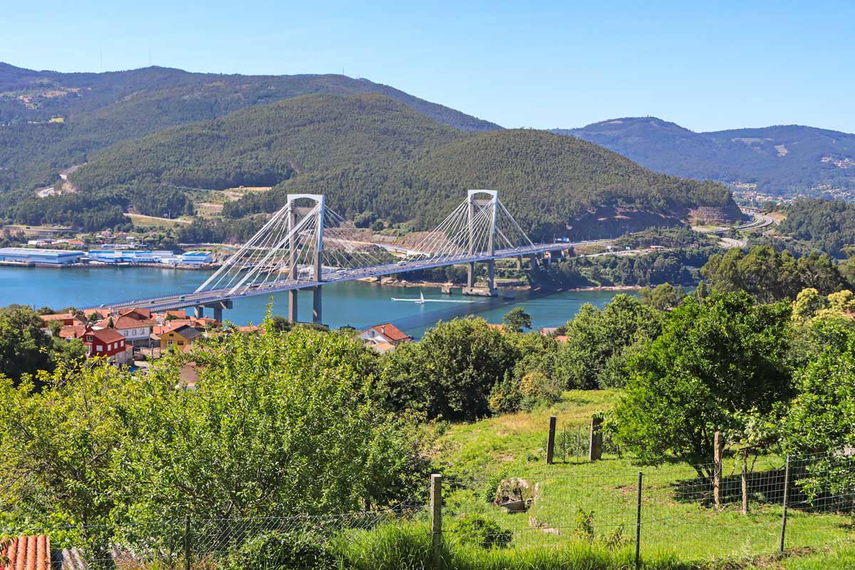
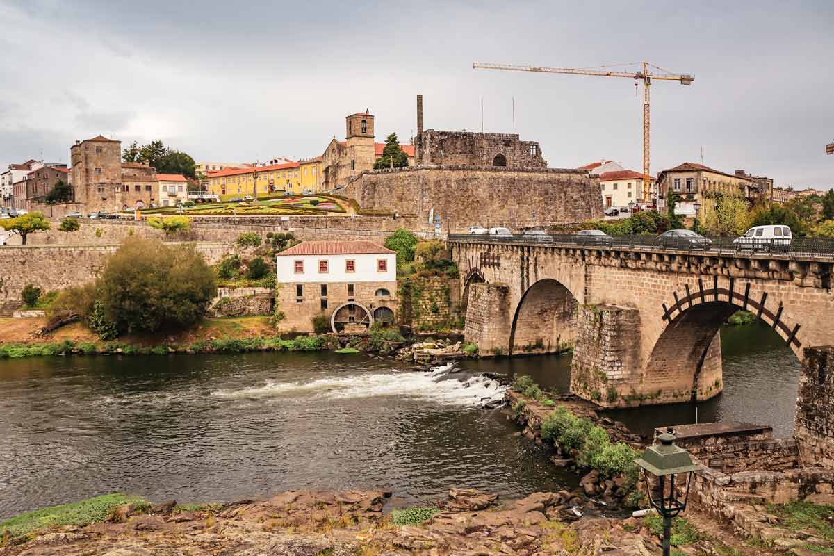
Is the Camino Guides Portugese Camino a Comprehensive Guide shown above a book ?
Hello, Nick. I'm not sure I understand your question. When you say "above" do you mean above the comment section on this post? If so the two pictures with titles that you see are two different posts on our site. One is on the different Camino routes and one is a detailed guide to the Portuguese Camino. You can click on the pictures and open those posts for reading.
Hi, thanks for this nice and useful blog!
We will start our family camino (with 3 kids) at the beginning of May in Porto and plan to walk daily up to max. 15km.
Please can you give us some tips as:
Are there enough places to get accomodation on such shorter daily tracks? Is May already busy so do we have to book beds in advance? We would like to mix staying in albergues and some more private accomodation.
Hello, Juraj. Thank you for the comment. We're going to walk the Portuguese Camino in May with our 8-months old daughter but we want to start in Tui, just over 100 km from Santiago. Maybe see you on the way.
As for your questions, there is enough accommodation on the Camino but you have to do some planning in advance. There are two downloadable PDF files (at the beginning of the post) with walking stages and accommodation on the Coastal Route that you can use for your planning. May is not very busy yet. We walked the route in May it's a good time for walking this route. I'd recommend booking accommodation some time in advance maybe a couple of days ahead because you're 5 people it might be more difficult to find places than for 1 or 2 people. I don't know how old your children are. I wouldn't stay in albergues in dormitory rooms with young children but if they're a bit older I think it's fine.
Buen Camino
Thank you guys for the excellent information Been planning to walk the Coastal Route for some time now. Congrats on the new addition to the family. I lived in Lagos for a few years myself
Regards
Mike from Ireland
Hello, Mike. Thank you very much for the comment. I'm sure you'll enjoy the Coastal Camino, it's a beautiful route. We're thinking of walking it in May this year with our daughter.
Buen Camino
Thank you for the insight, lots of great information. We planning to cycle the Camino starting south of Porto. We are also bringing our dog, so we have a lot of challenges ahead of us. Besides the direction to walk, my main questions are: are all the routes clearly marked in order to stay on the specific Camino? MUST you stay on the specified Camino? Lastly, how and where do you know where to obtain a stamp for your passport?
Hello, Richard. Thank you for the comment. All Camino Portuguese routes from Porto are well-marked. You can switch between the Central Route and the Coastal Route of the Portuguese Camino. You can switch in Vila do Conde and Caminha. From Redondela to Santiago there is only one route. All albergues and many hotels and guesthouses on the Camino can stamp your passport. Many bars, cafes, and restaurants along the route have stamps too. You often can see an announcement at the entrance saying you can get a stamp there. Some churches and chapels have stamps too.
Buen Camino
@Stingy Nomads, many thanks.
Thank you for this guys. Super informative and I am now even more excited to do this in 6 weeks time. Can I ask do you think it is necessary to train beforehand?
Hello, Paul. Thank you very much for the comment. We're planning to walk the Portuguese Camino in a couple of months again. We're quite excited too. I don't know how fit you're and how much you walk but I'd suggest preparing for the Camino by doing daily shorter walks and once or twice a week a longer 15-20km walk. You can try to walk with a loaded backpack as well to see how it goes. We have a detailed post on training for the Camino that might be helpful https://stingynomads.com/camino-de-santiago-training/
Buen Camino
Thanks for the wonderful report, I found a lot of useful things to design my camino. Best regards, Szilvia from Hungary
Looking to do it either late August or late September / October 2022. Worried about the weather
Hello, Jenny. Late August - the beginning of September is a good time to walk the Coastal Route of the Portuguese Camino. Late September - October it gets colder and starts rainy in northern Portugal and Spain.
Buen Camino
Great site, extremely informative.
We are from Australia, planning to be in France from April ‘23 for about 18 months, combining walking, cycling, running with general sightseeing plus maybe a wine or two!
We are looking to do the Camino from Porto or, if we have time, Lisbon.
How does October/November work? Does it get too cold and wet?
We’ve been to Portugal before, absolutely loved both Lisbon & Porto, and a gentle stroll has to be the best way to experience the country.
Food, wine, great company…
Cheers,
Hugh
Hello, Hugh. Thank you for the comment. We did the Portuguese Camino in May and it was great: warm, sunny, not too busy. We walked the Northern Way in October and the Camino Finisterre in November, the first half of October was nice but from mid-October, it got cold and rainy. If you start in Lisbon it'll be still warm and sunny in October but as you approach Spain it'll be getting colder and rainier. Since you have a lot of time in Europe you might consider starting the Camino in mid-September to be done by mid-October. It's a much better time frame.
The part from Lisbon to Porto is much tougher than from Porto to Santiago de Compostela. It's a more off-the-beaten-track route with fewer accommodation options and longer walking stretches. We did enjoy that part but it might be overwhelming to start in Lisbon if it's your first long-distance walking experience.
If you enjoy walking along the coast you might like the Fishermen's Trail https://stingynomads.com/fishermens-trail-rota-vicentina-itinerary/. It's not a Camino route it's a walking route in southern Portugal. October-November is a good time to walk it. Scenery wise we liked it more than the Coastal Route of the Portuguese Camino.
Buen Camino
Wonderful information! I am walking the Portuguese Camino w/ spiritual variant next month. In another blog I saw a recommendation to stay in Cambarro. Would it be doable to walk from Cambarro to Vilanova de Arousa? If not, could you recommend a town along the way? I'm having a hard time finding lodging along that stretch. Thanks again!
Hello, Kelli. Thank you for the comment. Combarro is a nice town we stopped there for an hour or so on the way if you wish you can stop there but it's a very short walk from Pontevedra, 12 km. The walk from Combarro to Vilanova de Arousa is about 32 km, it's quite challenging considering a steep and long ascent from Combarro to Armenteira. That's why the standard itinerary of the Spiritual Way of the Portuguese Camino is Pontevedra - Armenteira, 22 km and Armenteira - Vilanova de Arousa, 23 km. You can try to push and walk 32 km or split it into 3 stages; Pontevedra - Combarro, 12 km, Combarro - Armenteira, 10 km, and Armenteira - Vilanova de Arousa, 23 km. The monastery of Armenteira is quite an important place on the Camino if you don't stay in Armenteira make a stop there and visit the church. This is our suggestion we walked the standard itinerary. Maybe the people that recommend you to stay in Combarro can advise you better on how to walk the stretch.
There are two PDF files at the beginning of this post that contain walking stages and accommodation along the Coastal Route of the Portuguese Camino they might be helpful in your planning.
Buen Camino
Hi,
Great site. Do you also have the stages as .gpx files? I would love to have them if that is the case.
Kind regards,
Bart
Hello, Bart-Hein. Thank you for the comment. Unfortunately, we don't have gpx files for the Coastal Route of the Portuguese Camino. We're planning to walk the route again later this year with our GPS watch and will update the post after that. The Camino is very well marked finding the way won't be a problem even without navigation.
Buen Camino
Any tips for walking the coastal route with a dog? The bus around Vigo might be an idea.
Hello, Karen. Walking with a dog is not a problem finding places to stay is. I'd find out first about dog-friendly accommodation. If you can find one for every night unless you're going to camp or carry a tent for your dog that he/she can sleep outside. It's not easy to travel with dogs in Spain. As far as I know, dogs are not allowed on long-distance buses and only small dogs are allowed on trains in a special carrier. I'm not sure what you mean by "the bus around Vigo". You can walk to and from Vigo with a dog.
Cheers