The Portuguese Coastal Camino from Vigo - a detailed guide
The Portuguese Camino is the second most popular Camino de Santiago route after the Camino Frances. Its popularity has grown significantly in the last 5 years. In 2025 around 200 000 pilgrims walked the Portuguese Camino. Unlike most other Camino trails this one has not one but three routes from Porto; Central, Coastal, and Litoral. In Vigo both Coastal and Litoral routes merge and follow the same trail to Redondela where they join the Central Route.
Stingy Nomads participates in the Amazon Services LLC Associates Program and other affiliate programs. If you click on the link and purchase the item or make a booking, we will receive an affiliate commission at no extra cost. Thank You for supporting us and assisting us to produce quality, free content.
PDF of the Camino from Vigo
You can download our free PDF with a detailed description of standard walking stages and recommended places to stay.
Portuguese Coastal Route from Vigo PDF
Portuguese Camino planning tool
You can get a free customized itinerary of the Camino route from Vigo using our PLANNING TOOL. Just choose the route, starting point, and desired daily distance and get an itinerary with suggested places to stay.
GPX files of the Coastal Route from Vigo
You can download our GPX file and use them on your device for navigation. You can find more information on how to use GPX files on your mobile in our detailed post.
Reasons to walk from Vigo
Vigo is the second starting point of the last 100 km to Santiago on the Portuguese Camino. The first one and the most popular is Tui on the Central Route. According to the pilgrim's reception office in 2025 7.8% (41 643 people) of all pilgrims who arrived in Santiago started in Tui and 3.5% (18 678 people) started in Vigo.
Here I want to add that the modern variant of the Coastal Route through Vigo was recognized by the Cathedral in Santiago as the official route in 2016. Before then the Coastal route continued from Caminha (the last town in Portugal) through Valençia to Santiago. So in the second part the Coastal Route was the same as the Central. Now both routes merge in Redondela.
Starting the Portuguese Camino in Vigo vs in Tui
- Fewer people on the route from Vigo;
- you get to combine 2 routes in one walk (Coastal and Central) though you walk on the Coastal only the first day;
- the walk from Vigo is shorter than the walk from Tui. 102 km/ from Vigo to Santiago vs 117 km from Tui to Santiago.
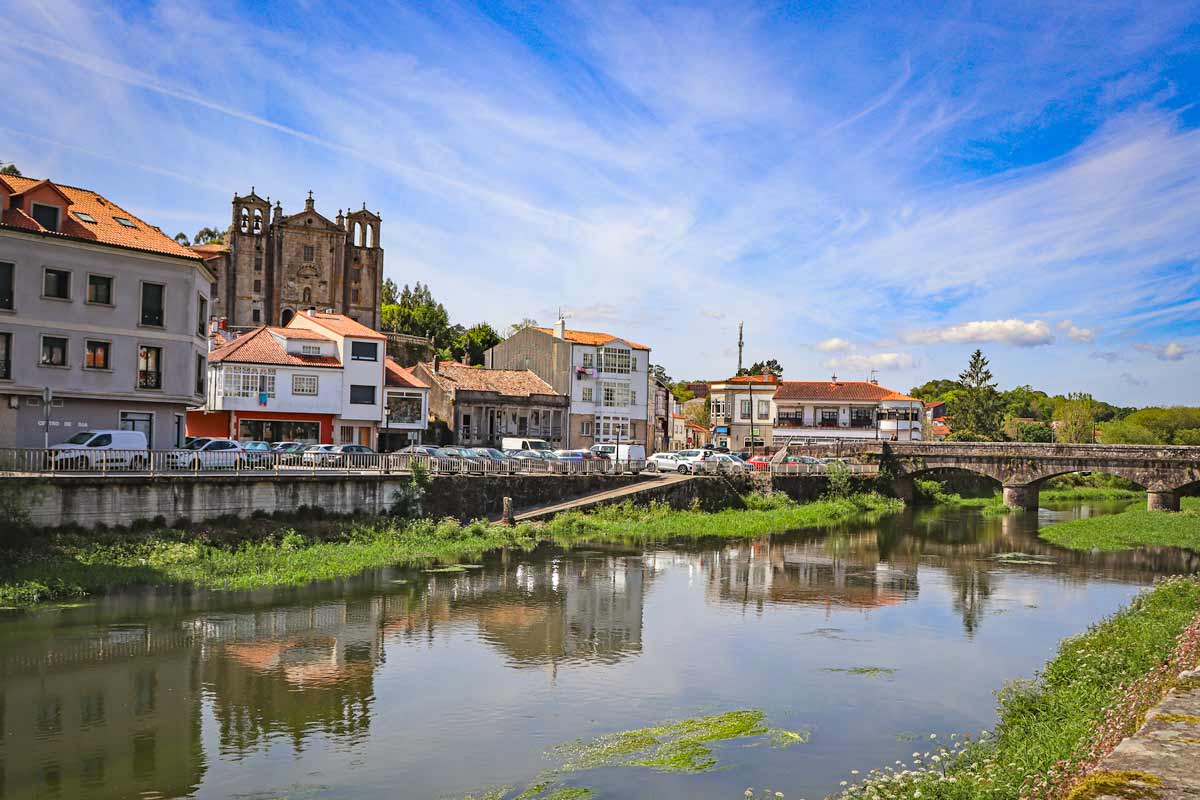
The Portuguese Camino from Vigo route overview
- Distance – 102 km/63.3 mi
- Number of days – 5-7 days
- Accumulated ascent – 1712 m
- Accumulated descent – 1442 m
- Walking surface – 68 km/42.2 mi – asphalt/tar; 34 km/21.1 mi – gravel road/footpath
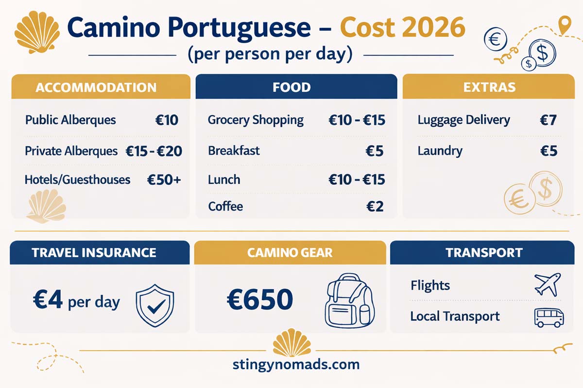
- Average cost – from 30 euros per person per day
- Route marking – yellow shells and arrows, stone distance poles
How long is the route from Vigo?
The total distance of the Portuguese Camino from Vigo is 102 km/63.3 mi which is just over the required minimum of 100 km for getting the Compostela certificate. It takes 5-7 days on average to complete it.
Where in Vigo does the Camino start?
The Church of Santa Maria is probably the best place to start. You can get your first stamp there and buy a Credential if you don’t have one. Keep in mind that the Camino route from the Cathedral is not really marked. You see occasional yellow arrows painted on the ground. I suggest using online maps for navigation.
As an option you can start at the exit of the city at the intersection of Rua de Urzaiz and Rua de Toledo. From there on it's easier to find the route you just follow yellow arrows panted on the ground and walls.
Is the route well-marked?
The route through Vigo is not well-marked and can be confusing. It gets better once you're on the way out of the city at Rua de Toledo. From there you can follow yellow arrows and soon you will start seeing the official Camino signs.
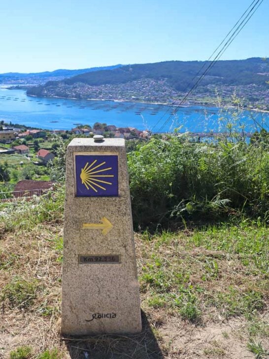
Once you’re out of Vigo the Camino is well-marked with yellow arrows and distance poles stating the distance left to Santiago.
The best time for walking
Weatherwise May, June, September, and the first half of October are the best months for walking. It’s warm and mostly sunny, not too hot, with little rain. And it’s not the peak summer holiday season which is July and August. These months are a very popular time for waking the Camino. It’s recommended to book accommodation in advance especially if you want to stay in affordable private rooms.
July and August are the peak summer months when it can get very hot, over 30°C. In order to skip the heat you will have to start walking early in the morning. These are the peak holiday months when many people come to Northern Spain especially to the coastal areas. Accommodation prices increase a lot.
April and second half of October are alternative months if you want to skip the crowds. You are likely to get some rain and cooler temperatures but on the bright side you don’t have to worry about finding a place to stay without advanced booking.
Walking the Portuguese Camino from Vigo during the off-season between November and March is good if you want to walk in solitude. Weather will be the main challenge. Be prepared to face rain and cool temperatures.
What is Credential and why do you need it?
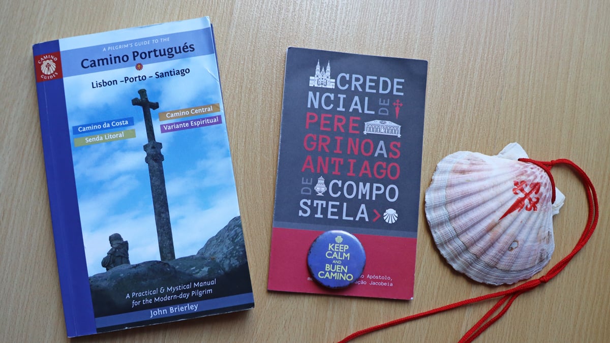
The Credential or Pilgrim’s Passport is a small paper book with empty spaces for stamps. Every day you collect stamps from your accommodation places, church, restaurants, etc. along the route. The required minimum for the last 100 km to Santiago is 2 stamps per day. You can collect more if you want.
At the end of the Camino in Santiago de Compostela you present your Credential at the Pilgrim’s Reception Office and they issue the Composteal certificate to you. The certificate confirms that you have completed one of the route of the Camino de Santiago.
You need the Credential
- to get the Compostela certificate at the end of the walk;
- to stay in public (municipal) albergues on the Camino;
- if you don’t need the Compostela and are not planning to stay in public albergues you can walk the Camino without the Credential.
Where to get a Credential in Vigo?
You can buy a pilgrim’s passport (Credential) at the following locations in Vigo:
- the Church (Concatedral) of Santa María de Vigo;
- Establecimientos Jamaica at Praza da Pedra 6 (a gift shop near Santa Maria Church);
- Iglesia de Santiago de Vigo.
The price is 2-3 euros.
Don’t forget to get your first stamp in Vigo before you start walking. You can get it at one of the churches, at your albergues or hotel and at some restaurants and cafes.
How difficult is the Portuguese Coastal Camino from Vigo?
It’s a moderate walk with slight ascents and descents but without any significant election gains. Seasoned walkers/hikers will find it being quite easy. Some training and preparation is recommended for those who are not used to regular walking/running.
How to get to Vigo?
Getting to Vigo from Santiago de Compostela
Probably the easiest way of getting to Vigo is from Santiago especially if you are coming from somewhere in Europe. This option is convenient if after completing the Camino you're going back home. You finish the walk in Santiago and fly back from there.
The international airport in Santiago offers direct flights to/from Ireland, Belgium, France, Switzerland, and of course Spain. If you can't find direct flights from your city in Europe I'm pretty sure you will be able to get to Santiago with one connection.
Direct trains connect two cities. Trains leave every 30 minutes to 1 hour. The journey takes 1 hour. Tickets cost 10-12 euros. You can find the up-to-date timetable and buy tickets on the official website.
Getting to Vigo from Porto (Portugal)
If you come from overseas you might not be able to get to Santiago with one connection (instead with 2 or more). If that's the case it's better to fly to Porto, the nearest large international airport. From Porto you can take a bus or a train to Vigo.
Direct buses depart several times a day. The journey takes 2h30 min. - 3 hours. The price is between 13 and 20 euros. You can buy tickets on the FlixBus website.
The direct train Train Celta from Porto Campanha station to Vigo departs twice a day (morning and evening). The journey takes 2h30 minutes. The price is 16-20 euros. You can buy tickets on the RENFE website.
Where to stay in Vigo?
- Low-end | Public Albergue de Vigo | R4Hostel | Hotel Nautico |
- Mid-range | Real4 | Hostal Real | U Hotel Ogalia Vigo |
- High-end | Hotel Panton | Hotel Compostela Vigo |
Luggage delivery service on the Camino from Vigo
You can have your luggage transferred daily on the Camino from Vigo. Several companies offer the service on the route. The main are Correos, Tui Trans, Pilbeo, Camino Facil. The average price is 7 euros per backpack/suitcase per stage.
You leave your luggage (backpack or suitcase) at the reception in the morning, a van picks it up and drives it to your next hotel or albergue. Usually by the time you arrive your luggage is already there. You walk the Camino with a day pack carrying valuables, water, and snacks.
Vigo to Santiago route map
The Portuguese Coastal Camino from Vigo walking stages
Stage 1. Vigo to Redondela, 16.5 km/10.2 mi
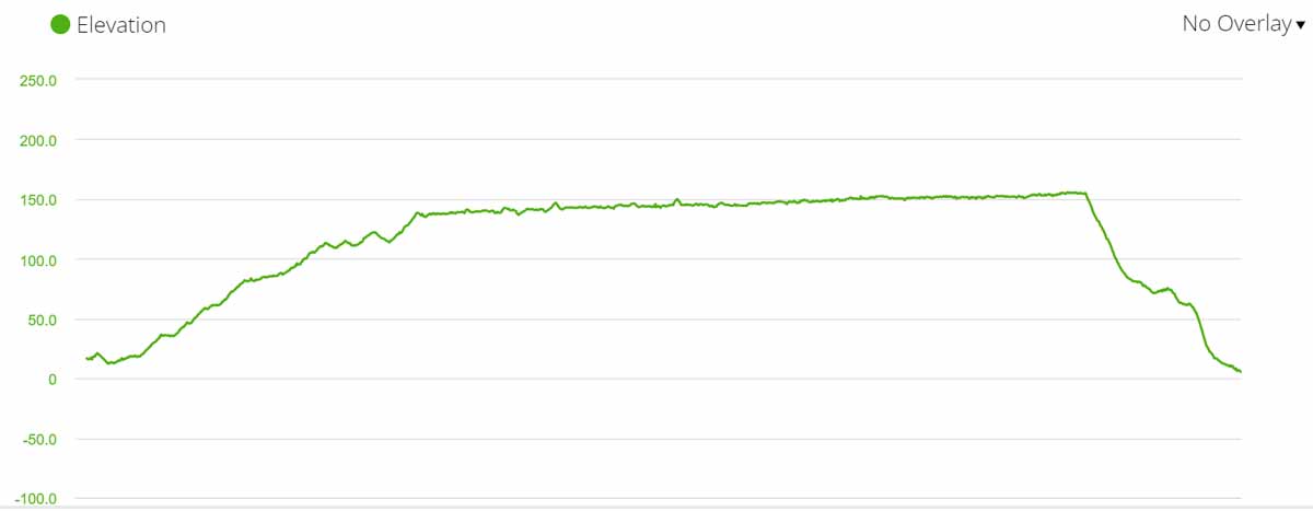
- Distance – 16.5 km/10.2 mi
- Time – 4-5 hours (moving time)
- Accumulated ascent – 203 m
- Accumulated descent – 210 m
- Walking surface – 11.5 km/7.1 mi – tar road/asphalt; 5 km/3.1 mi – footpath/gravel road
- Walking along the coast – 8 km/5 mi (between 5 km/3.1 mi and 13 km/8 mi) beautiful coastal views from the route
It’s a short and easy walking stage. The most difficult part is to find the Coastal Route in Vigo as there are very few Camini signs in Vigo. The easiest is to get to Rua de Urzaiz from your accommodation place and follow that street till the end (the last part is pedestrian). At the end turn left to Rua de Toledo (you’ll see yellow arrows). From there you can follow the Camino signs.
Challenges
- Finding the Camino route in Vigo
- No place to stop for coffee or food once you’re out of Vigo till you reach Redondela
Highlights
- The historical part of Vigo
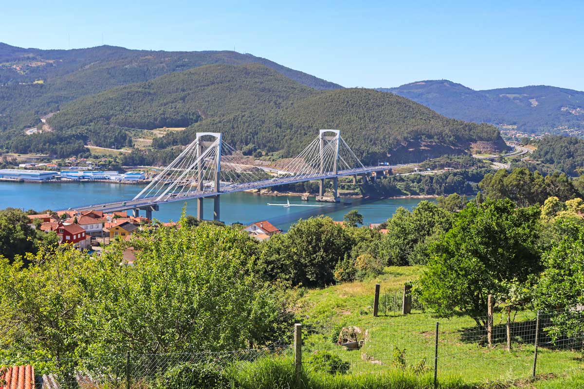
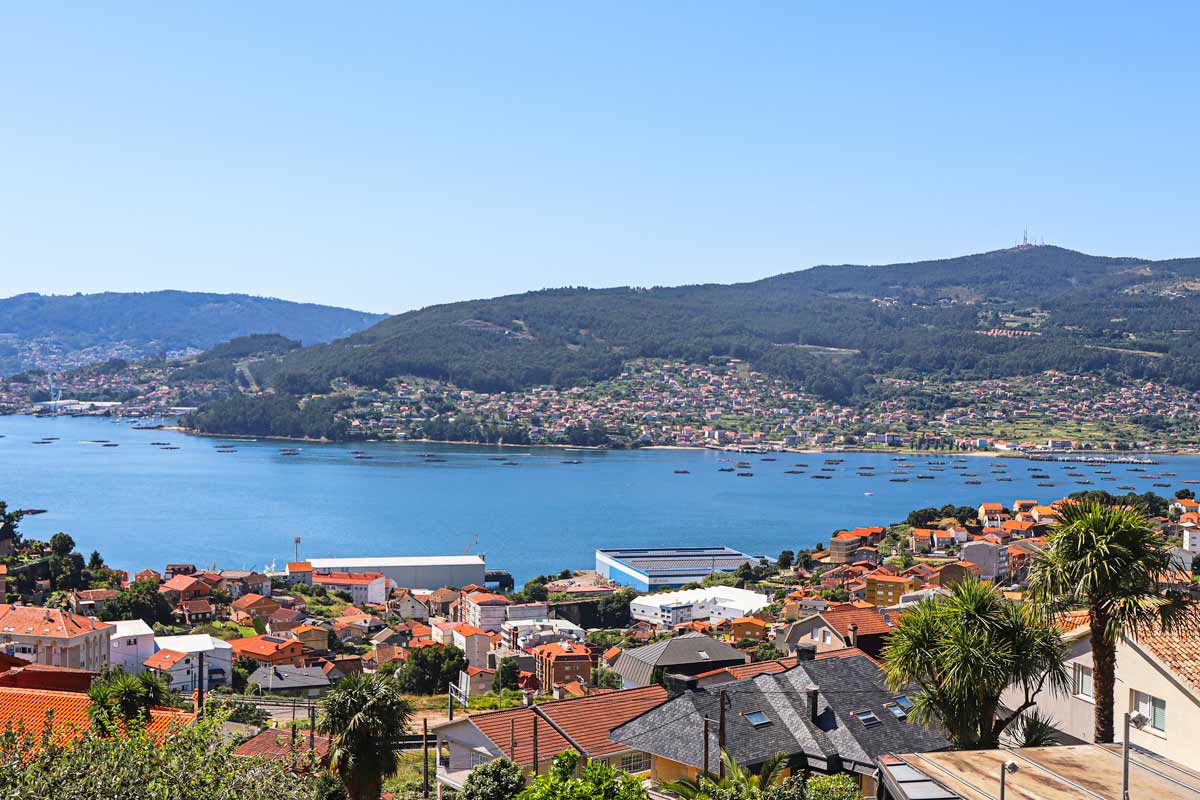
- Spectacular views of the coast, the bay, and the bridge from the route
- A beautiful waterfall in the forest
- The historical part of Redondela
Stage 1 route description
0-3 km/0-1.8 mi – through Vigo.
5-13 km/3.1-8 mi – on a slope of the hill with beautiful views of the coast.
9 km/5.6 mi – a small waterfall in the forest.
14 km/8.6 mi – the beginning of a steep descent.
16.5 km/10.2 mi – Redondela, the town where the Coastal Route merges with the Central Route. You will see more pilgrims.
Places to stay in Redondela
- Low-end | Public Albergue de Redondela | Albergue Parroquial Santiago Apostol de Redondela | Santiago de Vilavella |
- Mid-range | A Conserveira | Pilgrim Rooms | La Casa de la Abuela Boticaria |
- High-end | As Mimosas d'Cross Apartment |
Stage 2. Redondela to Pontevedra, 20.6 km/12.8 mi
- Distance – 20.6 km/12.8 mi
- Time – 5 hours
- Ascent – 425 m
- Descent – 400 m
- Walking surface – 13 km/7.4 mi – asphalt; 7.5 km/4.6 mi – footpath/gravel
- Walking on the road – 500 m/0.3 mi
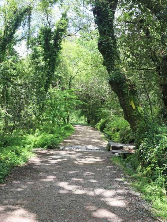
It was a pleasant walking day with beautiful forest scenery and many places to stop for coffee and rest including several spontaneous stalls in the middle of the forest where you can get snacks, coffee, cool drinks, and a stamp leaving a donation.

Challenges
- A steep ascent between 1.7 km/1 mi and 4.7 km/2.9 mi, around 140 m up.
- A steep and short descent between 4.7 km/2.9 mi and 6 km/3.7 mi, around 100 m down.
- Another steep ascent between 10 km/6.2 mi and 12 km/7.4 mi, around 130 m up.
Highlights
- Walking through a beautiful forest throughout the day.
- The Medieval Bridge de Pontesanpaio over the River Verdugo with spectacular views.
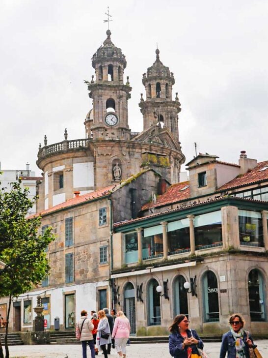
- The historical center of Pontevedra.
Stage 2 route description
The first 4 km/2.4 mi are through a quiet countryside.
2 km/1.2 mi - Cesantes, a small town with a private Albergue and a couple of cafes.
4-5.5 km/2.4-3.4 mi - the route goes through the forest.
6.5-9.6 km/4-6 mi – walking through several towns with several albergues, hotels, restaurants, and shops.
8.6 km/5.3 mi – Medieval Bridge of Pontesanpaio. It’s a beautiful bridge with spectacular views - a good place to stop for lunch or coffee. There are a couple of cafes and bakeries near the bridge.
9.6-11.6 km/6-7.2 mi – walking on a footpath through the forest.
15.5 km/9.6 mi – a bar, a shop, and a small chapel where you can get a stamp.
15.8 km/9.8 mi – a split on the Central Route. Most people take the complementary route because it goes through the forest instead of the “official” route along the road.
16-19 km/10-11.8 mi – walking on the footpath through the forest.
19 km/11.8 mi – an albergue/cafe.
19.5 km/12.1 mi – the outskirts of Pontevedra.
20.6 km/12.8 mi – the historical center of Pontevedra.
Places to stay in Pontevedra
- Low-end | Public Albergue Virgen Peregrina | Acolá Hostel |
- Mid-range | PENSIÓN SANTA CLARA | Slow City Hostel Pontevedra |
- High-end | Hotel Boa Vila |
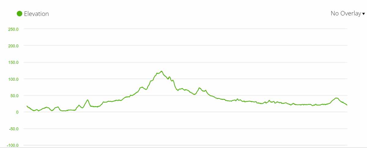
Stage 3. Pontevedra to Caldas de Reis, 21 km/13 mi
- Distance – 21 km/13 mi
- Time – 5 hours (moving time)
- Ascent – 275 m
- Descent – 270 m
- Walking surface – 12 km/7.4 mi – asphalt; 9 km/5.6 mi – footpath/gravel
- Walking on the road – 0 km, 1 km/0.6 mi on a footpath along the road
It’s an easy walking day without strenuous ascents or descents. In the first half there aren’t any places to stop for food or coffee it’s better to have breakfast in Pontevedra before starting the walk. In the second half after 9 km, there are cafes and bars. Caldas de Reis is s small town a lot smaller than Pontevedra. It has many hotels, albergues and restaurants, and a couple of supermarkets.
Challenges
- No places to stop for food/coffee for the first 9 km/5.5 mi
- 12 km/7.4 mi walking on tar (asphalt)
Highlights
- The beautiful forest between 6 km/3.7 mi and 9 km/5.5 mi and between 16 km/10 mi and 19 km/11.8 mi.
- The charming historical center of Caldas de Reis.
Stage 3 route description
0-1.4 km/0-0.8 mi – walking through the city
3 km/1.8 mi – the route split; the left route is the optional route Variante Espiritual (Spiritual Variant) and the right route is the main Portuguese Camino route. The split is well-marked.
6.5 km/4 mi – a 60 km sign
6-9 km/4-5.5 mi – through the forest
9 km/5.5 mi – cafe Pousada Peregrino
9.5 km/5.9 mi – Portela, private Albergue, 200 m away from the Camino (follow the signs)
9.5-10.5 km/5.9-6.5 mi – next to the road
11.5 km/7.1 mi – a vending machine and a bar
12-14.5 km/7.4-9 mi – through the forest
15 km/9.3 mi – a couple of cafes/bars
16.5 km/10.2 mi – Briallos, a public Albergue, 300 m from the Camino route (follow the signs).
18 km/11 mi – a cafe
19.5 km/12 mi – Tivo, Albergue/bar Vintecatro
21 km/13 mi – Caldas de Reis
Places to stay in Caldas de Reis
- Low-end | albergue a queimada | Albergue Agarimo |
- Mid-range | Pensión Caldas | Pensión Fornos |
- High-end | Alfonso Vll |
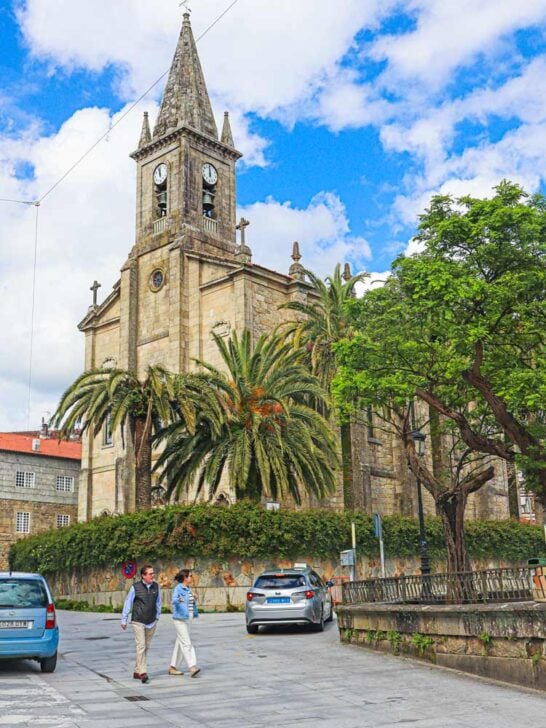
Stage 4. Caldas de Reis to Padrón, 18.5 km/ 11.5 mi
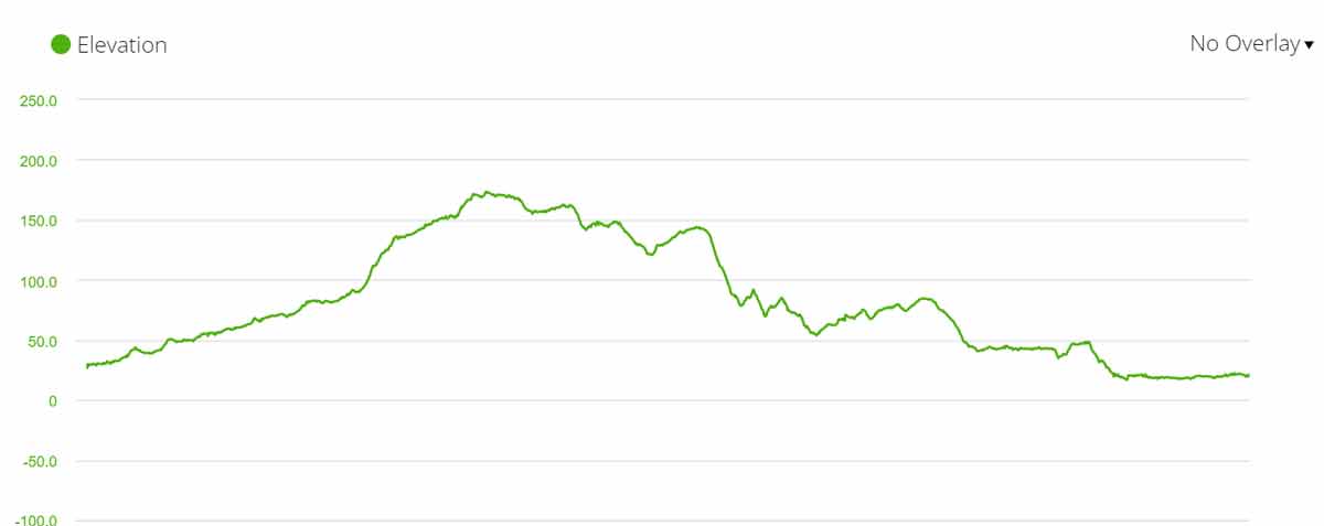
- Distance – 18.5 km/11.5 mi
- Time – 5 hours (moving time)
- Ascent – 283 m
- Descent – 296 m
- Walking surface – 11 km/6.8 mi – asphalt; 7.5 km/4.6 mi – footpath/gravel
- Walking on the road – 0 km
It’s a short and easy walking day with beautiful forest scenery. The forest part of this stage is one of my favorites on the Camino from Tui. Many pilgrims prefer not to stay in Padron and walk to one of the albergues/hotels to shorten their last walking day. It is a good idea and there are several places between Padron and Santiago where you can stop.
Challenges
- An easy walking day on the Camino.
Highlights
- The picturesque Galician forest with small waterfalls, rivers, and rest areas.
- A beautiful church at 5.8 km/3.6 mi.
- The historical center of Padron.
Stage 4 route description
2-5.2 km/1.2-3.2 mi – walking through the forest.
5 km/3.1 mi – a 40 km to Santiago sign.
5.4 km/3.3 mi – bar Parillada Antonio and guesthouse Pension Sevi 20 m from the Camino route after crossing the road.
5.8 km/3.6 mi – the beautiful church of Santa Mariña de Carracedo with a wooden statue of a shoe.
7 km/4.3 mi – a busy road crossing without a traffic light or pedestrian crossing.
7.2 km/4.4 mi – a cafe
7.6 km/4.7 mi – a small sculpture of a pilgrim on the top of a pillar
8.5 km/5.2 mi – a bar
9.6 km/5.9 mi – Municipal Albergue de Valga, 300 m from the Camino follow the signs.
9.8 km/6 mi – a rest area in the forest
10-11.5 km/6.2-7.1 mi – walking through the beautiful forest
12 km/7.4 mi – San Miguel de Valga, a cafe and a restaurant
14.6 km/9 mi – a rest area
15.5 km/9.6 mi – a drinking fountain (there are several fountains along the Camino route but I’d recommend drinking only from those that have a sign “Agua potable” which means drinking water in Spanish.
15.6 km/9.6 mi – a small coffee stall
16.3 km/10 mi – guesthouse Casa do Horreo
16.5 km/10.2 mi – Pontecesures, a small town
18.5 km/11.5 mi – the center of Padron (there are several albergues on the way from Pontecesures to Padron)
Places to stay in Padron
- Low-end | Public Albergue | Hostel & Rooms O Albergue da Meiga | Albergue Corredoiras |
- Mid-range | Pension Grilo | HOTEL CORONA DE PADRÓN |
- High-end | Padrón Suites |
Stage 5. Padrón to Santiago de Compostela, 25.5 km/15.8 mi
- Distance – 25.5 km/15.8 mi
- Time – 7 hours (moving time)
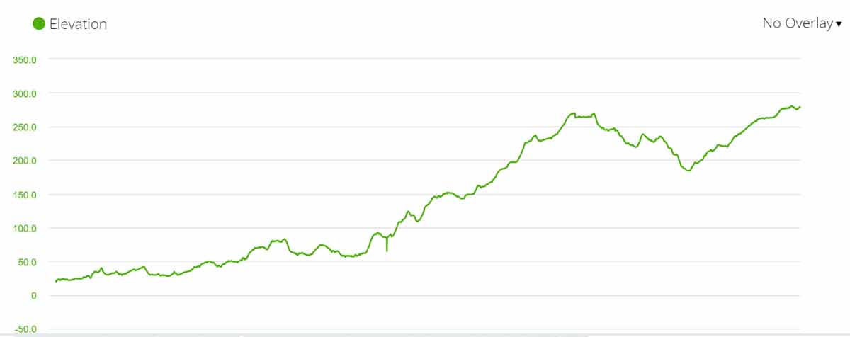
- Ascent – 526 m
- Descent – 266 m
- Walking surface – 20.5 km/12.8 mi – asphalt; 5 km/3.1 mi – footpath/gravel
- Walking on the road – 600 m on a quiet road
It’s a challenging day due to the distance and steep ascents in the last part of it. If you walk during the high season expect to see many people. The scenery on the last day is very diverse from walking next to a busy road to going through a quiet forest and countryside.
Many people split the day into two to make their last day shorter. There are plenty of places to stay in the second half of the day. E.g. the town of Milladoiro which is 7 km/4.3 mi before Santiago.
Challenges
- Several ascents in the second half of the stage, the accumulated ascent for the day is over 500 m.
- Relatively long distance, over 25 km/15.5 mi.
Highlights
- The beautiful Galician forest
- The historical center of Santiago de Compostela
- Arriving at Obradoiro Square and seeing the Cathedral and hundreds of other pilgrims
Stage 5 route description
2-3 km/1.2-1.8 mi – along a busy road
2.2 km/1.3 mi – a restaurant, a cafe
2.7 km/1.6 mi – hotel Scala, restaurant
3-4 km/1.8-2.4 mi – walking through small villages
5.5 km/3.4 mi – albergue O Lagar de Jesus. It might be a good place to stop if you want to walk further on instead of staying in Padron the previous day.
6.2 km/3.8 mi – A Escravitude, a small town with a beautiful church, restaurants, bars, and hotels. It’s another good place to walk from Caldas de Reis instead of Padron.
8.9 km/5.5 mi – a rest area
9 km/5.5 mi – Guesthouse Areal
9.5 km/5.9 mi – Picaraña, a couple of guesthouses and restaurants
10-11 km/6.2-6.8 mi – the beautiful forest
11 km/6.8 mi – O Faramello, a cafe, a restaurant, Municipal Albergue de Faramello (150 m from the Camino)
11.2 km/6.9 mi – Albergue/bar La Calabaza del Peregrino
12 km/7.4 mi – a bar
12.4 km/7.7 mi – Hotel/restaurant Parada de Francos
13.8 km/8.5 mi – Cafe/shop
14.2 km/8.8 mi – Pedreira, Albergue/cafe de Pedreira
17.6 km/10.9 mi – Milladoiro, a town with restaurants, cafes, supermarkets, and hotels. It is a good stop for those who want to split the last day into two stages.
20.5 km/12.7 mi – Parador La Roda, cafe & souvenir shop
23 km/14.2 mi – a route split
24 km/14.9 mi – Santiago de Compostela
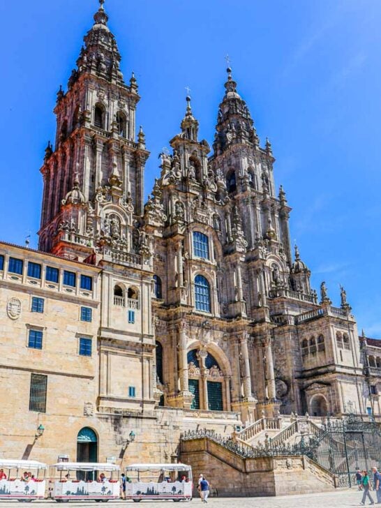
25.5 km/15.8 mi – Obradoiro Square and the Cathedral
Places to stay in Santiago de Compostela
- Low-end | Santiago KM-0 | Albergue SIXTOs no Caminho |
- Mid-range | Hospedería San Martín Pinario | Hotel Montenegro Compostela |
- High-end | San Francisco Hotel Monumento | Parador de Santiago – Hostal Reis Catolicos |
Questions or Comments?
Got any questions or comments? We would love to help! All questions and comments will be answered by us personally in Buy Me a Coffee. Click below and ask away.
Feel free to support our site by buying us a coffee!

The pretty half of Stingy Nomads, responsible for all our land adventures (hiking, climbing, walking the Camino) and following them write-ups. Alya loves walking since she was a child, she prefers to walk 1000 km with a backpack rather than to do a 10 000 km road trip (actually any road trip). Alya is a big fan of Latin America, the Spanish language, and dancing. Every time we go away she desperately misses our dog Chile.