Camino Frances walking stages 2026 + PDF, GPX
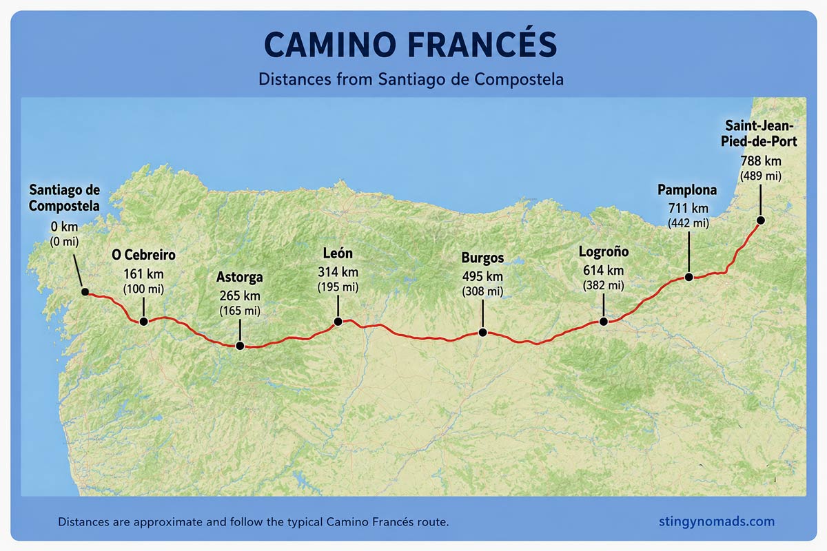
The Camino Frances is a 790 km/490 mi pilgrimage route from St.Jean-Pied-de-Port in France to Santiago de Compostela in Spain. It's the most popular Camino de Santiago route followed by the Portuguese Camino. The Camino is walked by hundreds of thousands of pilgrims every year. According to the Pilgrim's Reception Office in 2024 - 236 381 people completed the route.

The Camino Frances starts in France and on its way to Santiago crosses several regions of Northern Spain; Navarra, La Rioja, Castille and Leon, and Galicia. In this post, you'll find a detailed day-by-day itinerary of the route.
You can find all our posts on the Camino Frances on our Camino de Santiago resource page.

Stingy Nomads participates in the Amazon Services LLC Associates Program and other affiliate programs. If you click on the link and purchase the item or make a booking, we will receive an affiliate commission at no extra cost. Thank You for supporting us and assisting us to produce quality, free content.
Camino Frances free planning tool
You can use our free Camino Frances planning tool. Choose your daily distance and a starting point and get a customized itinerary with recommended places to stay.
Camino Frances PDFs
We've created PDF files with walking stages and places to stay on the Camino Frances. You can download them for free and use them for planning your Camino walk.
- Camino Frances places to stay. Part 1. St.Jean-Pied-de-Port to Leon PDF
- Camino Frances walking stages. Part 1. St.Jean-Pied-de-Port to Leon PDF
- Camino Frances places to stay. Part 2. Leon to Santiago de Compostela PDF
- PDF Camino Frances walking stages. Part 2. Leon to Santiago de Compostela
Route overview
- Total distance - 790 km/490 mi
- Number of days required – 30-34 days
- Walking surface – 290 km/180 mi - asphalt/tar; 500 km/310 mi - footpath/gravel
- Walking on the road – 70 km/43,4 mi mostly very quiet roads with almost no cars
- Accumulated ascent - 13 134 m
- Accumulated descent - 12 248 m
- Average cost - 35-40 Euros per person per day
- Accommodation - public and private albergues, hotels, guesthouses
- Route marking – yellow shells and arrows
Make sure you don't pack too much stuff and take only necessary clothing and gear. We have a detailed Camino packing guide with tips on what to pack for men and women for different seasons.
Our detailed guide to the French Way of St.James contains useful information for planning the pilgrimage.
Camino Frances GPX files
You can download for free our GPX files for every stage of the Camino Frances. See how to use our GPX files for navigation on your phone.
If our PDFs and GPX files helped you plan your Camino, consider buying us a coffee ☕ — it’s a small gesture that means a lot and helps us keep creating quality content for fellow pilgrims!

Travel insurance for the Camino
You can read more information on travel insurance for the Camino Frances in our dedicated post on Camino travel insurance or get an instant quote right now.
World Nomads travel insurance has been designed by travelers for travelers, with coverage for more than 150 activities as well as emergency medical, lost luggage, trip cancellation and more.St.Jean Pied de Port the start of the Camino
St.Jean Pied de Port has played an important role in the history of the Camino de Santiago as a gateway of the pass over the Pyrenees. It's a beautiful town where everything is about the Camino de Santiago. France is more expensive than Spain don't worry if everything costs more than you expected once you're out of France prices on the Camino Frances are lower.
Getting to St.Jean Pied de Port
You can get there via France or Spain. It depends on where your international flight arrives. We have a detailed explanation of how to get to St.Jean Pied de Port from both countries.
Accommodation in St.Jean Pied de Port
There are many places to stay in St.Jean including one municipal albergue that fills up quickly in the season.
- Budget | La Vita e Bella | Gite Compostella |
- Middle price | Gîte Zuharpeta Randonneur Pelerin | La Coquille Napoléon |
- Luxury | Maison Simonenia |
Camino Frances walking stages - a 1-month itinerary
Stage 1. St.Jean-Pied-de-Port to Roncesvalles, 25 km/15.5 mi
- Distance - 25 km/15.5 mi
- Time – 6-7 hours (moving time, excluding rest stops)
- Walking surface – 14 km/8.6 mi - asphalt/tar; 11 km/6.8 mi - footpath/gravel
- Walking on the road – 3 km/1.8 mi over the pass, a very quiet road, there were one or two cars
- Ascent - 1400 m
- Descent - 650 m
- Difficulty level – 5 out of 5

Highlights
- Stunning scenery; mountains, green hills, lookouts, patches of the forest if it wasn’t for the steep climb it would be a very pleasant walking day.
- Albergue Colegiata in Roncesvalles, a big and impressive old building.
- A beautiful service at the church of the Colegiata at 6pm.
Challenges
- A very long and sometimes very steep ascent, 1400 m over 21 km/13 mi
- A very steep descent, 650 m over 4 km/2.4 mi
Places to stay in Roncesvalles
- Budget | Municipal albergue de Roncesvalles |
- Middle price | Casa Sabina |
- Luxury | Casa de los Beneficiados |
You can find more details in our post on the route from Saint-Jean-Pied-de-Port to Roncesvalles.
Stage 2. Roncesvalles to Zubiri, 22 km/13.6 mi
- Distance - 22 km/13.6 mi
- Time – 5-6 hours
- Walking surface - 8 km/5 mi - asphalt/tar; 14 km/8.6 mi - footpath/gravel
- Walking on the road - 500 m
- Ascent - 443 m
- Descent - 871 m
- Difficulty level – 3 out of 5

Highlights
- Burgette - a small town with a beautiful church.
- Espinal - a small charming town with old houses, many flowers, a nice church etc.
- Zubiri - a very peaceful place with the Medieval Bridge, a small square, and a couple of small streets.
Challenges
- Many short ascents but nothing compared to the previous day.
- A steep and quite long descent just before Zubiri.
Place to stay in Zubiri
- Budget | Municipal albergue | Albergue Segunda Etapa |
- Middle price | Suseia - The pilgrim's home |
- Luxury | Txantxorena |
Stage 3. Zubiri to Pamplona, 22 km/13.6 mi
- Distance - 22 km/13.6 mi
- Time - 5 hours
- Walking surface – 11 km/6.8 mi - asphalt/tar; 11 km/6.8 mi - footpath/gravel
- Walking on the road – 1.5 km/0.9 mi
- Ascent - 405 m
- Descent - 491 m
- Difficulty level – 2 out of 5

Highlights
- A couple of charming towns along the route.
- Pamplona - one of the most beautiful cities on the Camino Frances. The Historical center is spectacular; the Cathedral, the Citadel of Pamplona, Museum of Navarra, Plaza del Castillo, etc.
- Pintxos (typical snacks) and local wines.
Challenges
- Many hills mostly at the beginning of the day.
Places to stay in Pamplona
- Budget | Municipal albergue | Albergue Plaza Catedral | Aloha Hostel |
- Middel price | Hotel Castillo de Javier |
- Luxury | Hostal Bearan |

Stage 4. Pamplona to Puente La Reina, 24 km/15 mi
- Distance – 24 km/15 mi
- Time – 5-6 hours
- Walking surface – 13 km/8 mi - asphalt; 11 km/6.8 mi - footpath/gravel
- Walking on the road - 500 m
- Ascent - 477 m
- Descent - 567 m
- Difficulty level – 3 out of 5

Highlights
- El Alto del Perdón - the famous sculpture group representing pilgrims on the Camino Frances. It’s probably one of the most famous photo spots on the route.
- A couple of nice towns with beautiful churches are on the way.
- Puente de la Reina - a picturesque town.
Challenges
- A long ascent to the Alto del Perdón with subsequent steep and rocky descents
- No shade to hide, in summer it's better to start walking earlier.
Places to stay in Puente La Reina
- Budget | Municipal albergue | Albergue Jakue |
- Middle price | Hotel Rural Bidean |
- Luxury | Hotel El Cerco |

Stage 5. Puente La Reina to Estella, 21.5 km/13.3 mi
- Distance – 21.5 km/13.3 mi
- Time – 4-5 hours
- Walking surface – 4.5 km/2.7 mi - asphalt/tar; 17 km/10.5 mi - footpath/gravel
- Walking on the road - 500 m
- Ascent - 483 m
- Descent - 437 m
- Difficulty level – 2 out of 5

Highlights
The Historical center of Estella; the church of Santo Sepulcro, the Convent of Santo Domingo, the Carcel Bridge, Plaza de los Fueros with a street market.
Challenges
- A couple of ascents and descents but in general an easy walking day.
Places to stay in Estella
- Budget | Municipal albergue | Alda Estella Hostel |
- Middle price | Pensión Buen Camino |
- Luxury | Hospederia Chapitel |
Stage 6. Estella to Los Arcos, 22 km/13.6 mi
- Distance - 22 km/13.6 mi
- Time – 5 hours
- Walking surface - 5 km/3.1 mi - asphalt/tar; 17 km/10.5 mi - footpath/gravel
- Walking on the road - 0 km
- Ascent - 435 m
- Descent - 414 m
- Difficulty level – 2 out of 3

Highlights
- Wine fountain (tap) about 3 km/1.8 mi from Estella at Bodegas Irache; one tap is with wine and another one with water.
- Rolling fields of wheat and vineyards. I walked the Camino Francés in September just before the harvest there was so much grape everywhere it was truly beautiful.
Challenges
- Nothing in particular just slight ups and downs all the way.
Places to stay in Los Arcos
- Budget | Municipal albergue | Albergue Los Arcos-solo para peregrinos |
- Middle price | Hostal Suetxe |
- Luxury | Apartamentos Jurramendi |
Stage 7. Los Arcos to Logroño, 28 km/17.3 mi
- Distance - 28 km/17.3 mi
- Time - 6-7 hours
- Walking surface - 11 km/6.8 mi - asphalt/tar; 17 km/10.5 mi - footpath/gravel
- Walking on the road - 2 km/1.2 mi
- Ascent - 488 m
- Descent - 553 m
- Difficulty level – 3 out of 5

Highlights
- Olive tree plantations and vineyards - picturesque scenery and very sweet grapes.
- Viana - a beautiful town with a beautiful cathedral, cobblestone streets, many restaurants, a good place to stop for lunch.
- Just before Logroño, the Camino enters La Rioja the wine country of Spain and its smallest region.
- The historical center of Logroño; the Cathedral, several churches, Calle de San Juan (San Juan street) with hundreds of bars. I ate some delicious pintxos here, the best pintxos on the Camino Frances.

Challenges
- Long walking day, the longest on the Camino Frances so far.
- Many ascents and descents in the first half of the day
- The last 5 km/3 mi of walking on asphalt is tough on your feet especially after walking more than 20 km/12.4 mi.
Places to stay in Logroño
- Budget | Municipal albergue | Winederful Hostel & Café |
- Middler price | Pensión Laurel | Hostal La Numantina |
- Luxury | Mercure Carlton Rioja |
Stage 8. Logroño to Navarrete, 12 km/6.4 mi
- Distance - 12 km/6.4 mi
- Time – 3 hours
- Walking surface – 8.5 km/5.2 mi - asphalt/tar; 3.5 km/2.2 mi - footpath
- Walking on the road - 300 m
- Ascent - 194 m
- Descent - 90 m
- Difficulty level – 1 out of 5
Highlights
- Navarrete - a small quiet town I really enjoyed staying here after bustling Logroño, it's a perfect stop for a relaxing day on the Camino.
Challenges
- Quite a bit of walking on asphalt.
- Not many places to stop for breakfast.
Places to stay in Navarrete
- Budget | Municipal albergue | Hostal A La Sombra Del Laurel |
- Middle price | Hotel San Camilo |
- Luxury | Posada Ignatius |
Stage 9. Navarrete to Azofra, 23 km/14.2 mi
- Distance - 23 km/14.2 mi
- Time - 5 hours
- Walking surface – 7.5 km/4.6 mi - asphalt/tar; 15.5 km/9.6 mi - footpath/gravel
- Walking on the road - 500 m
- Ascent - 354 m
- Descent - 316 m
- Difficulty level – 2 out of 5

Highlights
- Walking through vineyards most of the day, there are some wineries on the way that probably do wine tasting but everything was closed in the morning.
- Nájera - a beautiful town with cobblestone streets, the Cathedral, the old bridge etc.
Challenges
- A couple of moderate ascents and descents.
Places to stay in Azofra
- Budget | Municipal albergue |
- Mid-range | Pension La Plaza |
- Luxury | Hotel Boutique Real Casona De Las Amas |
Stage 10. Azofra to Grañon, 22 km/13.6 mi
- Distance - 22 km/13.6 mi
- Time - 5 hours
- Walking surface – 5.5 km/3.4 mi - asphalt/tar; 16.5 km/10.2 mi - footpath/gravel
- Walking on the road - 0 km
- Ascent - 400 m
- Descent - 234 m
- Difficulty level – 2 out of 5

Highlights
- A couple of kilometers after Grañon the Camino exits La Rija and enters Castile and León.
- The historical center of Santo Domingo de la Calzada.
Challenges
- A couple of ascents and descents throughout the day.
Places to stay in Grañon
- Budget | Albergue parroquial San Juan Bautista |
- Middle price | Casa Rural Cerro de Mirabel |
- Luxury | Casa Grande Hotel |
Stage 11. Grañon to Villafranca Montes de Oca, 28 km/17.3 mi
- Distance – 28 km/17.3 mi
- Time – 6-7 hours
- Walking surface – 7 km/4.3 mi - asphalt/tar; 21 km/13 mi - footpath/gravel
- Walking on the road - 0 km
- Ascent - 488 m
- Descent - 234 m
- Difficulty level – 3 out of 5

Highlights
- Sunflower fields though it was September and flowers were dried out but in summer it must look impressive.
Challenges
- Monotonous parts of walking along the road.
Places to stay in Villafranca-Montes de Oca
- Budget | Albergue San Anton Abad |
- Middle price | La Alpargateria |
- Luxury | Hotel San Antón Abad |
Stage 12. Villafranca Montes de Oca to Cardeñuela Riopico, 24.5 km/15.2 mi
- Distance – 24.5 km/15.2 mi
- Time – 5-6 hours
- Walking surface – 4.5 km/2.8 mi - asphalt/tar; 20 km/12.4 mi - footpath/gravel
- Walking on the road – 3 km/1.8 mi
- Ascent - 413 m
- Descent - 456 m
- Difficulty level – 3 out of 5

Highlights
- First 13 km/8 mi through the forest.
- A beautiful monastery and church of San Juan de Ortega.
- Interesting villages; San Juan de Ortega, Agés, Atapuerta.
Challenges
- 250-meter ascent right at the exit of Villafranca Montes de Oca. The first 4 km/2.4 mi of the route is up.
- Several small ascents and descents throughout the day.
Places to stay in Cardeñuela
Stage 13. Cardeñuela Riopico to Tardajos, 25.5 km/15.8 mi
- Distance – 25.5 km/15.8 mi
- Time – 5-6 hours
- Walking surface – 20 km/12.4 mi - asphalt/tar; 5.5 km/3.4 mi - footpath/gravel
- Walking on the road – the first 5 km/3.1 mi if you take the route through Villafría
- Ascent - 103 m
- Descent - 193 m
- Difficulty level – 3 out of 5

Places to stay in Burgos
- Budget | Hostel Burgos | Hostel Catedral Burgos |
- Middle price | Happy Hostal Carrales | PENSIÓN PEÑA |
- Luxury | Hotel Boutique Museo Burgos |
Highlights
- The historical center of Burgos; the cathedral is stunning from the outside and inside, I definitely recommend visiting it.
- The beginning of the famous Meseta - a long stretch of plains on the Camino Francés. For the next two weeks (basically till Astorga) the scenery will stay pretty much the same.
Challenges
- 5 km/3.1 mi of walking on the road (if you don’t take the river route).
- 8 km/5 mi of walking through the industrial area of Burgos (if you follow the main route).
- 20 km/12.4 mi of walking on asphalt. I think on the river route there will be less asphalt.
Places to stay in Tardajos
- Middle price | Albergue turistico "La Fábrica" | La Casa de Beli (private rooms) |
Stage 14. Tardajos to Castrojeriz, 30 km/18.6 mi
- Distance – 30 km/18.6 mi
- Time – 6-7 hours
- Walking surface – 8.5 km/5.2 mi - asphalt/tar; 21.5 km/13.3 mi - footpath/gravel
- Walking on the road – 7 km/4.3 mi very few cars
- Ascent - 331 m
- Descent - 335 m
- Difficulty level – 3 out of 5

Highlights
- A couple of nice towns on the way; Sambol, Hontanas.
- Beautiful ruins of San Anton Monastery 4 km/2.4 mi before Castrojeriz. There is an albergue next to it for donation but it has very basic facilities (no electricity, no hot water).
Challenges
- A long walking day with few places to stop in between.
Places to stay in Castrojeriz
- Budget | Albergue Rosalia/Pilgrim Hostel | aCienLeguas |
- Middle price | Iacobus | Camino de Santiago |
- Luxury | Emebed Posada |
Stage 15. Castrojeriz to Frómista, 25 km/15.5 mi
- Distance – 25 km/15.5 mi
- Time – 5-6 hours
- Walking surface – 3 km/1.8 mi - asphalt/tar; 22 km/13.6 mi - footpath/gravel
- Walking on the road – 1 km/0.6 mi, very few cars
- Ascent - 268 m
- Descent - 281 m
- Difficulty level – 2 out of 5

Highlights
- Can't recall anything specific maybe a small river a couple of kilometers before Frómista.
- A couple of nice churches in Frómista.
Challenges
- A steep ascent right at the beginning of the day, about 220 m up
- Not many places to stop, only two villages on the way with one bar and a couple of albergues each.
Places to stay in Frómista
- Budget | Albergue Estrella Del Camino |
- Middle price | Pension La Via Lactea | HOTEL RURAL San Pedro |
- Luxury | Hostal Camino de Santiago | Hotel Rural Oasibeth |
Stage 16. Frómista to Carrión de los Condes, 20 km/12.4 mi
- Distance – 20 km/12.4 mi
- Time – 4 hours
- Walking surface – 10 km/6.2 mi - asphalt/tar; 10 km/6.2 mi - footpath/gravel
- Walking on the road – 6 km/3.7 mi along the road
- Ascent - 110 m
- Descent - 74 m
- Difficulty level – 1 out of 5

Highlights
- A nice walk next to the river and through the fields on the alternative route.
- Carrión de los Condes; Monastery Santa Clara, Church of St.Maria del Camino, Contemporary Art Museum etc.
Challenges
- The last 6 km/3.7 mi of walking along the road.
Places to stay in Carrión de los Condes
- Budget | Albergue del Espiritu Santo |
- Middle price | Hostal Santiago | Hostal Plaza Mayor | Hostal La Corte |
- Luxury | Hotel Real Monasterio de San Zoilo |
Stage 17. Carrión de los Condes to Terradillos de los Templarios, 26 km/16 mi
- Distance – 26 km/16 mi
- Time – 5-6 hours
- Walking surface – 8 km/5 mi - asphalt/tar; 18 km/11 mi - footpath/gravel
- Walking on the road – 4 km/2.5 mi
- Ascent - 216 m
- Descent - 158 m
- Difficulty level – 3 out of 5
Highlights
- The main highlight was a restaurant at 17 km/10.5 mi with cold drinks and some food.
Challenges
- For the first 17 km/10.5 mi there are no towns on the Camino, make sure to take enough water. In the peak season there is a food truck at about 8 km/5 km and a small bar Oasis at 10 km/6.2 mi.
- A long and tiring day of walking through the plains with nothing around.
Stage 18. Terradillos de los Templarios to Bercianos del Real Camino, 24 km/15 mi
- Distance – 24 km/15 mi
- Time – 5 hours
- Walking surface – 4 km/2.4 mi - asphalt/tar; 20 km/12.4 mi - gravel/footpath
- Walking on the road – 500 m
- Ascent - 193 m
- Descent - 254 m
- Difficulty level – 2 out of 5

Highlights
- Sahagun; Church of San Tirso and Church of San Lorenzo.
Challenges
- Not many places to stop on the way, between Sahagún to Bercianos for 10 km/6.2 mi there is nothing just fields.
Albergue Bercianos 1900 is a good place to stay.
Stage 19. Bercianos del Real Camino to Mansilla de las Mulas, 27 km/16.7 mi
- Distance – 27 km/16.7 mi
- Time – 5-6 hours
- Walking surface – 2.5 km/1.5 mi - asphalt/tar; 24.5 km/15.2 mi - gravel/footpath
- Walking on the road – 500 m
- Ascent - 141 mm
- Descent - 194 m
- Difficulty level – 2 out of 5
Highlights
- Beautiful sunrise, in the Meseta if it’s not cloudy you can see the sunrise.
- Mansilla de las Mulas – a nice town with a beautiful church and a couple of restaurants.
Challenges
- Not many places to stop on the way
Places to stay in Mansilla de las Mulas
- Budget | Las Delicias del Camino |
- Middle price | La Casa de Mansilla |
- Luxury | MENCIA |
Stage 20. Mansilla de las Mulas to Leon, 19 km/11.8 mi
- Distance – 19 km/11.8 mi
- Time – 5 hours
- Walking surface – 7 km/4.3 mi - asphalt/tar; 12 km/7.4 mi - gravel/footpath
- Walking on the road – 600 m
- Ascent - 164 mm
- Descent - 140 m
- Difficulty level – 1 out of 5
In León, it’s possible to switch to the Camino Primitivo. First walk from Leon to Oviedo following the Camino de San Salvador and from Oviedo continue on the Camino Primitivo to Santiago.
Highlights
- The historical center of León; the Cathedral, the Basilica of San Isidoro, La Plaza Mayor, La Plaza San Martín, several churches.
- A Pilgrims’ Mass takes place every day in the Basilica of San Isidoro at 7 pm. at the end of it, you can get a blessing and a stamp.
- Going out for tapas is another must-do activity in León, El Barrio Húmedo and El Barrio Romántico in the center are famous for their tapas bars.
Challenges
- Short parts of walking next to the road.
- Walking through the outskirts of Leon (nothing bad or ugly).
Places to stay in León
- Budget | Check In León | Hostel Covent Garden |
- Middle price | Pension La Catedral | Hostal Prada Borges |
- Luxury | Hotel Real Colegiata San Isidoro | NH Collection León Plaza Mayor |
Stage 21. León to Villar de Mazarife, 21 km/13 mi
- Distance – 21 km/13 mi
- Time – 5 hours
- Walking surface – 12.5 km/7.7 mi - asphalt/tar; 8.5 km/5.2 mi - gravel/footpath
- Walking on the road – 3 km/1.8 mi (very few cars)
- Ascent - 276 m
- Descent - 232 m
- Difficulty level – 2 out of 5

Highlights
- Church of Virgen del Camino.
Challenges
- The first 8 km/5 mi walking through the populated area of the city.
Stage 22. Villar de Mazarife to Astorga, 31 km/19.2 mi
- Distance – 31 km/19.2 mi
- Time – 7-8 hours
- Walking surface – 7 km/4.3 mi - asphalt/tar; 24 km/15 mi - gravel/footpath
- Walking on the road – 0 km
- Ascent - 293 m
- Descent - 329 m
- Difficulty level – 3 out of 5
Highlights
- Hospital de Órbigo - a beautiful little town with cobblestone streets, old houses and an impressive Medieval bridge Puente del Paso Honroso.
- Villares de Orbigo.
- the famous David's place; a great stop on the route about 5km before Astorga.
- The historical center of Astorga; the Cathedral, the Gaudi Palace, the Plaza Mayor, Old Roman Walls, etc. The city is not big all the main sights are close to each other.
- My personal highlight staying at a spa hotel in Astorga, it was absolutely worth the money.
The Via de la Plata, one of the longest Camino de Santiago routes in Spain merges with the Camino Frances in Astorga.

Challenges
- A long walking day, 31 km/19.2 mi.
- A couple of ascents in the second half of the day.
Places to stay in Astorga
- Budget | Municipal albergue | Albergue Só Por Hoje |
- Middle price | Hotel Astur Plaza |
- Luxury | Hotel Spa Ciudad de Astorga | Posada Real Casa de Tepa |
Stage 23. Astorga to Foncebadón, 26 km/16 mi
- Distance – 26 km/16 mi
- Time – 5-6 hours
- Walking surface – 6 km/3.7 mi - asphalt/tar; 20 km/12.4 mi - gravel/footpath
- Walking on the road – 800 m (few cars)
- Ascent - 642 m
- Descent - 100 m
- Difficulty level – 3 out of 5

Highlights
- Rabanal del Camino - a beautiful little village.
- Different from the Meseta scenery; green hills, forests, mountains.
Challenges
- A long ascent in the second half of the route, 600 m up.
Places to stay in Foncebadón
- Budget | Albergue Domus Dei |
- Middle price | El Trasgu de Foncebadón | La Posada del Druida | Convento de Foncebadon |
Stage 24. Foncebadón to Ponferrada, 27 km/16.7 mi
- Distance – 27 km/16.7 mi
- Time – 6-7 hours
- Walking surface – 7.5 km/4.6 mi - asphalt/tar; 19.5 km/12 mi - gravel/footpath
- Walking on the road – 1.7 km/1 mi
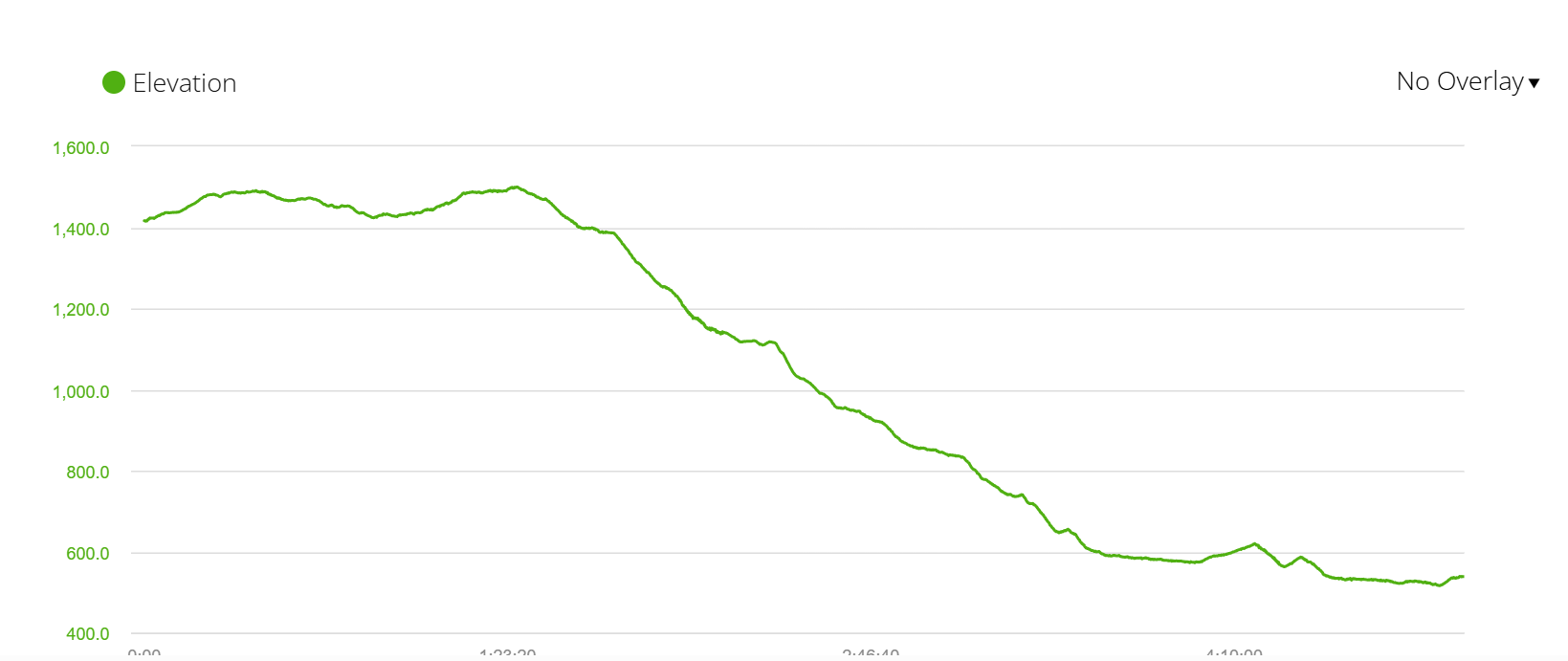
- Ascent - 308 m
- Descent - 1186 m
- Difficulty level – 3 out of 5
Highlights
- El Cruz de Ferro.
- Spectacular mountain scenery during the first 10 km/6.2 mi.
- A couple of small beautiful towns; El Acebo, Riego de Ambrós, Molinaseca.
- The Historical center of Ponferrada.

Challenges
- A steep and sometimes rocky and slippery descent for 1100 m.
- Walking on the asphalt for the last 5 km/3.1 mi.
Places to stay in Ponferrada
- Budget | La Rosa Azul Rooms |
- Middle price | Hotel Aroi Bierzo Plaza | Hostal Virgen de la Encina |
- Luxury | Hotel Aroi Bierzo Plaza |
Stage 25. Ponferrada to Villafranca de Bierzo, 24 km/15 mi
- Distance – 24 km/15 mi
- Time – 5 hours
- Walking surface – 18 km/11 mi - asphalt/tar; 6 km/3.7 mi - gravel/footpath
- Walking on the road – 2 km/1.2 mi (along the road)
- Ascent - 316 m
- Descent - 351 m
- Difficulty level – 2 out of 5

Highlights
- Beautiful vineyards for the last 10 km/6.2 mi.
- Villafranca; the Collegiate Church of Santa Maria, the Convent of San Nicolás El Real, the Church of Santiago with its Puerta de Perdón (the Gate of Forgiveness) that get opened only in Holy Years.
Challenges
- The first 11 km/6.8 mi the Camino goes next to the road with the not very impressive scenery.
- Walking surface, most of the day you walk on asphalt.
Places to stay in Villafranca
- Budget | Albergue El Castillo |
- Middle price | San Nicolas el Real | Micro-Hostal La Puerta del Perdón |
- Luxury | Plaza Mayor | Las Doñas del Portazgo |
Stage 26. Villafranca de Bierzo to O Cebreiro, 28 km/17.3 mi
- Distance – 28 km/17.3 mi
- Time – 7-8 hours
- Walking surface – 18 km/11 mi - asphalt/tar; 10 km/6.2 mi - gravel/footpath
- Walking on the road – 16 km/10 mi along the road with very few cars
- Ascent - 905 m
- Descent - 138 m
- Difficulty level – 4 out of 5


Highlights
- Many small villages along on the way; Trabadelo, La Portela de Valcarce, Las Herrerías, La Faba etc.
- Stunning views on the way from Las Herrerías up to O Cebreiro.
- Beautiful scenery from the viewpoint in O Cebreiro.

Challenges
- A lot of walking on asphalt and along the road.
- A very steep and long ascent, about 700 m over the last 6 km/3.7 mi, the ascent starts at 21 km/13 mi after Las Herrerías. One of the toughest days on the Camino Frances.
Places to stay in O Cebreiro
- Budget | Municipal albergue |
- Middle price | Hostal Mesón Antón | Venta Celta |
Stage 27. O Cebreiro to Triacastela, 20 km/12.4 mi
- Distance – 20 km/12.4 mi
- Time – 5 hours
- Walking surface – 2 km/1.2 mi - asphalt/tar; 18 km/11 mi - footpath/gravel
- Walking on the road – 0 km
- Ascent - 305 m
- Descent - 1063 m
- Difficulty level – 3 out of 5

Highlights
- Great views on the way down from O Cebreiro.
Challenges
- Several ascents and descents in the beginning.
- A long and steep descent to Triacastela.
Places to stay in Triacastela
- Budget | Municipal albergue | Pensión Garcia |
- Middle price| Complexo Xacobeo | Pension-Albergue Lemos | Casa Simon |
- Luxury | Casa Pacios |
Stage 28. Triacastela to Sarria, 25.5 km/15.8 mi
- Distance – 25.5 km/15.8 mi
- Time – 6 hours
- Walking surface – 11 km/6.8 mi - asphalt/tar; 14.5 km/9 mi - gravel/footpath
- Walking on the road – 6 km/3.7 mi, quiet road, not many cars
- Ascent - 210 m
- Descent - 320 m
- Difficulty level – 2 out of 5
Highlights
- An incredible Galician forest 5 km/3.1 mi past Triacastela, a very peaceful walk with no towns, roads or people.
- The Monastery of Samos - a big beautiful complex. If you have time it’s worth visiting the church.

Challenges
- A long stretch in the beginning right after Triacastela along the road, about 4 km/2.4 mi but there were practically no cars.
Places to stay in Sarria
- Budget | Albergue Obradoiro | Pensión-Albergue Puente Ribeira |
- Middle price | Albergue Casa Don Alvaro | Pensión Casa do Gallo Sarria |
- Luxury | Hotel Alfonso IX |
Camino Frances stages 29-33
A detailed itinerary for the last 5 stages of the Camino from Sarria to Santiago de Compostela can be found HERE.
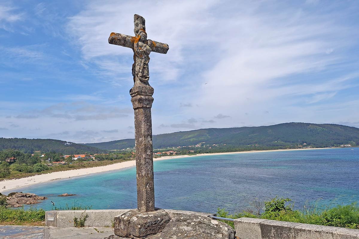
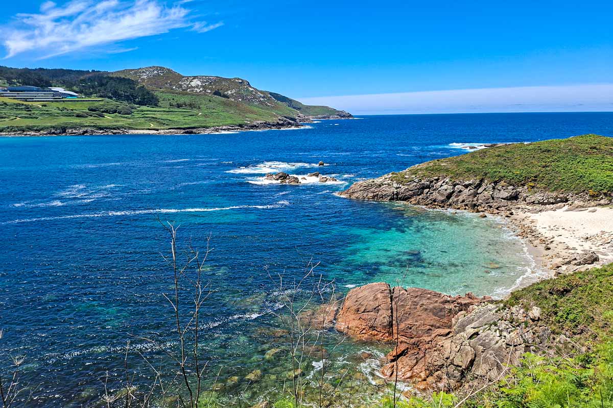
As an option after finishing in Santiago, you can continue walking to Finisterre, it'll take 3-4 more days.
Camino Frances planning resources
- Plan your Camino Frances budget | The cost of walking the Camino de Santiago |
- Learn more about the route | French Camino 2026 guide |
- Get useful tips for planning the pilgrimage | The best Camino de Santiago tips |
- Connect with other pilgrims | Camino de Santiago forum |
- The best guidebook for the Camino Frances | A Pilgrim's guide to the Camino de Santiago; Camino Frances |
Questions or Comments?
Got any questions or comments? We would love to help! All questions and comments will be answered by us personally in Buy Me a Coffee. Click below and ask away.
Feel free to support our site by buying us a coffee!

The pretty half of Stingy Nomads, responsible for all our land adventures (hiking, climbing, walking the Camino) and following them write-ups. Alya loves walking since she was a child, she prefers to walk 1000 km with a backpack rather than to do a 10 000 km road trip (actually any road trip). Alya is a big fan of Latin America, the Spanish language, and dancing. Every time we go away she desperately misses our dog Chile.

This is wonderful, thank you for creating it. I am planning to walk the French Way beginning August 3 (giving a day to get my ducks in a row landing on August 2). And would love to finish on my birthday August 31! I do feel nervous about rushing to a place to sleep each night- arriving at the public albeguries by 3pm is okay do you think?
I envision having a small breakfast then finishing the 15 or so miles before a very large lunch and sleeping early.
I am also seeking to place additional luggage in storage without seeing it again until I finish the luggage service tagged is in Spain. So is the best case to drop off in Spain then get to the Frances start by bus, then take a bus back to Spain to pick it up after finishing the trek?
Hello Stephanie. Thank you for the comment. Traditionally August is the peak season for the Camino Frances. I walked it in September and there were still a lot of pilgrims on the route. I'd suggest booking accommodation (private albergues, hotels) in small places with limited options in advance e.g. Roncesvalles, O Cebreiro, some smallish villages in the Meseta. In big cities like Pamplona, Burgos, and Leon as well as on the stretch from Sarria to Santiago there are many places to stay.
As for luggage, you can send your extra luggage to Santiago de Compostela (the end of the Camino route) using Correos. You can send it from any place in Spain to Santiago. When you finish the walk your luggage will be there waiting for you. They keep your luggage safe in a special storage place. Here is the link to their page where you can find more details and prices of the service. https://www.elcaminoconcorreos.com/en/transfer-luggage By the way you walk in France for only one day the rest of the Camino Frances is in Spain.
Buen Camino
Very helpful site. I'm planning to start mid April 2023. When you say - Book early, just how early? Weeks in advance or a day or so out?
Hello, Melody. Thank you for the comment. The recommendation to book accommodation in advance is mostly for the peak season between June and September. April is still a quiet time on the Camino Frances. If you want to stay in private I'd say book it a couple of days in advance because budget private accommodation is quite limited. If you're planning to stay in albergues you don't have to book anything in April there will be beds available.
Buen Camino
Hi I'm trying to find accommodation in Zubiri in May 2022, any help please.
Hello, Mike. Have you contacted any of the albergues in Zubiri that are listed in the PDF file with accommodation on the Camino Frances? You can find it in the second paragraph of this post. There are several albergues in the list with their e-mail addresses you can contact them for booking.
Buen Camino
@Stingy Nomads, thanks, i had no luck but have found other accommodation.
Sign me up please
Great tips. Thanks. Walking August, 2023
I am planning to walk Camino Frances next September. Thanks for these wonderful tips.
Thank you for the great information
We’re planning to do the Camino Frances for about 4 weeks. Any suggestions on what we could omit from the stages to fit our schedule? I’d say we’re average walkers; we completed Tui to SDC in the usual 6 days, walking from 7am to 1 or 2pm enjoying breaks in between. That said, we’re hoping to start from SJPP and stop at Roncesvalles on Day 1. Should be workable for us?
Hello, Armi. The Meseta was my list favorite part of the Camino Frances. I'm not a big fan of walking through flats, fields, etc. If I were you I would cut some stages between Burgos and Leon. The suggested itinerary is for 33 days if you omit 5-6 days in the middle you'll be able to complete the Camino in 4 weeks. The total distance between Burgos and Leon on the Camino is about 180 km. If you feel you rather want to spend an extra day in one of the cities you can skip the entire part of the Meseta and take a train from Burgos to Leon. There is a direct train that takes about 2h30min.
I'm sure you'll be able to walk from SJPP to Roncesvalles though it's probably the toughest part on the Camino Frances. You have to start walking very early. As an option on the day, you arrive in SJPP you can walk to Albergue D'Ornisson which is 8 km away to make your next day's walk a bit shorter and split the tough ascent over the pass. I'd recommend booking beds at the Albergue in Roncesvalles to make sure you get a spot.
I hope it helps.
Buen Camino
Hey @Armi, What did you end up omitting ?
I am in the same dilemma
@Tom, We will be walking the Camino again in June but can only commit to 200kms from Ponferrada. Hopefully, we can carve out 4 weeks next time around. How about you, were you able to go this year?
@Stingy Nomads, Thank you.
Im planning to do the walk next year
Hello Stingy Nomad, What are the conditions for drinking water on the Camino Frances from Sarria to Santiago? Is tap water OK for an American? Do I need to buy bottled water? At home in California, I never buy bottled water. Thank you, Jean Staats
Hello, Jean. We always drink tap water in Spain like most other pilgrims. The only time I bought bottled water on the Camino Frances was when I walked through the Meseta as I'd heard some people had some stomach problems after drinking tap water. From Sarria to Santiago and in Santiago we drank tap water.
Buen Camino
Hello, we'll be three women in our 60+ part of life, and we are wondering can one town we stay in, phone the next town and to keep 3 beds for us at an albergue along the Frances Camino? We're thinking August/Sept 2022, we want to start training now. What's your advise? thanks, great read by the way.
Hello, Juliette! You have to book albergues yourself maybe some hosts can do it out of courtesy but it's not a common practice. Public (municipal) albergues can't be booked at all; they work on the first come first serve principle. Private albergues and hotels along the Camino Frances can be booked through booking.com or over the phone. August - September is the peak season for the Camino. I walked the Camino Frances in September and it was very busy. I used booking.com a lot to book private albergues it was very easy. Private albergues are a bit more expensive than public but they usually have better facilities and if you book a bed you don't have to worry about finding a place to sleep or getting there in time. You don't have to book accommodation for the entire Camino you can just book 2-3 days in advance. I'm busy putting together downloadable PDF files for the Camino with walking stages and all accommodations along the route. Please, check our site in a month or so to download them it'll make your planning easier.
Cheers!
Hi Stingy Nomads,
I have read this post several times over the last few months, I am planning to do the Camino Frances in May 2022. I am sure there used to be a very useful table at the end of every stage listing where the shops, pharmacies and ATM's were on that day's route, but I cant see it any more. Have you moved it to another article?
Hello, Geoff! Yes, there used to be tables for every stage but we had to move them. We changed our blog design (it was too slow) recently and the tables didn't load properly with our new theme. I'm busy creating downloadable PDF files with stages that will include all stops along the route and separate files with accommodation. I think they'll be ready in a month or so.
Cheers!
@Stingy Nomads,
Thanks for the info and your prompt reply.
Geoff
Hi, congratulations on this webpage!
I'm planning to do the Camino Frances, starting mid-early September. Anyone else planning it or have feedback because of the virus situation? Just want to make sure it's viable.
Thanks!
Where are the legs from Sarria to Santiago?
Oh mind, my bad, I see the link - thanks
Hi, Robin! I wrote a separate post for the last 100km from Sarria because many people walk only that part of the Camino Frances. I hope it's not too inconvenient. Please, check this post in a couple of weeks we'll add free downloadable PDF files with stages and places to stay on the Camino.
Buen Camino!
Hi, I left a message asking about the final 100kms to Santiago de Compostela, that it wasn't on your itinerary but i have found these days as a separate itinerary so all good. I have now put together a full itinerary...... using your notes........ thanks so much for great notes. Walking the Camino is top of my bucket list and has become a life long dream.
Hi, Shane! I replied to your comment, maybe you haven't seen it. I'm glad you've found the last part of the itinerary. I'm busy making downloadable PDF files for the Camino Frances that will contain walking stages and accommodation along the route. I think they will be available here in a week or two.
Buen Camino!
Hello. I am planning my first Camino in May 2020 and am deciding between the French way or Del Norte. I see that most of the people choose the French way over the others. Is there a reason for it that I should choose it as well? I would appreciate your thoughts. Thank you
Hello, Ron! The French Camino is the most famous route, many people don't even know about del Norte or other Camino routes it's probably the main reason why many people walk it as the first Camino. We met many people on del Norte walking it as their first Camino. The French route has more albergues and hotels, it's a bit shorter and a bit easier than the Norther Way. Which one to choose is up to you, if you want to walk along the coast choose del Norte, if you want more of a cultural experience (historical cities and towns, etc.), fields and vineyards then choose the French Way.
Buen Camino!
Hi, so happy to have found your website but can I ask you to fix an error? The first stage from St Jean Pied de Port you have a section "Accomodation on the Camino" that lists the accomodation in km's from Roncesvalles when in fact they are from St Jean. I was studying this quite intently as I'm nervous to do this section. I thought Albergue Orisson was 8km from Roncesvalles when in fact it is only 8km from St Jean. The list under "Challenges" is correct though. With best intentions, Aneeta.
Hello, Aneeta! Thank you very much for the correction! I added accommodation after I'd finished the post it took me so long to put it together I definitely meant distances from St.Jean.
Buen Camino!
Thank you for all of this valuable information. I am still in the planning stages.
Hello, Peg! Thank you for the feedback! I'm sure you'll enjoy the walk!
Buen Camino!
I agree with your comments about booking rooms on the Camino. I like to know I have a bed for the night. I'm a fast enough walker that I can always beat the crowd. Also, I love the dark and quiet morning hours so I tend to start early (6:30 or 7:00). But with some planning you know the towns you want to visit; Gaudi built something here, beautiful Cathedral, Knights Templar Castle, etc. After a few days you know how far you want to walk, I liked 25-30 km. Then the plan just falls into place. I used booking(dot)com to plan most of the last two weeks or so. The only down side is I still get announcements for reduced prices at some of those towns.
Hi - thanks for the fantastic info you are providing!
One question - how much of the track is actually on roads (not sealed paths on the side, but actually along the road)? Same question for El Norte, as I've seen a few comments about that too.
Deciding which of the two to do in May 2020. Both look exciting!
Hello, Philip! Thank you for the comment! Around 70km walking on the road on the Camino Frances (but most of the time very quiet roads with one or two cars driving every now and then), on the Camino del Norte it a little bit more but not too bad, there is one stage from Gigon and Aviles that is pretty bad along the highway. I personally enjoyed the Camino del Norte more because of the scenery, many days you walk along the coast next to the ocean. On the French Camino, 10 days of walking through the Meseta were a bit too long for me, I prefer mountains or the ocean over fields and plains but is my personal opinion.
Buen Camino!