The Camino Finisterre - walking stages 2026, GPX, PDF
The Camino Finisterre is the only Camino de Santiago route that starts in Santiago de Compostela. The Romans believed it was "the end of the earth" - finis terrae in Latin. Nowadays this route is a popular trail that is walked by many pilgrims.
I have walked this Camino twice. The first time in 2017 after completing the Camino del Norte and the second time in May 2026 as a separate route. Many people walk the Camino Finisterre after completing a longer Camino route.

There are two finishing points on this Camino; Finisterre and Muxía. You can choose one of them or walk to both (they are connected). The first 60 km/37 mi from Santiago are the same, at Hospital (the middle of the stage 3) the Camino splits.
I've walked both routes and find that the scenery on the route to Finisterre (the last stage) is more interesting than on the route to Muxia. You get to walk through Cee and Corcubion, two beautiful seaside towns and along the coast. the route to Muxia is more inland. Which one to walk to first is up to you.
Stingy Nomads participates in the Amazon Services LLC Associates Program and other affiliate programs. If you click on the link and purchase the item or make a booking, we will receive an affiliate commission at no extra cost. Thank You for supporting us and assisting us to produce quality, free content.
Camino Finisterre Navigation
This is a Google Maps track of the walking route from Santiago de Compostela to Finisterre to Muxia and can be used on a mobile phone for navigation. We created this map following the trail markers with a GPS device. The link can only be opened while online (with Wi-Fi or data), but navigation on the track works even when offline. Click on the map, make it full screen, zoom in and keep the blue dot on the trail.
Camino Finisterre PDFs
To help you with route planning we've created downloadable PDF files with walking stages and places to stay along the Camino.
If you want to walk shorter stages between 15 km/9.3 mi and 20 km/12.4 mi you can download the alternative itinerary.
If you don't feel like walking more after completing one of the Camino routes you can do a day trip from Santiago to Finisterre and Muxia.
GPX files of the route
You can download our GPX files of the Camino Finisterre and use them on your phone or GPS watch for navigation.
Travel insurance for the pilgrimage
You can read more information about travel insurance for the Camino de Santiago or get an instant quote for your trip right here.
World Nomads travel insurance has been designed by travelers for travelers, with coverage for more than 150 activities as well as emergency medical, lost luggage, trip cancellation and more.
Camino Finisterre route overview
- Distance – 117 km/72.7 mi - Santiago to Finisterre to Muxia; 90 km/55.9 mi from Santiago to Finisterre; 27 km/16.7 mi from Finisterre to Muxia.
- Number of days (stages) – 4-6 days depending on the route and daily distances
- Starting point – Santiago de Compostela
- Finishing point – Cape Finisterre or Cape Muxia
- Difficulty level – moderate
- Accumulated ascent (over 5 days) – 2732 m
- Accumulated descent – 2839 m
- Walking surface - 66 km/41 mi - asphalt; 51 km/31.6 mi - footpath/gravel road.
- Average cost – between 30 and 50 euros per person per day mostly depending on the cost of your accommodation.
Camino Finisterre-Muxia map

Santiago de Compostela, the beginning of the route
The Camino Finisterre is the only Camino route that starts in Santiago de Compostela. Most pilgrims walk it as an extension after completing one of the other routes. It can be a nice addition to your route if you walk one of the inland Camino routes e.g. the Camino Frances, Camino Primitivo, or the Central Route of the Portuguese Camino.
Places to stay in Santiago
There are many great places to stay in Santiago de Compostela for different budgets from albergues to luxury hotels.
- Low-end | Albergue Seminario Menor | Santiago KM-0 |
- Mid-range | Hospedería San Martín Pinario | CampusSur |
- High-end | Via Aetcal Hotel & Wellness | Parador de Santiago – Hostal Reis Catolicos |

Camino Finisterre-Muxia walking stages
Stage 1. Santiago de Compostela to Negreira, 20.7 km/12.8 mi
- Distance – 20.7 km/12.8 mi
- Time – 5-6 hours
- Accumulated ascent – 500 m
- Accumulated descent – 597 m
- Walking surface – 15.7 km/9.7 mi – asphalt; 5 km/3.1 mi – footpath/gravel.
- Walking route - Santiago de Compostela - Ponto Maceira - Negreira.
A beautiful walking day mostly through the forest with a steep ascent in the middle part.
The Camino starts at the Cathedral in Santiago de Compostela. It’s a strange feeling to start walking from there. The first 400 m are not well-marked. You can see faded yellow arrows painted on the ground. But it’s not difficult to follow the route. From Obradoiro Square go down to and follow it out of the town till you see the first official Camino sign at the pedestrian crossing across the road.
There are no places to stop for food or water for the first 9 km/5.5 mi. It’s better to have breakfast before you leave Santiago and pack enough water and some snacks.
Elevation profile
Challenges of the stage 1
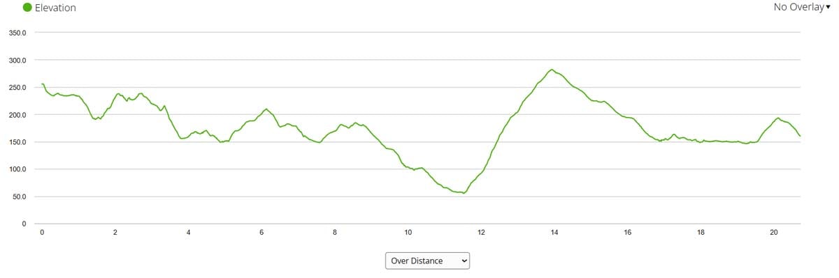
- No place to stop for food or water between 1 km/0.6 mi and 8.8 km/5.4 mi.
- Several ascents and descents throughout the day.
- A steep and long ascent at 12 km/7.4 mi - 230 m up over 2 km/1.2 mi.
- Walking on the road for 2 km/1.2 mi at the end of the stage.
Highlights
- The beautiful Galician forest.
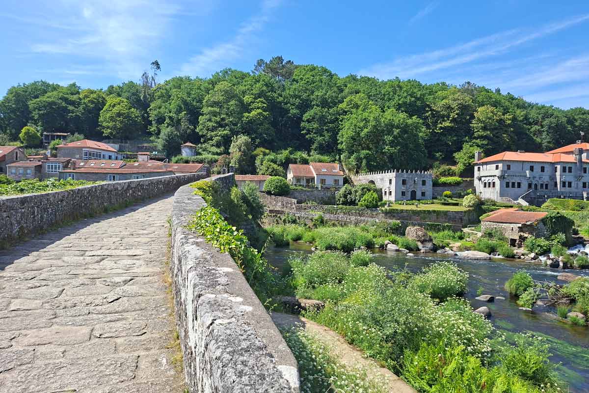
- Ponte Maceira, a charming place with the Medieval bridge, small waterfalls, and old stone houses surrounded by the forest.
Stage 1 route description
0-1 km/0-0.6 mi - through Santiago de Compostela.
1.5-8.8 km/0.9-5.4 mi - through the forest with no place to stop for food or water.
8.8 km/5.4 mi - a restaurant
10 km/6.2 mi - private albergue A Casa da Boi and a cafe.
11 km/6.8 mi - a cafe and a pharmacy.
11.6 km/7.2 mi - a cafe.
12 km/7.4 mi - a steep and long ascent in the forest. It’s the toughest part of the stage and probably the most challenging ascent of the entire Camino Finisterre. You go up 230 m over 2 km/1.2 mi.
12-16 km/7.4-10 mi - through the forest.
15 km/9.3 mi - a bar.
17 km/10.5 mi - Ponte Maceira, a small picturesque place with a beautiful bridge, small waterfalls, and restaurant with great views from its terrace.
17-18.8 km/10.5-11.6 mi - through the forest.
18.8-20 km/11.6-12.4 mi - on or along the road.
20.7 km/12.8 mi - Negreira.
Places to stay in Negreira
- Budget | Municipal Albergue | Albergue Bergando |
- Middle price | PENSION ORUEIRO VILASERIO |
- High-end | Piso Camiño a Fisterra |
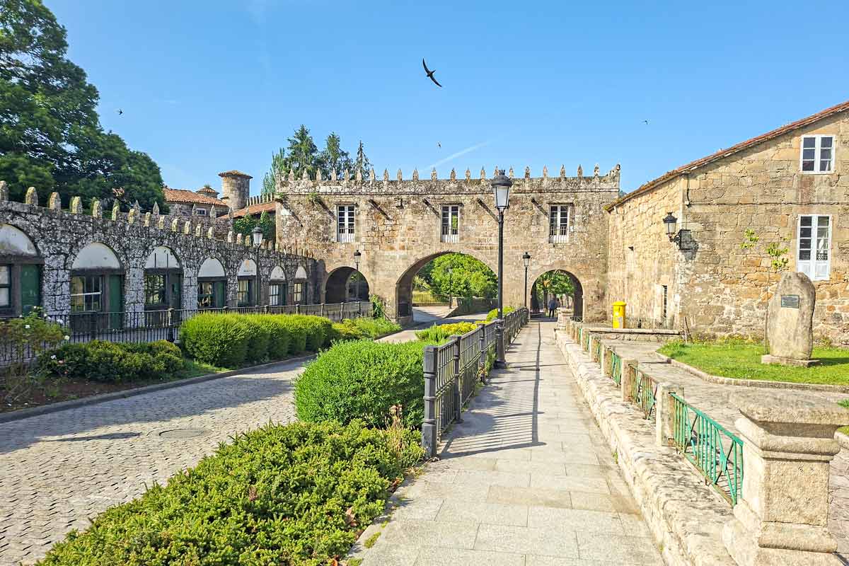
Stage 2. Negreira to Lago (Mazaricos), 28.6 km/17.7 mi
- Distance – 28.6 km/17.7 mi
- Time – 7 hours
- Accumulated ascent – 746 m
- Accumulated descent – 558 m
- Walking surface – 16.3 km/10.1 mi – asphalt; 12.3 km/7.6 mi – footpath/gravel.
- Walking route - Negreira - A Cabana - Santa Marinas - Lago.
It is the longest walking day in this itinerary. As an option you can adjust it. First walk from Negreira to Santa Marinas, 21 km/13 mi. Then from Santa Marinas to Olveiroa, 13 km/8 mi.
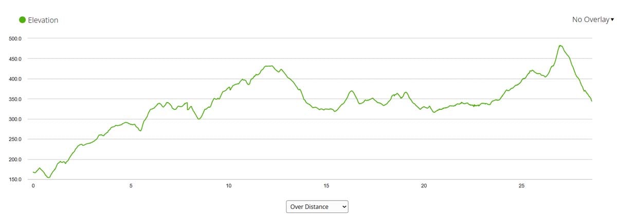
The walk overall was nice mostly through the forest and fields with a couple of stretches of walking on quiet roads. In the second half there are no places to stop for food and water for 8 km/5 mi. I strongly recommend carrying enough water and some snacks with.
Elevation profile
Challenges of the stage 2
- A long walking day.
- A long and gradual ascent from Negreira.
- Walking along the road for 4 km/2.4 mi (two stretches).
- Several ascents and descents throughout the day.
- No place to stop for food and water for 8 km/5 mi, between 13 km/8 mi and 21 km/13 mi.
- A steep ascent with a subsequent descent at the very end of the day, the last 2 km/1.2 mi. You can skip it by continuing walking on the road to Lago instead of turning left to the gravel road at 26 km/16.1 mi.
Highlights
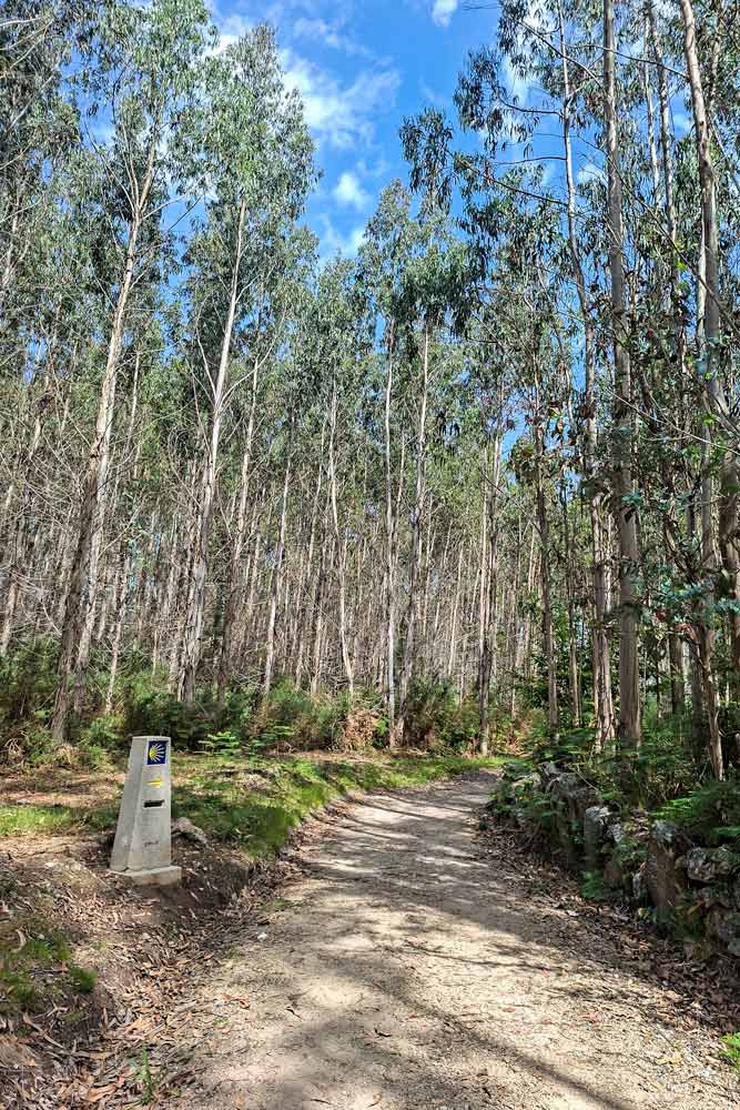
- The beautiful forest in the first part of the day.
- Rural scenery in the last part of the walk.
Stage 2 route description
1 km/0.6 mi - Municipal Albergue of Negreira.
1.6-8.6 km/0.9-5.3 mi - through the forest.
3.7 km/2.2 mi - a small cafe.
5.5 km/3.4 mi - an ascent.
8.6 km/5.3 mi - A Cabana. A private albergue/cafe Alto da Pena.
8.7 km/5.4 mi - a restaurant, Albergue/hotel San Mamede da Pena.
10-13 km/6.2-8 mi - through the fields.
11-13 km/6.8-8 mi - along a quiet road with very few cars.
13 km/8 mi - Vilaserio. Private Albergue Casa Velha, private Albergue/guesthouse O Rueiro, a restaurant.
13.4-15 km/8.3-9.3 mi - along the road with not many cars.
15 km/9.3 mi - a vending machine with cool drinks and snacks.
15.4-16.4 km/9.5-10 mi - through the forest.
17-28 km/10.5-17.3 mi - mostly through the fields.
21 km/13 mi - private Albergue/restaurant Casa Pepa.
22 km/13.6 mi - private albergue Santa Mariña and a bakery.
26 km/16.1 mi - a steep and short ascent with a subsequent descent.
28 km/17.3 mi - Lago, a small place with one private albergue and two cafes.
Places to stay in Lago
Private albergue Monte Aro (a private room and a dormitory)
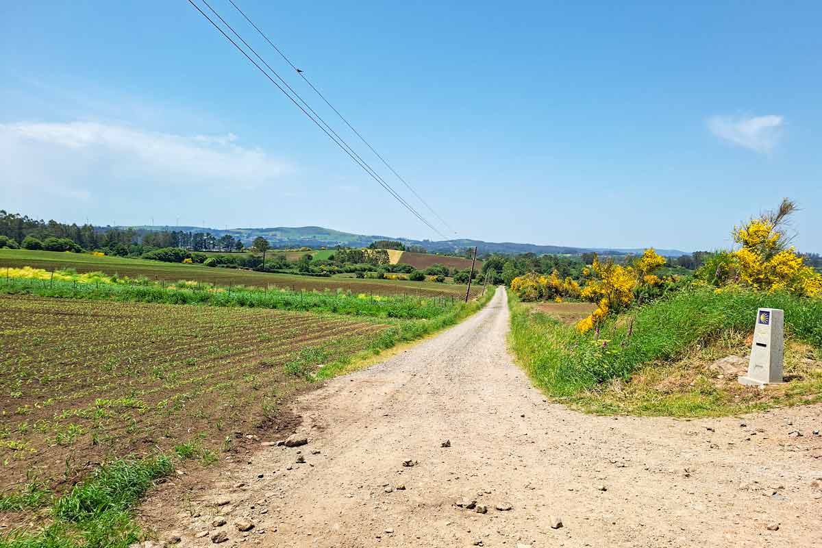
Stage 3. Lago to Cee, 25.4 km/15.7 mi
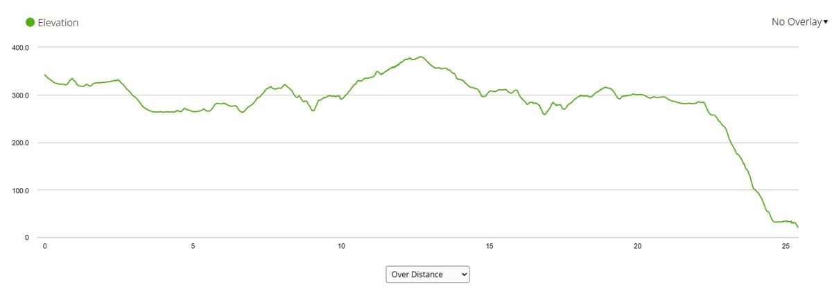
- Distance – 25.4 km/15.7 mi
- Time – 6 hours
- Accumulated ascent – 380 m
- Accumulated descent – 698 m
- Walking surface – 9.4 km/5.8 mi – asphalt; 16 km/10 mi – footpath/gravel.
- Walking route - Lago - Oliveira - Hospital - Cee.
Elevation profile
Challenges of the stage 3
- A long and steep downhill to Cee.
- No place to stop for food or water for the last 13 km/8 km, between 12 km/7.4 mi and 25 km/15.5 mi.
Highlights
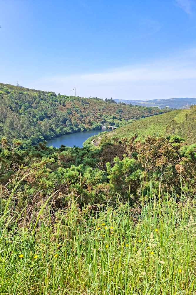
- Walking over the hills with stunning views.
- Olveiroa, a nice small town.
- Senora das Neves Chapel in the forest.
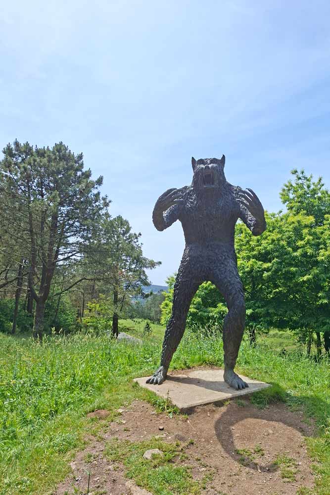
- A scary 5-meter tall bronze statue of Vakner, a werewolf from Galician mythology in the middle of the forest. There is a metal plank with a legend and explanation of its origin.
- The beautiful town of Cee.
Stage 3 route description
0-4 km/0-2.4 mi - through the fields.
4.2 km/2.6 mi - private Albergue/guesthouse Ponte Olveiroa and a restaurant.
4.5-6 km/2.7-3.7 mi - along the road.
6 km/3.7 mi - Olveiroa, a small town with several Albergues, guesthouses, and restaurants.
7-11 km/4.3-6.8 mi - over the green hills with beautiful views.
10 km/6.2 mi - O Logoso, private Albergue/cafe O Logoso and guesthouse A Pedra.
12 km/7.4 mi - Hospitale, private Albergue O Castelino, a cafe the last cafe for the next 13 km till Cee.
12.5 km/7.7 mi - the route split; the right route goes to Muxia, the left route goes to Finisterre.
13-24 km/8-15 mi - over the hills and forest.
16.7 km/10.3 mi - Sra das Neves Chapel in the forest.
22 km/13.6 mi - a long and sometimes steep ascent to Cee.
24.6 km/15.2 mi - a private albergue and a bar.
25 km/15.5 mi - Cee, a picturesque coastal town with many albergues and cafes.
Places to stay in Cee
- Low-end | Tequeron | Albergue O Bordón |
- Mid-range | Hotel Larry | Abuela Maruja |
- High-end | Hotel Oca Insua Costa da Morte |
Stage 4. Cee to Finisterre, 15.5 km/9.6 mi
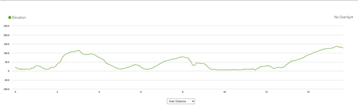
- Distance – 15.5 km/9.6 mi
- Time – 4 hours
- Accumulated ascent – 405 m
- Accumulated descent – 300 m
- Walking surface – 11.5 km/7.1 mi – asphalt; 4 km/2.4 mi – footpath/gravel.
- Walking route - Cee - Corcubion - Finisterre (town) - Finisterre lighthouse.
In Cee there is a route split. One route is 1 km/0.6 mi longer and it goes more inland. The other route goes along the coast through Corcubion (another town next to Cee). Both routes merge after a couple of kilometers.
It’s a short walking stage (compared to the rest of the itinerary). In the middle there is a part of walking on a busy road between Corcubion and Sardineiro Beach. The Camino crosses from one side to the other side of the road at least 5 times which is not nice considering the lack of pedestrian crossings and traffic lights.
Finisterre Cape is 2.5 km/1.5 mi from the town. Once you are in the town you can head to your accommodation place, leave your backpack there, and then walk to the point. Most people do it that way.
From the cape you can walk back to your hotel/albergue or take a taxi. There are no public buses between the town and the lighthouse.
Elevation profile
Challenges of the stage 4
- Walking on the road for 1.5 km/0.9 mi between Corcubion and Finisterre (town).
Highlights
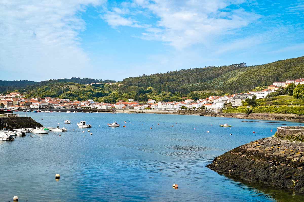
- The charming seaside town of Corcubion.
- Walking through the beautiful forest.
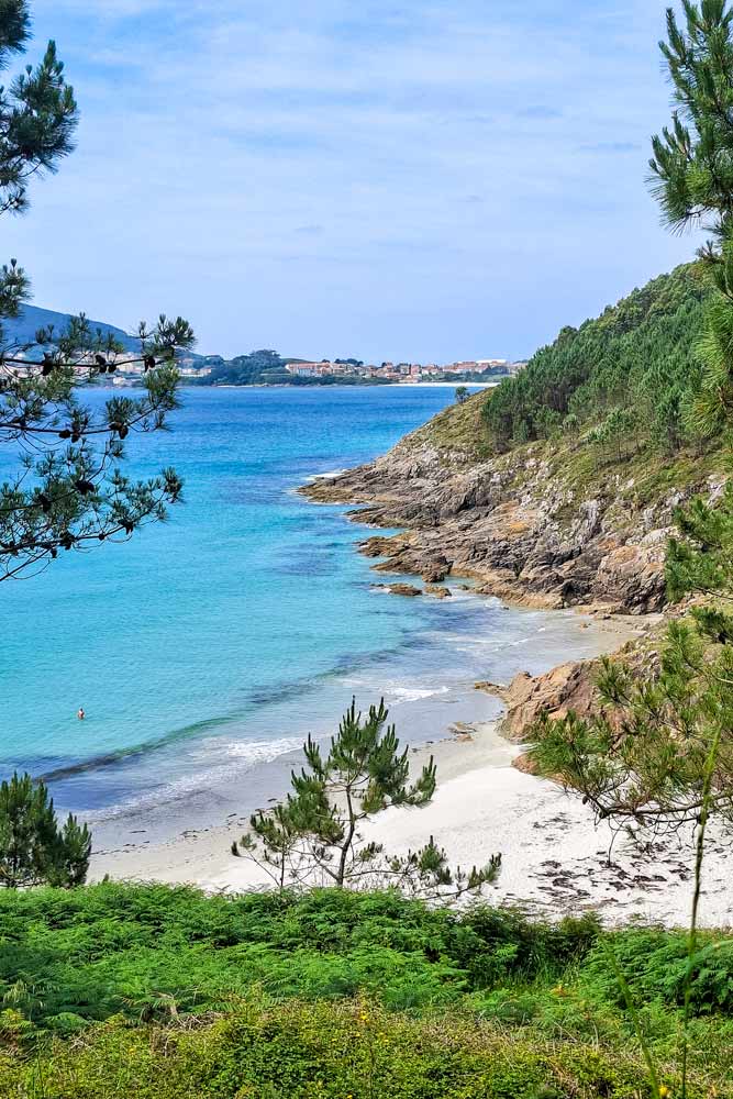
- Walking for 2 km/1.2 mi along Langosteira Beach.
- The town of Finisterre.
- Spectacular views of the coast on the way to the lighthouse.
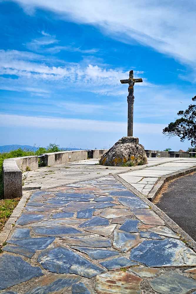
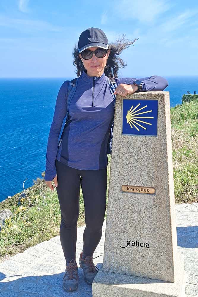
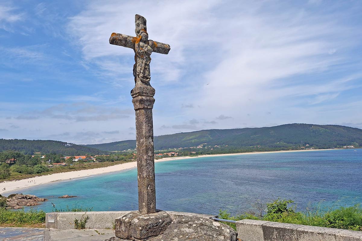
- Breathtaking views from Cape Finisterre, the lighthouse, and the KM0 sign.
Stage 4 route description
0-2 km/0-1.2 mi - walking through the town of Corcubion.
3 km/1.8 mi - municipal Albergue San Roque.
4 km/2.4 mi - private Albergue San Pedro.
4.3-5.5 km/2.6-3.4 mi - walking on the road.
5 km/3.1 mi - hotel/restaurant Playa de Estorde.
5.2 km/3.2 mi - campsite Ruta Finisterre.
6 km/3.7 mi - Sardineiro Beach, a small place with a couple of guesthouses, hotels, and restaurants.
6.2 km/3.8 mi - hotel/cafe Playa de Sardiñeiro.
7-8.7 km/4.3-5.4 mi - walking through the beautiful forest.
9 km/5.5 mi - private Albergue Cabo da Vila.
9.5-11.5/5.9-7.1 mi - along the beautiful Langosteira Beach. You can walk on a sidewalk along the beach for 2 km/1.2 mi or on the sand on the beach.
10.7 km/6.6 mi - a bar.
11.5-13 km/7.1-8 mi - through the town of Finisterra.
13-15 km/8-9.3 mi - on a footpath along the road.
15.5 km/9.6 mi - KM0 sign and Cape Finisterre lighthouse.
To get back to the town you have to walk back (another 2.5 km/1.5 mi) or take a taxi. It’s possible to stay right at the lighthouse at Semaforo Hotel but the place is quite pricey.
Places to stay in Finisterre
You can stay at the very cape Finisterre, next to the Lighthouse at Hotel O Semaforo. It's quite pricey but the location and the scenery around are truly spectacular. It's a small and cozy hotel with beautifully designed rooms, breathtaking views, and a nice restaurant.
- Budget | Municipal Albergue | Albergue Mar del Plata | Albergue Oceanus Finisterre |
- Middle price | Pensión Mirador Fin da Terra | Hotel Ancora |
- High-end | Hospedium H Cabo Sport |
Stage 5. Finisterre to Muxia, 27.5 km/17 mi
- Distance – 27.5 km/17 mi
- Time – 7-8 hours
- Accumulated ascent – 701 m
- Accumulated descent – 686 m
- Walking surface – 13.2 km/8.2 mi – asphalt; 14.3 km/8.8 mi – footpath/gravel.
- Walking route - Finisterra - Lires - Muxia town - Muxia cape
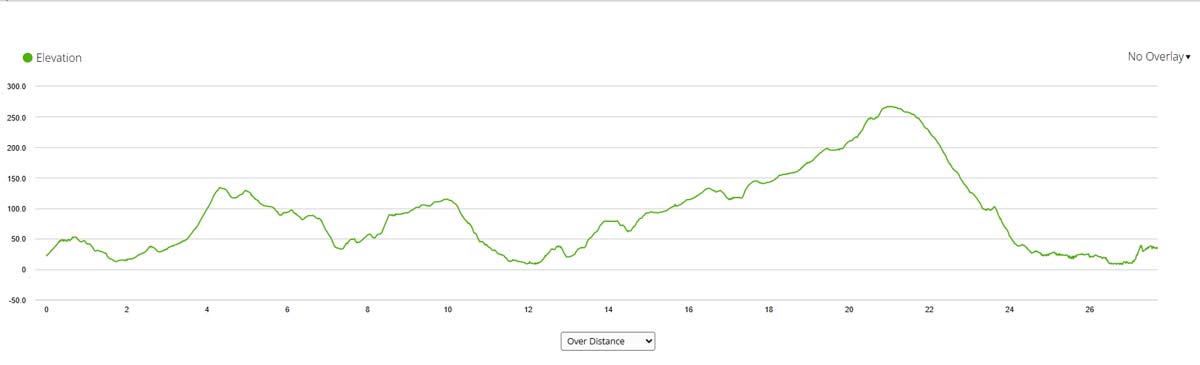
It’s another long walking day. It went quite quickly for me because I really enjoyed the scenery. Most of the day the Camino goes through the forest. The last 2 km/1.2 mi to Muxia are along the coast past some spectacular beaches. Overall despite the distance the day went by quite fast.
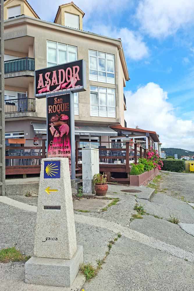
The first Camino sign to Muxia can be found in front of Asador San Roque restaurant at (Langosteira Beach), about 1 km/0.6 mi from the center of the town.
Elevation profile
Challenges of the stage 5
- A long walking day.
- Several ascents and descents throughout the day.
- Not many places to stop for food in the second half of the stage.
- Walking on the road (with not many cars) for 1.5 km/0.9 mi.
Highlights
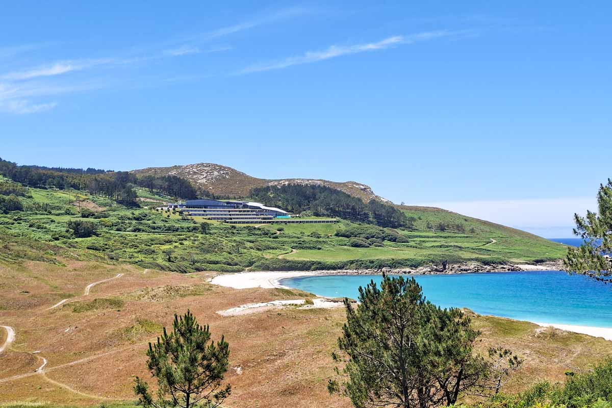
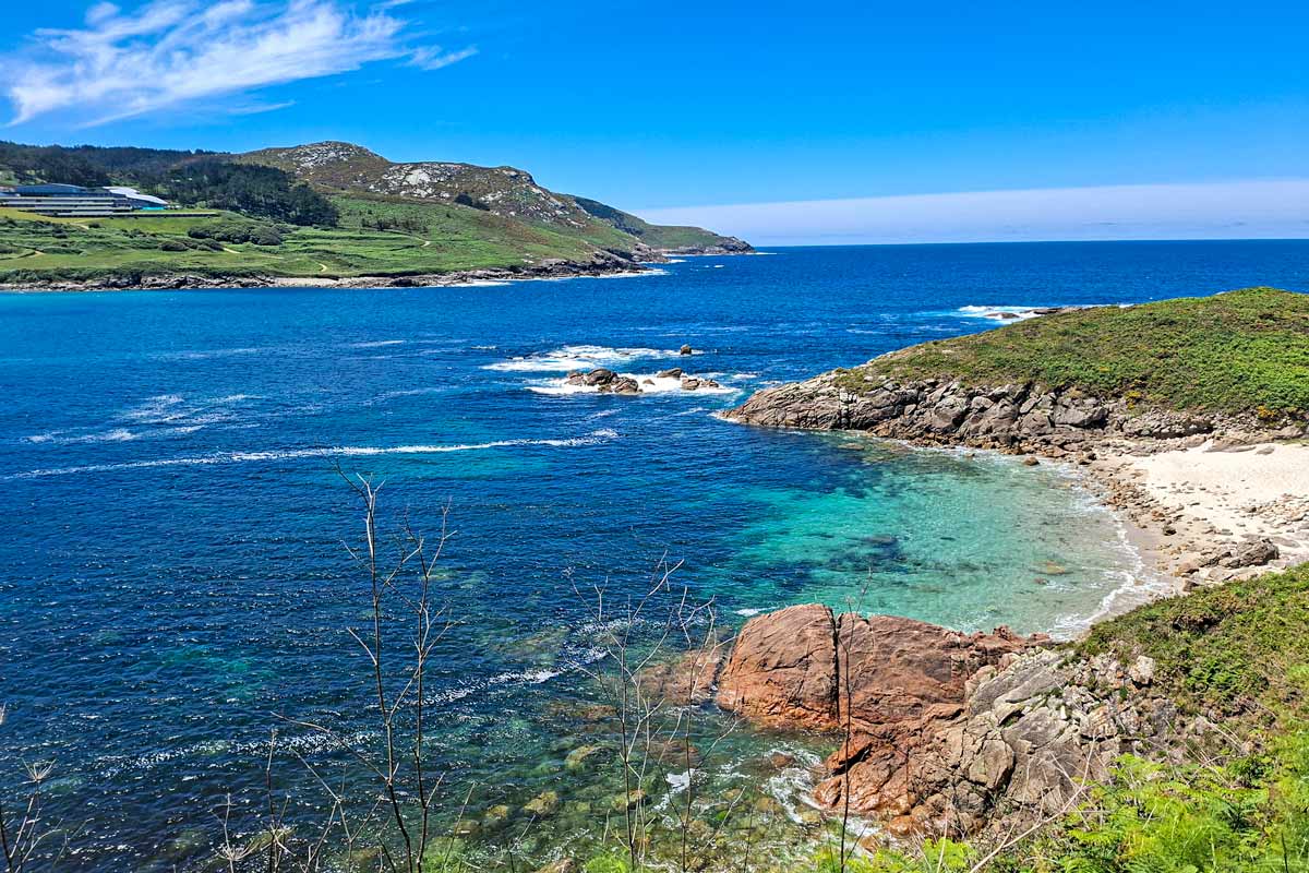
- Walking through the picturesque Galician forest with spectacular coastal views for the most of the day.
- Praia de Lourido, a beautiful white sand beach at 25 km/15.5 mi.
- Walking along the coast for the last 2.5 km/1.5 mi to Muxia.
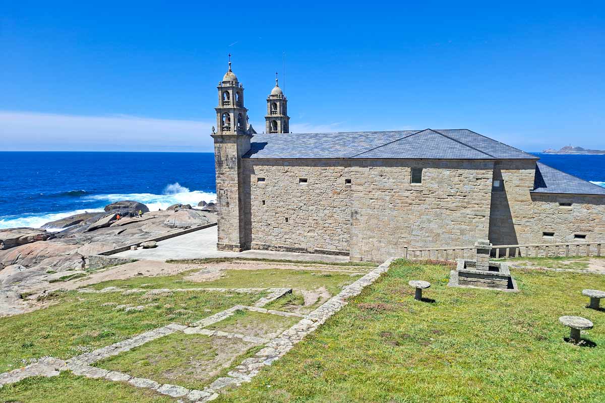
- The beautiful Muxia Cape with the Church of Nuestra Sra do Barco, a small lighthouse, and several other monuments.
Stage 5 route description
3 km/1.8 mi - a cafe.
3.6 km/2.2 mi - a short ascent.
5.7 km/3.5 mi - a cafe.
7.6 km/4.7 mi - a cafe.
8.3 km/5.1 mi - a short ascent
8.5-12 km/5.2-7.4 mi - through the forest.
12 km/7.4 mi - the small town of Lires. It looked like a very nice place. If you don’t want to walk 27 km/16.7 mi in one day you can stop here. There are plenty of guesthouses and one private albergue Albergue As Eiras.
12.2 km/7.5 mi - Casa Raul guesthouse.
12.4 km/7.7 mi - Restaurant/guesthouse Liresca.
12.5-24 km/7.7-15 mi - through the forest.
18.8 km/11.6 mi - a bar.
20 km/12.4 mi - an ascent.
24-25.5 km/15-15.8 mi - on a road with beautiful coastal views.
25 km/15.5 mi - the stunning white sand beach Praia de Lourido.
25-26.5 km/15.5-16.4 mi - along the coast to Muxia.
26.7-27.5 km/16.5-17 mi - the walk from the town to the cape. You can walk there following Rua Atalaia or on a footpath along the cliffs.
27.5 km/17 mi - the church of Nossa Senhora da Barca and the lighthouse.
The cape is about 1 km/0.6 mi from the town. To get back you have to walk.
Places to stay in Muxía
- Budget | Municipal Albergue | Muxia Mare | Albergue Bela Muxia |
- Middle price | Four Rooms | Apartamentos Praia do Capitàn |
- High-end | Pensión Rustica Alemana |
How to get back to Santiago?
Finisterre to Santiago de Compostela
There are 7 daily direct buses from Finisterre to Santiago. The journey takes 2 to 3 hours (depending on the route and stops). The bus leaves from the bus stop around the corner from the municipal albergue. The price is 7,30 Euro pp. You can check online for the current departure times, prices, and tickets. Note! In the search box "Departure point" type "Fisterra", the Galician name of the town.
Muxia to Santiago de Compostela
A bus from Muxía to Santiago takes 1h45min., the price is 6.85 Euro. There are 2 daily direct buses and one that goes through Finisterre. The bus leaves from Cafeteria Don Quijote, the second stop is at the bar O'Xardin. You can purchase tickets and check the up-to-date itinerary on the MonBus website.
Questions or Comments?
Got any questions or comments? We would love to help! All questions and comments will be answered by us personally in Buy Me a Coffee. Click below and ask away.
Feel free to support our site by buying us a coffee!
Liked this post? Pin it!


The pretty half of Stingy Nomads, responsible for all our land adventures (hiking, climbing, walking the Camino) and following them write-ups. Alya loves walking since she was a child, she prefers to walk 1000 km with a backpack rather than to do a 10 000 km road trip (actually any road trip). Alya is a big fan of Latin America, the Spanish language, and dancing. Every time we go away she desperately misses our dog Chile.

Thank you! Your guide was incredibly helpful. Without it, I would have wasted so much time. By the way, it looks like some of the GPX files you uploaded are duplicates: files 1 and 4 appear to be the same, and files 2 and 5 also appear to be identical.
Hello Soung, thanks for pointing that out, I corrected the error. Happy to hear our content was helpful. Safe travels!
A lot of very good information for anyone planning this part of the Camino. I walked it last year (2024). I also published the story of my days on the Camino. Just published : WALKING TO THE END OF THE WORLD; Camino Fisterra-Muxia.
Hi guys! Your website helped me soooo much, planning my first camino in May this year! (I did the Camino Portugues from Porto to Santiago and I absoluters LOVED it!). Right now I’m planning to walk from Santiago to Fisterra and Muxia in May ‘24. Your PDF files and all the advice you give is so incredibly useful! Thank you so much for that!
Hello Sarah. Thank you for the comment. We're sure you'll enjoy the Camino Finisterre. It's a beautiful route.
Buen Camino
In September 2023 I am returning to complete the Portuguese Coastal Route. I am hoping to finish in Finisterre, if I can still walk, but should be OK after a days R&R in Santiago. , I'm intending to walk to Finisterre.
I've just discovered this site, and its been so informative.I'm coming from NZ, and this time around I will be much better prepared.
You guys do fantastic guide books! Thank you. Brendan.
Hi Stingynomads,
thank you very much for the guide.
I just arrived in Negreira municipal albergue and have to add that the kitchen here is not equipped at all. It is empty. There is a microwave for sure and cooking plates, but besides that, nothing else. I found two plates, two glasses, one knife and bottle opener in the cupboards. That's it.
Hello, Marina. Thank you for the comment. When we were there the albergue in Negreira definitely had more than you described. Maybe they'll get new utensils again. For the last two years, most albergues were closed there might be some lack of infrastructure or facilities.
Buen Camino
I volunteered for two weeks in a municipal albergue this year (2023). I learned that because Galicia's municipal albergues do not have cooking implements like pots, pans, colanders, etc. This is because each albergue is staffed with only one person who cleans and sanitizes all buildings from 9am-11am, then handles check in from 1pm-10pm. Adding kitchen cleanup to their duties isn't sustainable due to these time limitations.
Kitchens often have a microwave for heat-eat meals. One enterprising pilgrim bought heavy-duty aluminum foil (to use as a baking sheet) and made five pizzas from scratch in the oven. If pilgrims want to cook in the municipal albergues, consider bringing a lightweight pot to use in the stove or order a la carte from a local restaurant. Hope this helps!
Hello Stingynomads,
Thank you very much for making this guide.
My friend and I are both female in mid sixty want to do the Camino Santiago- Muxia -Finnisterre at the end of May but we doubt that we can make the distances you suggested between stops. We are not used to long walk ( we try). Can we find accomodation between stops which you suggested? We are aiming to walk around 15km per day without luggage and allocate two and a a half weeks for the journey. Though personally I prefer municipal alberques because we will be among other pilgrims, on this journey we need a private room in any accomodation ( don't mind hotel/private alberque ) because of Covid as my friend is a cancer survivor so we have to be extra carefull.
I appreciate any information/tips from anyone from this forum.
Eleonora Priadi
Hello, Eleonora. Thank you for the comment. You can adjust the itinerary to your needs. At the beginning of this post (3rd paragraph), you can find two downloadable PDF files. One file contains walking stages for the Camino Finisterre (with distances between every town along the route), and the second file contains a list of places to stay along the route. Two and a half weeks only for walking the Camino or in total for the trip including getting to and back? Even if you walk only 10 km a day you will be able to complete the route in 10 days. There are private accommodation options on the Camino Finisterre it's understandable that you and your friend rather stay in private. Albergues are fun and social but besides the Covid situation, you often don't get good rest there.
Buen Camino
@Stingy Nomads,
Hi Stingynomads, Thank you again for the guide and I will continue to monitor the site for more information.
With the help of your guide I have now made an itinerary with a distance between stops around 9- 14.5 km except for Santiago- Nigreira which is still 21km. I tried to check your map to find the name of the village or town between them to find the possibility of accomadation (Airbnb maybe?) but could not see anything even after using magnifying glass. Maybe you or anyone else who has done the route know. I appreciate the help because my friend and I are not sure we can walk the 21 km with the possibility of being lost thus will take longer.
We will have enough time because we allocated 19 days for the whole journey including flights from New York and London and we also plan to do the day tours from Santiago as you suggested as well.
I appareciate all youyr tips,
Eleonora
Hello, Eleonora. Thank you for the comment. I updated the post and added two hotels in Roxas that is about 8 km away from Santiago on the way to Negreira. Please, check the itinerary sections of the post for (the first walking day from Santiago to Negreira). There are two hotels in Roxos. They're not as budget as albergues but these two are the only options I can find on the sections of the Camino Finisterre between Santiago de Compostela and Negreira.
Buen Camino
@Eleonora Priadi, Hi Eleonora, my friend and I would also like to do the Camino Santiago- Muxia -Finnisterre. We are both in our 60's and prefer to walk a shorter distance than some of the routes suggest, however, we also want to have our luggage transported between hotels. But to do that it seems we are restricted to one of the tours with their itinerary . How did you manage not to carry your luggage on the walk and would you mind sharing with us the route and hotels you used in May? Thank you so much
Pam Banks
Hello Pam. I'm not sure if Eleonora is going to answer or even see your message. She's just one of our readers. She used our PDF files to plan the itinerary that suited her the best. You can find the PDF files that contain walking stages and a full list of places to stay on the Camino Finisterre (with distances between them) in the 3rd paragraph just before the photo. It's possible to split the days and walk around 10 km per day on average. There are albergues and hotels every 10 km or so.
The first day from Santiago to Negreira can be split into two as well. If you want to split the stage into two you can stop at Roxas, a small village about 8 km from Santiago de Compostela. It’s about 800 meters away from the Camino. There are two hotels Hotel O Desvio and Asador de Roxos Casa Albardonedo. This way you walk 21 km over 2 days; 8 km and 13 km.
As for luggage transfer service, you don't have to use any tours. You can directly contact one of the companies providing the service. Pilbeo delivers your bags from place to place even if they are just 5 km apart. https://www.pilbeo.com/backpack-transport/camino-a-fisterra
I hope it helps.
Buen Camino
“There is a tradition of burning an old piece of clothing or shoes at the boot sculpture. We didn’t do it (it was super windy and rainy) but if you decide to go for it make sure you don’t leave any traces and rubbish behind.”
Please, please, PLEASE remove this note from your website! This is not a true tradition, and given the danger of fire in Spain, it’s a recipe for disaster — not to mention it’s disrespectful to local residents who take pride in their environment.
I’m amazed that you would promote such action!
Hello, Laurie. Thank you for pointing it out. You have a valid point and I totally agree with you. I updated the post a week or so ago but somehow missed that part. It's been removed from the post now.
Buen Camino
@Stingy Nomads,
Thank you very much!
I had a question about the places to stay in between towns. I use a CPAP machine for sleep at night, would that mean I would need to stay at hotels for each night to ensure I had a place to plug in my machine? I imagine most albergues wouldn't have power outlets near the beds for people. Thank you!
Hello, Robert. You don't have to stay only in hotels. Albergues on the Camino Finisterre (mostly private albergues) have power outlets next to beds you'll just have to make sure you get the right bed. You can book accommodation for the route in advance and contact the places to ensure they have power outlets next to the beds and ask them to book a bed next to it.
Buen Camino
I am confused if you mean the muni albergue is before I reach Negreira (and would need to go into town and then back to the albergue) or on the far side of town.
And am I foolish to try this in November?
Hello. The municipal albergue of Negreira is about 1km past the town on the Camino route. You don't have to walk back to the town unless you want to go out or walk around the town a bit. You can do shopping on the way to the albergue so you don't have to walk back. We did the Camino Finisterre at the beginning of November and the weather was terrible; heavy rain, strong wind, and cold. You might be lucky but overall it's usually quite unpleasant in November in Galicia.
Buen Camino
Hi, thanks so much for your incredible article. I don't think I could have planned this without your help! I have a question about Olveiroa. I am traveling with a large group of family and friends to do the Camino Finisterre, and I wonder if you know how many spaces in private Albergues there will be? We have 4 couples that will need private rooms, do you think there will be enough space in that small town? THanks so much!
Hello, Jonas. Thank you for the comment. I'm glad you've found our post helpful. I'd suggest stopping in Ponte Olveira, a place 2 km before Olveiroa. There is a private albergue Albergue Ponte Olveira. I can see in the booking (there is a link to the place in the post and in the PDF file) that they have 4 private rooms (3 double and 1 triple room). You can book it online in advance to make sure there will be enough rooms for your Camino party.
Buen Camino
Hi, thanks a lot for the nice and infomative website. I am thinking about going form Santiago to Muxia. I was wandering if I can use albergue for pilgrims on the way if I am starting from Santiago? And do you know if it is possible to get the credencial in Santiago? Thanks.
Hello, Marketa! Yes, you can still use albergue on the way to Muxia if you start walking in Santiago. I believe you'll be able to get the Credential at the Pilgrims' office in Santiago.
Buen Camino!
A quick question... Is it possible to walk BACK to Santiago from Muxia? Is it well marked? Can i get a Compostela if I do Santiago-Finisterre-Muxia-Santiago? I heard that you can only get a Compostela if you walk more than 100km and you end the journey in Santiago. Not sure if this is correct. I hope to do the walk in April 2020.
Hello, Cynthia! It's true you can get the Compostela only if you walk at least the last 100km to Santiago. It's possible to walk from Muxia to Finisterre and to Santiago the route is marked both ways though the marking from Santiago is better. Most people start it in Santiago and walk to Finisterre where you can get the Finisterrana it's a certificate that states that you've walked the Camino Finisterre if you walk to Muxia you can get the Muxiana another certificate. If you start in Muxia and walk to Finisterre and then to Santiago it's already more than 100km no need to walk it from Santiago. Theoretically, you should be able to get the Compostela for walking to Santiago from Muxia just remember that for the last 100km on any Camino route you need 2 stamps a day, the first you can get in your albergue and the second in any restaurant or bar on the way (many of them have stamps).
Buen Camino!
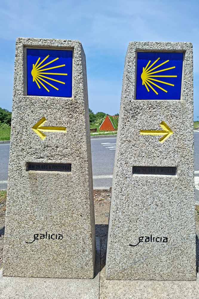
In 2016, I walked the Camino in reverse from Finisterre to Santiago, and found decent waymarking. Usually it's a blue arrow with a spiral. Also, the path between Muxia and Fisterra is well marked with stone columns pointing the way in both directions. There were a few confusing places, but if I waited for a pilgrim to come from the opposite direction, I could find the path again.
Hi
Do you have any information regarding availibility of busses between Muxia and Finisterre. Perhaps any timetables and frequency of busses.
Regards
Hello, Gerda! There is a paragraph in the post "Getting back to Santiago from Finisterre and Muxia", in this paragraph, there is a link to the site of a bus company if you click on the words "on the site" it'll open their site where you can check for buses.
Regards
Hi,
The link is not working...hopefully it is temporary!!
I can see on the site that currently there are two buses from Finisterre to Muxia at 9.45am and 5.40pm, it takes 50min., price 2.85Euro paid on the bus.
Regards
Hello,
I am doing this route in August, Are there many main roads on it?
Thanks
Ita
Hello, Ita! As I remember there were no busy roads on the Camino Finisterre, you do occasionally cross a road here and there but most of the time you walk through the forest and fields, maybe next to a secondary road sometimes but there was never a lot of traffic.
Buen Camino!
Hi
Thanks for that
You site is brilliant
Buen Camino!
Hi there, really informative, many thanks.
I am hoping to do Santiago to Muxia/Finistere this coming September. I would like to stay for a couple days when I complete it before I head back to Santiago, but unsure which spot to stay? if you had any suggestions. I would ideally like a beach nearby with good restaurants. Which area would you recommend?
Many thanks
Hello, Allison! Thank you for the comment! Both Finisterre and Muxia have beaches nearby and restaurants. We like Muxia more first because it felt less touristy fewer day tourists come here, second because the cape with the church in Muxia is basically right in the town which means you can go there and back any time when in Finisterre the cape itself about 3 km away from the town. We had dinner twice at A Marina restaurant in Muxia, they have all the traditional Galician food on the menu. It's not that we didn't like Finisterre we just were very unlucky with the weather there. If I'm not mistaking there are more daily buses from Finisterre to Santiago than from Muxia.
Buen Camino!
Very useful .Thanks.