Cerro Castillo - a 2024 trekking guide
Cerro Castillo trek (Las Horquetas) is a 50 km route through Cerro Castillo National Park, one of the best Patagonia National Parks for hiking. The scenery on the trek is stunning; indigenous forest, hanging glaciers, mountain rivers, snow peaks, turquoise blue lakes, bizarrely shaped mountains - untouched nature combined with unpredictable Patagonian weather.

There are different hiking routes in Cerro Castillo National Park. You can do a day hike to Laguna Cerro Castillo or a 4-day trek through the park. Compared to other multi-day hikes in Patagonia e.g. treks in El Chalten or backpacking in the famous Torres del Paine, Cerro Castillo has fewer people.
Stingy Nomads participates in the Amazon Services LLC Associates Program and other affiliate programs. If you click on the link and purchase the item or make a booking, we will receive an affiliate commission at no extra cost. Thank You for supporting us and assisting us to produce quality, free content.
Las Horquetas trek overview
- Total distance - 51 km/31,6 miles
- Days required - 3 to 4, we’d recommend 4 to have more time to enjoy the scenery but if you’re short on time you can push it to 3 days.
- Starting point - Valle de la Lima, Ruta 7.
- Finishing point - Cerro Castillo village.
- Average altitude - 1000m.
- Highest points - Cerro Castillo pass - 1600m and Portezuelo Peñon pass - 1435m.
- Permits - no special permits or guides are required.
- Entrance fee - for a multi-day trek is CLP 30 000/US$34 (paid at the gate), and for a day hike to Mirador Cerro Castillo is CLP 20 000/US$23.
Travel insurance for hiking in Patagonia
Who are World Nomads?
World Nomads’ mission is to support and encourage travelers to explore their boundaries.
They offer simple and flexible travel insurance and safety advice to help you travel confidently, destination guides and tips to help you plan your trip, and responsible travel insights to help you travel better
World Nomads provides travel insurance for travelers in over 100 countries. As an affiliate, we receive a fee when you get a quote from World Nomads using this link. We do not represent World Nomads. This is information only and not a recommendation to buy travel insurance.
Best time for trekking
Summer (December to March) - is the best time for hiking in Patagonia in general; nice and warm during the day (it rarely gets hot), and days are long (you have daylight till 9 pm) though it rains a lot in Patagonia any season be prepared to experience some rainfalls. We hiked in February and in general, were very lucky with the weather on this hike, not a single drop in 4 days.
In winter (June to August); night temperatures go down to -2°C and below, and days are cold and short, you'll likely encounter snow on the trek. April and September are the months with the most rain probably the worst time for hiking. March, October, and November are quite cold though the temperature even at night stays above 0°C and it doesn't rain too much.


Tips for trekking in Cerro Castillo
There are no shops or restaurants inside Cerro Castillo National Park you must be self-sufficient and bring all the equipment and food with you.
Some travelers consider the Cerro Castillo trek as a good (less crowded) alternative to the W trek in Torres del Paine.
There are 4 designated campsites (Rio Turibio, El Bosque, Porteadores, and Neozelandes) with basic facilities in the park where you’re allowed to camp, wild camping is not permitted.
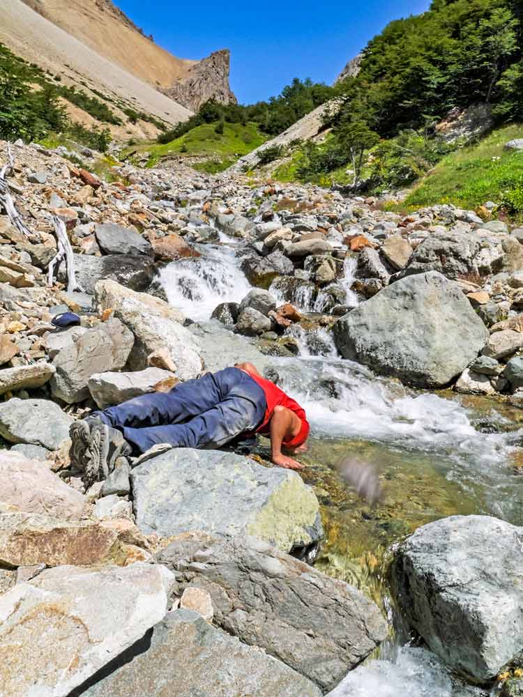
Drinking water can be found everywhere (taps, rivers, lakes, falls), it's good quality and drinkable. We didn't use any purification tablets or a UV filter here.
Patagonian weather is unpredictable; strong winds and heavy rains are frequent so make sure your gear is right.
The hiking route is marked well, the only time we were unsure about it was at the beginning of the second day.
If you hike in summer, especially in December and January bring insect repellent there might be many tabanos (horseflies) in Patagonia this time of the year, they are very annoying.
Not many people in Patagonia speak English so basic knowledge of Spanish will help.
In peak season; January-February many people travel the Carretera Austral - a road through Patagonia. Sometimes it's challenging to get on a bus because they are full. Hitchhiking in the area is safe, locals and tourists stop to pick up travelers. We hitched to Cerro Castillo from Pumalin Park and it worked out great.
How we rank Cerro Castillo trek
- Difficulty level - 3 out of 5, there are two steep ascents and descents on the way.
- Scenery - 4 out of 5, pine forest, lakes, glaciers, rivers - quite impressive landscape.
- Touristy - 2 out of 5, we hiked in February which is still high season but there were not many people, mostly Chileans, and very few foreigners - nothing compared to day hikes in Torres del Paine.

Cerro Castillo vs Torres del Paine
If you have to choose between visiting Carro Castillo or Torres del Paine National Parks I would recommend the second one. We've been to both parks and enjoyed hiking there but for me, the scenery in Torres del Paine is far more impressive than in Cerro Castillo. The attractions of Torres del Paine include some of the main Patagonia highlights such as Grey Glacier, Mirador Las Torres, Nordenjkold Lake, Mirador Frances, and Pehoe Lake. The scenery in Cerro Castillo is beautiful with the Mirador Cerro Castillo being the main highlight but I wouldn't choose it over Torres del Paine.
The main advantage of Cerro Castillo is that it's easier to arrange the hike. Unlike in Torres del Paine, you don't have to book campsites in advance to be allowed to enter the park. It's possible to do the Cerro Castillo trek last minute without too much planning. It's cheaper to hike in Cerro Castillo than in Torres del Paine because the entrance fee includes camping. In Torres del Paine you pay the entrance fee + camping fee.
Where does the Cerro Castillo trek start and end?
The 4-day trek starts at the Las Horquetas entrance and finishes at the Estero Parada entrance. It's walked from east to west.
Cerro Castillo National Park entrances
- Estero Prada Entrance (the start of a day hike) - from 7 am to 4 pm for hikers, from 7 am to 1 pm for day visitors.
- Entrance to Mirador Cerro Castillo (day hike) - from 7 am to 12 pm
- Entrance Las Horquetas (the start of the 4-day trek) - from 7 am to 1 pm.
Cerro Castillo trek cost
- Transport - CLP 10000/US$12 bus
- Shopping (food, gas) - CLP 9000/US$10
- Accommodation + entrance fee. If you do a multi-day hike, you pay CLP 30 000/US$34, including the entrance fee and overnight camping in the park. For more details on price check the official website.
Total: CLP 48 000/US$56
Distances on the Las Horquetas route
- Las Horquetas - campsite Río Turbio - 15 km/9,3 miles
- Rio Turbio - campsite Estero del Bosque - 12 km/7,4 miles
- El Bosque - campsite Neozelandes - 11 km/6,8 miles
- Neozelandés - Cerro Castillo village - 13 km/8 miles
Campsites in Cerro Castillo
Río Turbio, Day 1
Facilities
- Toilet - yes
- Running water - yes
- Tables, benches - yes
Estero del Bosque, Day 2 (it was moved 1 km on following the trail)
Facilities
- Toilet - yes
- Running water - yes
- Tables, benches - yes
Porteadores, Day 3
Facilities
- Toilet - yes
- Running water - yes
- Tables, benches - no
Neozelandes, Day 3
Facilities
- Toilet - yes
- Running water - yes
- Tables, benches - yes

How to get to Cerro Castillo?
Cerro Castillo National Park is about 75 km from Coyhaique, the capital of the region. To get there you can catch a daily bus from the Coyhaique terminal, which leaves around 9.00 am for CLP 10 000/US$11. The hike starts at Las Horquetas, about 30km before (if you drive from Coyhaique) Villa Cerro Castillo. If you go by bus just ask a bus driver to stop there.
To get to the Las Horquetas entrance from Villa Cerro Castillo you can get on a bus to Coyhaique that leaves at 7 am and get off at Las Horquetas.
We had some extra luggage and didn't want to walk for 4 days with two backpacks each so we had to go first to Villa Cerro Castillo and ask to store our extra bags in one of the campsites (for free), we promised to stay there when we're back.
As an option, you can hitchhike, depending on your luck and how many people are on the road you can wait for a long time or get a ride in 15 minutes.
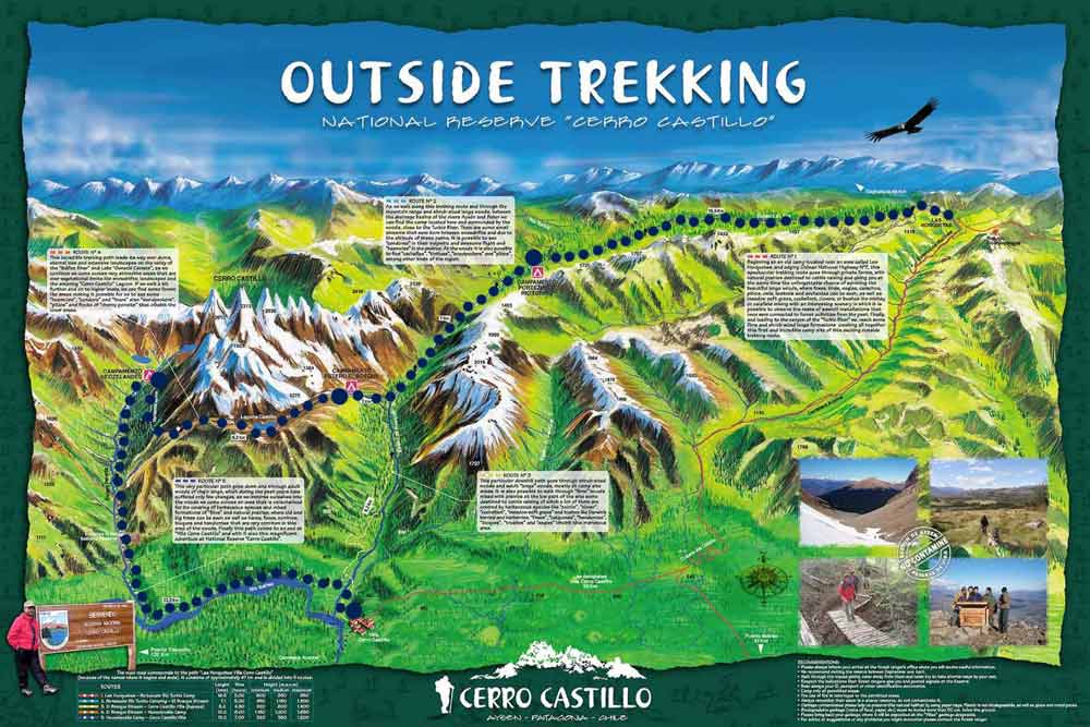
You can find a new map of Cerro Castillo National Park here.
Cerro Castillo trek (Las Horquetas) - a 4-day itinerary
Day 1. Las Horquetas – Campamento Río Turbio, 15 km/9,3 mi
Trek starts at Las Horquetas a turn from Carretera Austral to the gravel road, between Coyhaique (75km) and Villa Cerro Castillo (30km). From the turn to the park entrance about 13km; easy walk, mostly flat, on the gravel road through fields and forest.
At the entrance, you register, pay CLP 30 000/US$34 entrance fee, and get a free map.
Highlights
- Indigenous forest
- The beautiful valley of Río Turbio
Challenges
- It was an easy day of walking without steep ascents or descents.

Day 2. Río Turbio – El Bosque, 12 km/7,4 mi
In the beginning nice easy walk through the forest along the river for about 4km at some stage. We lost the trail but found it quickly. Then only one long steep up on the hike to El Peñon pass, on top of it you'll get a chance to walk on snow/ice in the middle of summer.
After an ascent there is always a descent; steep and rocky so be careful, don't rush, and watch your step. Walk from the campsite to the pass and over it takes about 5 hours. Once down, it's 1,5 hours more to El Bosque campsite. Note! In 2022 the campsite El Bosque was moved deeper into the forest. It's a 40-minute walk from the original campsite which is closed for recovery.
There used to be another campsite La Tetera, about 1-hour walk from El Bosque but as of August 2022, it's closed for recovery.
Highlights
- Stunning views from the top of El Peñon pass
- Snow and ice on the top of the pass
Challenges
- A steep ascent from the valley to El Pañon pass, +600m
- A steep and rocky descent from the pass, -700m

Day 3. El Bosque/La Tetera – camping Neozelandes, 11 km/6,8 mi
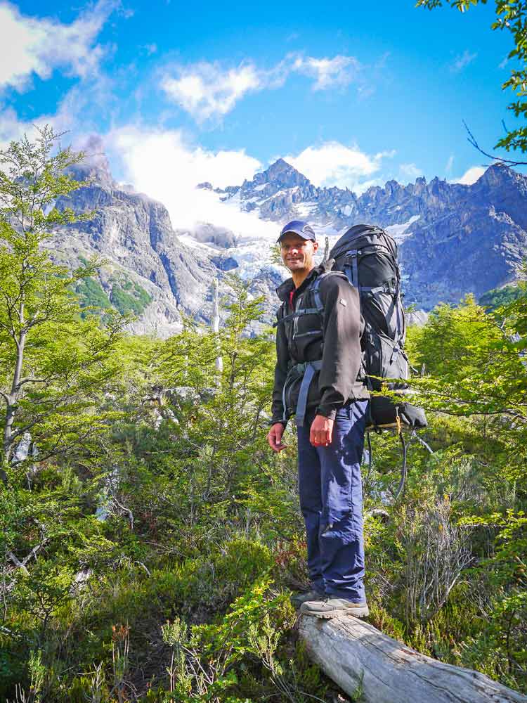
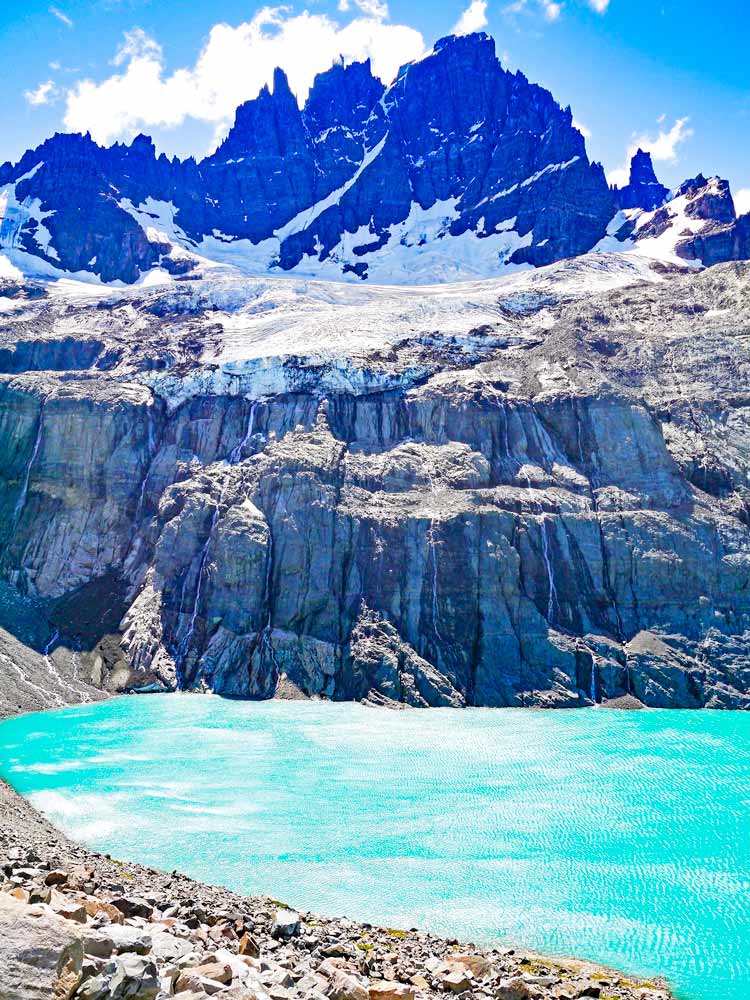
At the beginning of the day after a 1-hour walk you arrive at the lake - Laguna Cerro Castillo (you start there if you camped at La Tetera), one of the most impressive sceneries on the hike; turquoise color lake, hanging glacier, and mountains around. From the lake, you'll start ascending to Cerro Castillo pass, 1600m.
Don't forget to turn around from time to time to check the view, from the top of the pass it's even more impressive. Once at the top, you start a steep long descent. You should be very careful it's steep, rocky, and gets very windy.
After about 1,5 hours you'll find yourself at Los Porteadores campsite near the river. Here you have several options; to camp at Los Porteadores and walk to Neozelandes without your backpack, to skip Neozelandes and go down to Cerro Castillo village, or to keep walking with your backpack, about 1,5 hours, to Neozelandes and camp there. We chose the last option and enjoyed it, the area around the campsite is absolutely beautiful; a green valley with a river surrounded by bizarre-shaped mountains. Camping Neozelandes was the least crowded, we were 6 people camping there.
If for some reason you don't want or can't continue the hike you can take an emergency route. From La Tetera walk up to the Mirador Cerro Castillo where you'll see Sendero de Emergencia, a route that will take you straight to Villa Cerro Castillo. This route is used by day hikers to get from the town to Laguna Cerro Castillo and back in one day. The descent is very steep, about 900m down.
Highlights
- Turquoise blue lake Laguna Cerro Castillo
- Hanging Cerro Castillo Glacier
- Stunning views from the top of the pass
- A beautiful valley at Neozelandes campsite
Challenges
- A steep rocky ascent to Cerro Castillo pass, +700m
- A very steep and rocky descent from the pass, -800m

Day 4. Neozelandes – Villa Cerro Castillo, 13 km/8 mi
Last bit and only down, all the way to the road, about 3,5 hours and from there 1,5 hours to the village and campings.
At the exit, you can be asked to show your ticket and keep it till the end. The trekking is not very difficult but can be if the weather is bad, the path is well marked, no dangerous animals or poisonous snakes, and you walk between 6-7 hours daily.
Highlights
- Walking through the forest
Challenges
- A long descent to Villa Cerro Castillo - 800m

What to pack for the Cerro Castillo trek?
There are no accommodation options, restaurants, or shops inside the National Reserve bring with you all you need for three nights of camping.
Tent. For camping in Patagonia, we'd recommend having a good quality reliable tent that is waterproof and wind-resistant. After 5 years of traveling, hiking, and camping sometimes in very bad weather conditions, we bought an MSR Hubba Hubba NX tent. It's light, pack small, easy to pitch, waterproof, and very stable in strong wind. They might be not the cheapest tents but will serve you for years without fail.
Camping mat. We are both entirely for an inflatable camping pad. It's small and light, easy to wash, fits inside a backpack, soft and comfortable.
Sleeping bag. If you're going to Patagonia in summer 0°C comfort sleeping back will be good enough, in other seasons we'd recommend bringing a bag with comfort to -5°C. I prefer a down sleeping bag. They are lighter, pack smaller, warm, very soft, and comfortable but if they get wet it'll be a problem.
Cooking gear (stove, pots, gas). We recommend bringing a stove to be able to cook hot meals and boil water for tea. Modern camping stoves are very light and small and will hardly add 500 grams to your backpack weight. Buy a stove with Piezo Ignition to have a backup in case you lose a lighter or matches get wet.
As for pots we always take two pots with lids (that we use as plates); one for cooking and one for boiling water. You'll be able to buy gas in almost any town in Patagonia. You can buy a cooking set with a stove, pots, and utensils.
More details on hiking and camping gear for Patagonia can be found in our Patagonia packing list post.
Mirador Cerro Castillo - one day hike
It's possible to do a one-day hike to the Mirador Cerro Castillo from where you can see the lake and Cerro Castillo glacier. In my opinion, it's one of the best day hikes in Patagonia.
- Starting and finishing point - Villa Cerro Castillo
- Distance - 12km return
- Altitude gain/loss - 900m ascent to the Mirador (viewpoint) with subsequent 900m descent back to the valley.
- The time required - 6-7 hours
- Permits - no special permits are required. The entrance fee is CLP 19 000/US$22 is charged at the entrance. For a day hike access to the trail is from 7 am to 12 pm. It's done to ensure you'll have enough time to descend before it gets dark.
Mirado Cerro Castillo hike with a tour
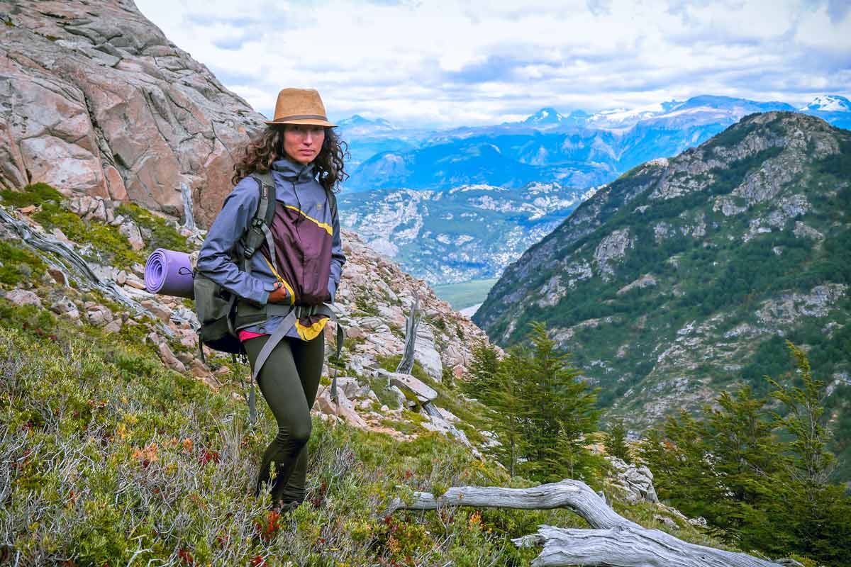
How to get to Laguna Cerro Castillo hike?
The trek starts at Villa Cerro Castillo, take a bus or hitchhike from Coyhaique. Once there find a sign "Sendero de Chile" and follow the road until you reach a check-point. There you pay the entrance fee of CLP 19 000/US$22 and start a steep ascend to the Mirador.
Day hikers to Laguna Cerro Castillo have to ascend and descend following the same trail. It's not allowed to enter or exit through the Estera Prado Entrance (the entrance for the circuit). Day hikers are not allowed to descend to the lake as it takes too much time.
Highlights
- Laguna Verde
- Cerro Castillo Glacier
- Views from the Mirador
Challenges
- A very steep and long ascent from Villa Cerro Castillo to the Mirador, 900 m up
- A steep and long descent back to the town, 900 m down
Laguna Cerro Castillo packing list
- Water bottle
- Snacks, sandwiches - it's a 7-hour hike you'll get hungry.
- Sunglasses
- Cap
- Rain jacket
- Hiking poles will be useful on the way down, it's steep and long.
- Sunscreen - on a sunny day it's a must.
- Insect repellent - there might be sandflies, they are very annoying.
Where to stay before trekking in Cerro Castillo?
For Patagonia, Coyhaique is quite a big place. It's the last town with good infrastructure down south till El Chalten in Argentina or Puerto Natales in Chile. If you need to upgrade your gear, buy gas, draw cash - it's the place to do it. There are a couple of gear and second-hand shops (Ropa Americana) in the town, which was quite important for me because on the way to Coyhaique, I lost my backpack with all my clothes, it fell out of the car while we were hitchhiking.
Coyhaique facilities
- Hotels - yes
- Campsites - yes
- Supermarket, shops - yes, big Unimark and one or two outdoor gear shops
- Restaurants, cafes - yes
- ATMs - yes
- Information office - yes
Accommodation in Coyhaique
There are many guest houses, hotels, hostels, and campsites in the town. If you are on a tight budget bring a tent - camping is the only budget accommodation option in this part of Patagonia. We can recommend El Camping. It's a bit outside of the town. It has good facilities; hot shower, wi-fi, power outlets but no kitchen you need your cooking gear, the price is CLP 11 000/US$13 per person.
- Budget | Patagon Backpackers | Casa Balmaceda Backpackers |
- Middle price | Hostal Viento Sur |
- High-end | Los Mañios | Huellas y Senderos Hotel |
The Las Horquetas 4-day hike finishes in Villa Cerro Castillo. It's a small town with a couple of restaurants, a shop or two, and small guest houses/cabins and campsites. For more accommodation and restaurant options go back to Coyhaique.
Villa Cerro Castillo facilities
- Hotel - yes, a couple of guest houses and cabins (cabañas)
- Campsite - yes, several around the town
- Shop - yes, a couple of smallish shops
- Restaurant - yes, several local restaurants
- ATM - no
- Tourist information - yes
Accommodation in Villa Cerro Castillo
| Hospedaje Cabaña y Restaurante Don Niba | QUELEN PATAGONIA | B&B y Cabañas Cerro Castillo |
How to get from Villa Cerro Castillo to Coyhaique?
If you arrive in the town early you'll have a chance to catch a bus back to Coyhaique the same day. There are two or three daily buses from Cochrane to Coyhaique but in the season they might be full. Go to the tourist information office just a block away from Carretera Austral. You can try to hitchhike but it can be difficult due to the many people on the road - dozens of backpackers locals and foreigners hoping to get a ride.
How to get from Villa Cerro Castillo to Puerto Río Tranquilo?
If hitch-hiking is not your cup of tea you can catch a bus just need to know that public transport is very scarce in the area. There is a bus at 11 am to Cochrane, the price is 9000 pesos/US$10. In our experience the bus was already full when arrived, some people could get in. We hitched to Puerto Río Tranquilo, 120km south of Villa Cerro Castillo, and were very lucky to get a ride quickly.
Recommended books and guidebooks
- Lonely Planet Chile and Easter Island, Travel Guide, Kindle, and paperback.
- Patagonia on a budget by Matthew Morgante. How to travel Patagonia on US$30 a day, Kindle.
- Walking Patagonia by Caspian Ray. Don't expect a hiking guide, it's a fiction story about a young guy who went to Patagonia in search of adventure and love.

The pretty half of Stingy Nomads, responsible for all our land adventures (hiking, climbing, walking the Camino) and following them write-ups. Alya loves walking since she was a child, she prefers to walk 1000 km with a backpack rather than to do a 10 000 km road trip (actually any road trip). Alya is a big fan of Latin America, the Spanish language, and dancing. Every time we go away she desperately misses our dog Chile.


Hey there, thanks for the info! I don't have any time crunch to deal with and am thinking of doing this trek twice. Do they limit the entrances or would a double trek be doable?
Hello, Peter. Thank you for the comment. I'm sure nobody will prevent you from doing the Cerro Castillo Circuit twice though if you leave the park you'll have to pay the entrance fee again. If you don't want to pay it twice you can do a return trek start and finish at Cerro Castillo Village. There are many other amazing hikes in Patagonia if you have a lot of time I'd rather consider doing different routes. You can find more info on Patagonia hikes in this post https://stingynomads.com/best-hikes-patagonia/
Cheers
@Stingy Nomads,
Really appreciate the insight! I'm doing various treks through Patagonia, Bolivia and Peru for 6 Months in January. Very fortunate to have resources like your site.
All the best!
Hey Stingy Nomads your website has been a valuable resource for me during my travels. I have one question, unfortunately due to the time it has taken for Chile to validate our vaccinations we no longer have so much time as originally planned. Would you do the complete O Circuit or would you do the W and The Cerro Castillo Circuit?
Hello, Matt. I'm not sure how much time you have left. We really enjoyed the John Gardner Pass and the views of the Grey Glacier from up there on the O Circuit. If I had to choose I'd do a day hike up to the Cerro Castillo Lake and Glacier (the highlights of the trek) and do the O Circuit. I hope you still have enough time for that.
Good luck and enjoy Patagonia!
Hello, we would like to do the Trek in February. We do have a rental car for our journey. The Trek is no O-Trek, so do you know how we can get back to our car. Is there a bus or would you say we can go back to the starting point by hitchhike?
Thank you very much
Marco
Hello, Marco! I'd suggest to leave your car in Villa Cerro Castillo (at your campsite or hotel) and take a bus or hitchhike if there is no bus (as we did) to Las Horquetas, the beginning of the trek. It's nicer to finish hiking and get to your car immediately than spend a couple of hours hitchhiking back to it.
Safe travels!
Hello,
Looking to do this hike at the end of January/February. Did you have to book campsites along the trek in advance, and if so, where can you do this?
Thanks!
Hello, Elizabeth! We didn't book any campsites on the circuit.
Cheers!
Hey, thanks for the information, it was very useful to plan this trek.
For the record, the price they ask at the gate is now 23.500 CLP which felt like a complete ripoff! Regarding the fact that this money goes for the most part to some landowner and not the conservation of the park, in retrospect we would not have done it. Probably better to stick to the day hike.
Anyway, it was still a great trek, but it was a bitter beginning, so it's best of other knows it beforehand.
Hello, Thomas! Thank you very much for the update! We'll contact the park regarding the price changing. At what entrance did they charge that much, Las Horquetas or at Cerro Castillo village? As I'm aware for the day hike you have to pay the entrance fee as well it used to be the same amount as for the multi day hike.
Cheers!
Hi,
Tahnk you for the valueble information
Is it possible to do the Circuit (including Neozelandes) in 3 days?
I do not want to take the emergency route but i want to do the trail complete.
Tahnk you
Hello, Igor! Thank you for the comment! It's possible to walk the circuit (it's only 53km) in 3 days if you're a fit person. On 3rd day you can walk from El Bosque campsite to Neozelandes and from there to Villa Cerro Castillo. This way you'll walk the complete route, the only difference - you won't camp at Neozelandes.
Enjoy Patagonia!
Hello, thank you very much for this article. I have one question : we don't need to book the camping sites, do we?? Thank you!!
Hello, Izel! We're glad you found our post helpful! You're right you don't need to book campsites in Cerro Castillo, I don't think it's possible at all.
Enjoy Patagonia!
Hi! We are trying to plan for Patagonia in January and working out treks between Cero Castillo, Torres Del Paine, and Patagonia National Park. We are (like others) finding TDP difficult to book campsites for and trying to figure out our options. This post is incredibly helpful! Just had a few questions if you have a chance:
1. How do you compare Cero Castillo vs. TDP in terms of hike difficulty, scenery, crowds, etc.? If you had to pick one, do you have a preference? It feels like the back half of O loop is really worthwhile, but W part is very crowded, but overall seems the most stunning (usually find when things are crowded, its for good reason)?
2. Camp sites on Cero Castillo seem pretty up to discretion of hikers - are they somewhat designated or is it really just camp where you decide to stop?
Thank you!
Hello, Jesse! Sorry for the late reply we're busy walking the Camino de Santaigo and don't have good Internet every day. We did both hikes in late February, early March. Cerro Castillo is a beautiful hike but if we have to choose we'd go for the O trek in Torres del Paine. You're right the W part is more impressive but the back half of the O is quite nice because it's quite remote. The walk over the Gardner pass when you see Grey glacier from the top was our favorite part of the hike. As for difficulty if you're a seasoned hiker both hikes are quite doable though the O is quite a bit longer then the trek in Cerro Castillo which means you'll have to carry more food with.
Campsites in Cerro Castillo are designated but very basic some have plastic toilets, tables and benches, there is always a source of water nearby.
Good luck and enjoy Patagonia!
Hi guys! Very helpfull description! I'm planning to do this trekking at the end of November, do you think there's any possibility to find snow? Is it possible to rent a tent and sleeping bags somewhere in Coyhaique for example? Would you also recommend a 2 days and one night hike as we don't have plenty of time? Have you done other hikes in Patagonia and Tierra del Fuego you would suggest? Thank you so much!!
Serena (Italy)
Hello, Serena! Thank you for your comment! There will be definitely snow at the pass - it's always there even in the mid summer. We didn't see specific gear rental places in Coyhaique we were looking for a second-hand sleeping bag to buy but found only new bags in expensive gear shops but we didn't look for a rental place. In 2 days you'll see the highlight of the trek Laguna and glacier Cerro Castillo. If you don't find a place to rent camping gear you can do a day hike to the glacier and back you'll see basically the same as in 2 days just won't camp there for the night. We have an itinerary for a day hike to the Laguna in the post as well. As for other hikes in the region - yes, we did quite a few we spent 2 months in Patagonia. At the end of this post you can see "Related posts" with the links to all other treks we did in Patagonia and places we visited.
Good luck!
Dear Campbell and Alya,
My husband and I are keen to take our 12yo and 14yo children and do 4-day hike in Cerro Castillo. We have done hiking in NZ (Routeburn, Waikaramoana and other not so well known staying at night in cabins.) We endeavour to do the 6-foot track in NSW, Australia and do it camping, in winter to prepare us for our planned trip in Cerro Castillo in January. We are fit but apart from my husband, not experienced campers Do you think we would be capable of doing Cerro Castillo? Denise
Hello, Denise! Sounds like you're fit enough to hike Cerro Castillo for 4 days, it's not a very difficult hike though there are one or two steep up and downs. If you go in January it won't be too cold might be rainy and windy. For camping there you just need the right gear; good water and windproof tent, warm enough sleeping bags, good mattresses, cooking stuff etc. and you'll be fine. All you need to know is how to use your camping gear not much experience needed. If you're going to do the 6-foot track in winter it'll be a great chance to test your gear and get some camping experience. If you have more questions about hiking in Patagonia we'll be happy to answer.
Cheers!
Thanks so much for your help and in general for your generous informative blog - I'll let you know how it goes.
All the best for your future travels,
Denise
What would you consider the lower age limit for this route? I'm trying to find a backpacking trip that I can do with my 9 year old daughter that isn't crowded like torres del paine or similar.
Thanks
Great write-up, really helping for our planning to hike this in a few weeks!! Just one question, I saw that you headed to Torres for trekking after...how did you travel overland from Cerro Castillo to Puerto Natales? Looking at some options and just wondering how busy it is...if we need to book ahead, etc., etc.
Thanks!
-Jerrett&Jenilee
Hi, Jerrett! Thank you for the question! We kept hitch-hiking till Villa O'Higgins, with several stops on the way, then took a ferry to Candelario Mancilla and from there walked to El Chalten (Argentina). We did a couple of hikes in El Chalten and from there hitched to Perito Moreno glacier and then to Puerto Natales. Hitchhiking in Patagonia was easy except from El Chalten to Perito Moreno there were too many people on the road, we waited the whole day. We have two blog posts in Chile section about hitchhiking Carretera Austral and Walking from O'Higgins to El Chalten as well as Hiking Torres del Paine. If you're considering buses there are very few on the section from Cerro on, maybe once a day or so and as I remember those that stopped at Villa Cerro Castillo were quite full. From El Chalten to Puerto Natales there were buses I don't think it will be a problem though they're quite expensive.
Good luck!
Great post. Thanks! 2 questions: 1) How would the weather in mid-March differ and how might it affect this itinerary? and 2) Your intro mentioned a 3-day option. Do you have any guidance on how that would work? Thanks again!
Hi, Tom! Thank you for the question! We did the hike end of Feb and the weather was good, quite warm and sunny. But Patagonian weather is unpredictable it can change in a few hours and chances for rain in March are higher though we did Torres in Mid March and it was fine. As for itinerary you can do from one day to 4-5 day hikes in Cerro. For a 3-day one you can start and finish at Cerro Castillo village, go first to campamento Neozelandes, then to El Bosque and take the trail from the lagoon that day hikers use to get back to the village. Good luck!
Hello,
What month did you do your trip? We are thinking of doing this route in early December but are curious about snow and river crossing conditions.
Thanks!
Hi, Stephen! We did this trip the end of January - February but I don't think there will be snow there in December, it's beginning of Summer. Maybe you'll have to cross some rivers barefoot in knee-deep water but the rivers are not that big and strong, it can't be a big problem.
Good luck and enjoy Patagonia!
Thanks for the information. How long is a day hike from Villa Cerro Castillo up to the laguna and back? How does it compared to a day hike at Fitz Roy or Torres del Paine (day hike)?
Hello, Owen! Sorry for the late reply we were on a hike and just came back.
We didn't do any day hike in Patagoina so we can't really compare them. For Cerro Castillo if you want to go up to the laguna and back the same day you have to start early at 7-8am to have enough time to get back before dark (it gets dark very late in summer about 9-10pm). We enjoyed all three hikes the scenery on all of them was amazing; glaciars, lakes, mountains. For Torres in one day you won't be able to see much just Las Torres and a lake or two. Fitz Roy you can do different day hikes there are several routes but to see Fotz Roy at sunrise you have to camp there it's too far from the entrance. Hope we could help you a little bit.
Good luck!
Hello!
I'm female and travelling solo.
1. Would you recommend doing this trail, with camping, alone or engaging a guide for safety?
2. If I plan on going from top to bottom on my patagonia journey would this be easier accessed before or after Fitzroy and Los Glaciares?
Thank you, loved the article and hope to read more such posts!
Hello, Anthea! Thank you for your comment!
1. It depends when you're planning to do a hike. If in summer you can easily do it on your own there are no dangerous animals and all people on the way are tourists/backpackers nobody to be scared of. The hike is quite popular among Chileans so there will be always people walking and camping nearby. If you want to do it in winter (we don't even know if it's possible) I wouldn't do it at all.
2. We traveld from top to bottom and it was quite easy to access Cerro Castillo from Coyhaique by bus or hitch-hiking. Fitz Roy and Los Glaciares are more South if you go there first you'll have to go up again. For us Chilean Patagonia and Carretera Austral was one of the most beautiful places in South America so we'd definitely recommend to go down Chilean side and then cross to Fitz Roy.
If you have more questions don't hesitate asking!
Good luck!
We have done it in January this year. What a stunning place. No doubt that it is safe. Nevertheless, watch for inclement weather. Enjoy!
Hi, Jan! We're glat you enjoyed Patagonia and Ceroo Castillo! The place is really amazning!
Cheers!
Hey there, great write up!
I did the hike too and loved it - though a slight variation. Im trying to find out the names of the glaciers and lakes above the neozelandes campsite, do you have any idea of them? I'm trying to find out more about the moraines they left lying around up there - so incredible!
Thanks 🙂
Hello, Nicholas! Thank you! The neares to the campsite lake is Laguna Duff. About the glacier we aren't sure on our map it says Neozelandes the same name as for the campsite.
Cheers!
Okay great, thanks for the name. Will have peek into it. Well. You know what I mean.
All the best!
Thanks so much for such an informative post! This is all the information we need for our trip in a few weeks time 🙂
Hello, Marcella! Thank you for the comment! We're sure you'll enjoy the hike!
Good luck!
thank you kindly
Hi, we are going there end of December. Are there any mules / horses available and allowed INSIDE the park? Thanks. Jan Lubbe
Hello, Jan!
We didn't see any horses (there are no mules in Patagonia at all) or porters in the park all tourists carry their own stuff. And we didn't see anywhere in the area advertising horses for rent. The only one National park in Patagonia where it is definitely possible to rent a horse is Torres del Paine but it's quite expensive.
Good luck!
Hi, thanks for your description of this trek! It's really useful. My husband and I are planning to do it next year. Am I right in assuming that you can get the maps you posted pictures of above at one of the Park Offices, and if so which one (I've heard there are several)? Also, what kind of (if any) navigation equipment did you carry - will a compass and map do? Thanks 🙂
Hello, Bettina! Thank you!
Yes, we got our map at the entrance at Cerro Castillo village, it's free. You can get it at both entrances but sometimes there is nobody at the entrance from Valle de la Lima then you don't pay the entrance fee and don't get a map. You can as well buy your own map in one of book or gear shops (e.g. in Coyhaique). We didn't have it but other tourists told us it was better than the free one.
We used only the map no other navigation for Cerro Castillo the trail is quite clear and there were other tourists to follow. Often for navigation we use app Maps.me it usually has trekking trails and works offline. If you have more questions we'll be happy to answer!
Good luck!
That's great to know, thanks! I'll let you know if other questions come up, as I'm sure they will. 🙂