
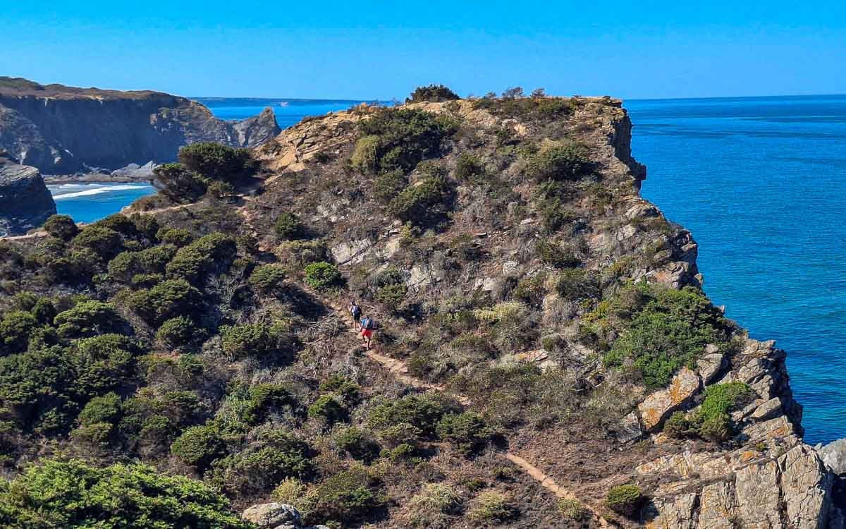
The walk from Zambujeira do Mar to Odeceixe is an 18.5 km (11.5 mi) stage of the Fishermen’s Trail along the Rota Vicentina in Portugal and is one of my favorite days on the route. Starting the walk with spectacular sea views the beautiful ocean scenery continues for the first 14 kilometers. Another challenging day on the trail with about 8km walking on sand, but I found the stage less demanding than the deep, loose sand of the previous stages. The Seixe River is also a scenic section, even though you walk on the road for the last 4 km, it is not a busy road. Just before Odeceixe, the Fishermen’s Trail crosses the Ribeira de Seixe from the Alentejo region into the Algarve.
Stingy Nomads participates in the Amazon Services LLC Associates Program and other affiliate programs. If you click on the link and purchase the item or make a booking, we will receive an affiliate commission at no extra cost. Thank You for supporting us and assisting us to produce quality, free content.
Odeceixe is not at the beach, if you prefer to stay closer to the beach you can walk 3 km/1.8 mi extra to Praia de Odeceixe, a tiny place with a couple of hotels and restaurants. This beautiful little settlement is on the next stage towards Aljezur.
Zambujeira do Mar to Odeceixe Route Overview
- Total distance – 18.5km/11.5mi
- Time – 5 to 6.5 hours
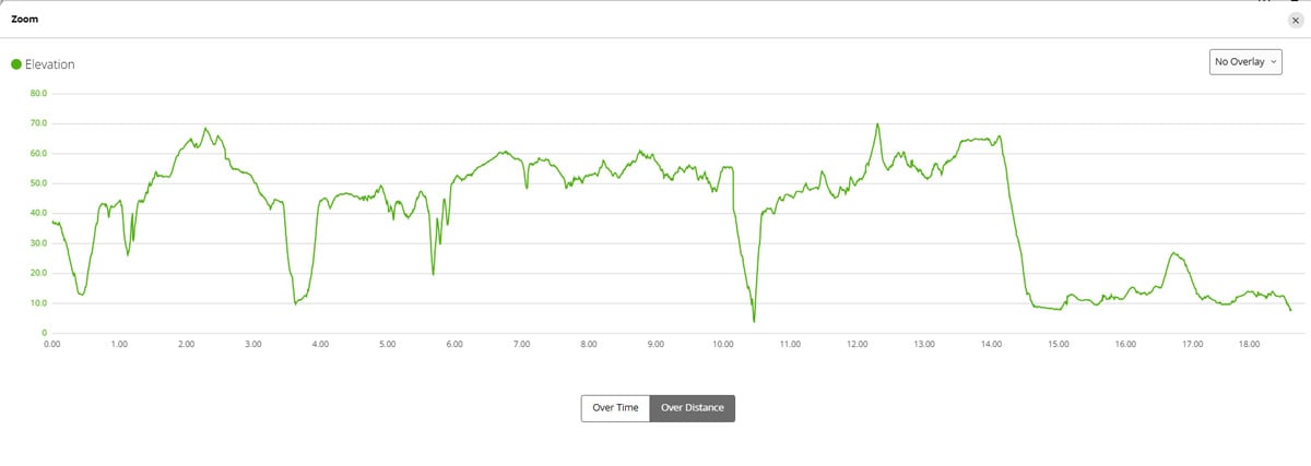
- Total ascent – 371 m
- Total descent – 383 m
- Difficulty – medium difficulty – sand walking, A couple of steep but short ascents
- Starting point – Rota Vicentina sign board, near Rita restaurant
- Finishing point – Rota Vicentina sign board in Odeceixe (intersection of Rua do Rio and Variante 19 de Abril)
- Walking Surface – Tar -4km/2.4mi, Gravel – 6.3km/3,9mi, Sand – 8.5km/5.2mi
- Walking route – Zambujeira do Mar – Caravalhal beach bar – Azenhas do Mar – Odeceixe
Navigate walking from Zambujeira do Mar to Odeceixe
Find below a Google Maps track we created by following the trail from Zambujeira do Mar to Odeceixe. This Google maps trail can be used on a mobile phone for navigation.
The link can only be opened while online (with Wi-Fi or data), but navigation on the track works even when offline. Make the map full screen, zoom in and keep the blue dot on the the trail.
GPX file of the route
You can download our GPX file of the trail and use it on your phone or watch for navigation.
You can use this digital map on your phone for navigation. Want to know how to use a GPX file for phone navigation?
Where does the trail start?
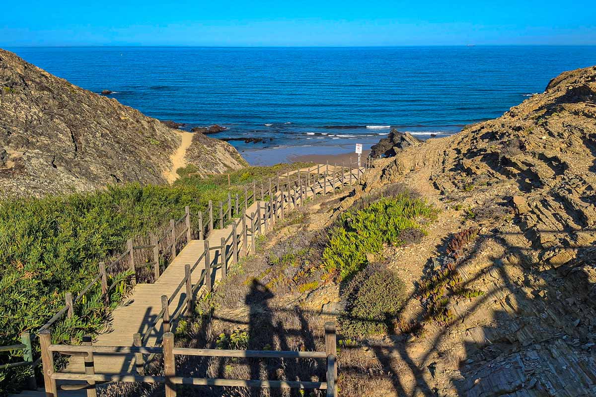
The trailhead of the Zambujeira do Mar to Odeceixe walk is at the Rota Vicentina sign board, near Rita restaurant in Odeceixe. There are some spectacular views of Praia de Zambujeira do Mar from this area.
Where Does the Trail End?
The trail ends at a Rota Vicentina sign board in a small square in Odeceixe at the intersection of Rua do Rio and Variante 19 de Abril.
The highlights of the trail
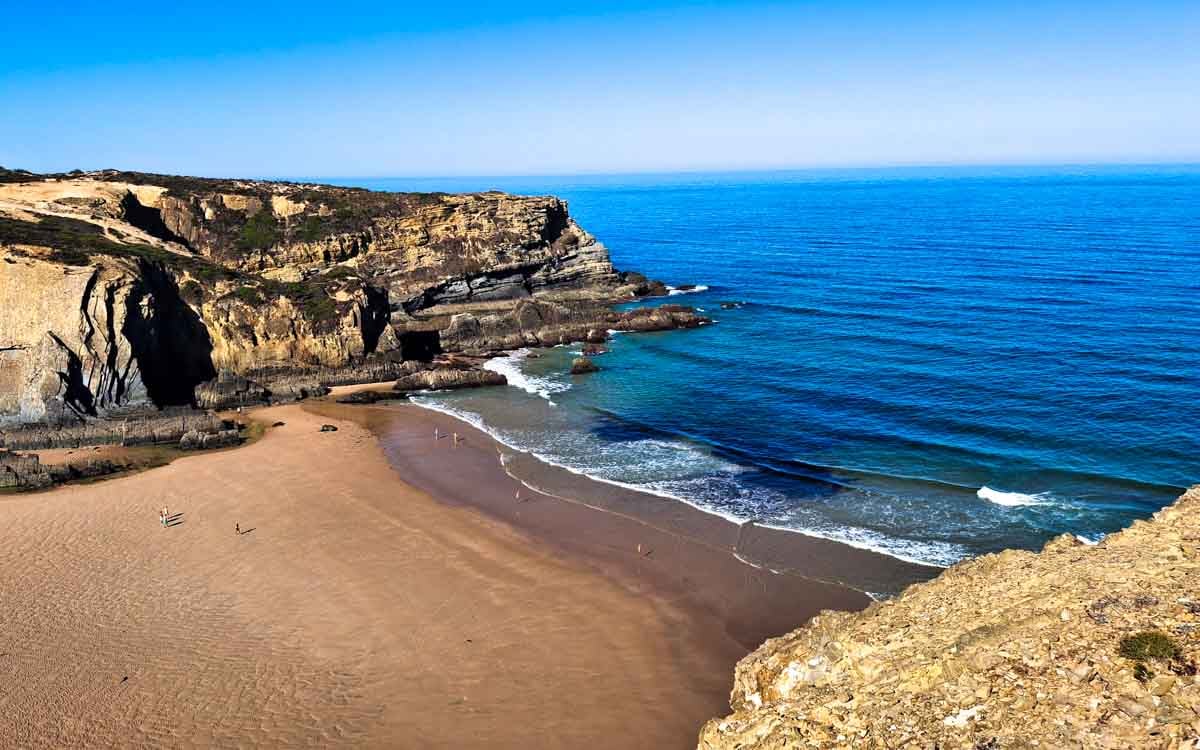
- The trail has some amazing viewpoints of beaches from the cliffs. Many of the beaches can be reached by a short detour sometimes on a short, challenging trail!
- Beaches Along the Walk and How to Reach Them
- Praia da Zambujeira do Mar: Beautiful beach in Zambujeira at the start of the trail with full facilities.
- How to reach: Walk down the paved road from the village center and use the main stairs or ramps.
- Praia dos Alteirinhos: A gorgeous, quiet sandy beach just south of Zambujeira, famous for a waterfall and natural rock pools at low tide.
- How to reach: Directly accessible via steep wooden stairs leading down from the clifftop parking area just south of Zambujeira do Mar.
- Praia do Carvalhal: A wide, peaceful valley beach with a small stream, located about 4 km south of Zambujeira.
- How to reach: Accessible via a dirt road/path turnoff from the main coastal tracks or by a short drive/walk down the valley from the nearby plateau.
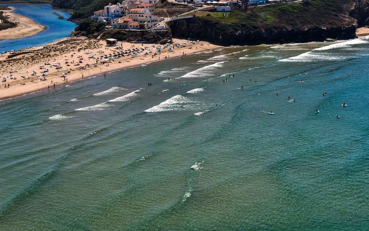
- Praia de Odeceixe (Odeceixe Mar): Popular surf and swim beach, where the Seixe River empties in a horseshoe bay meeting the ocean, offering both calm river swimming and ocean surf.
The challenges of the walk
- Walking in deep sand from time to time
- A couple of steep but short ascents
In which direction to walk?
This stage is actually nice to walk from south to north, starting in Odeceixe and ending the walk in Zambujeira do Mar. I prefer to walk the section on the road in the beginning of the day, finishing with nice beach views.
Elevation profile of the Zambujeira do Mar to Odeceixe trail
Stops along the route
- At 3 km/1.8 mi Praia do Carvalhal there is a coffee shop.
- At 10 km/6.2 mi Azenha do Mar – a tiny village with a restaurant
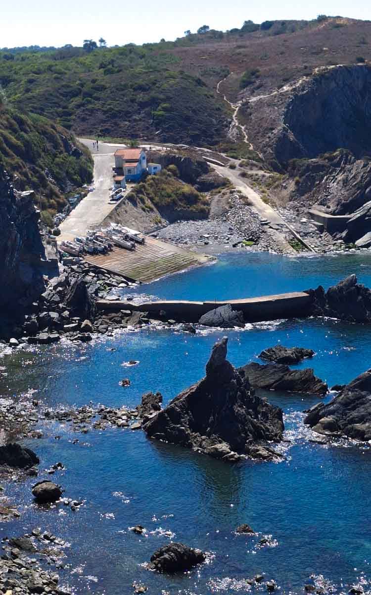
Route Description Zambujeira do Mar to Odeceixe route
- Starting point – Rota Vicentina sign board, near Rita restaurant in Zambujeira do Mar. Great views of Praia de Zambujeira do Mar
- 30 m – trail starts basically immediately starts with a steep decent in Zamujeira, followed by challenging climb
- 500 m – turn onto a gravel trail
- 1 km/0.62 mi – viewpoint of Praia dos Alteirinhos: A gorgeous, quiet sandy beach famous for a waterfall and natural rock pools at low tide. – How to reach: Directly accessible via steep wooden stairs leading down from the clifftop parking area just south of Zambujeira do Mar.
- 1.25 km/0.74 mi – sand starts, don´t miss the turn off
- 2 km/1.2 mi – nice viewpoint over the ocean, turn inland into a pine forest
- 2.7 km/1.67 mi – nice ocean viewpoint, continue in tunnels in the forrest.
- 3.7 km/2.3 mi – steep downhill to Caravalhal beach bar, nice beach, food, drinks, toilet
- 3.8 km/2.36 mi – challenging uphill
- 4 to 4.5 km/2.48 mi to 2.8 mi – informal safari enclosure featuring exotic animals like ostriches, llamas, and a bull bison
- 5.2 km/3.2 mi – Praia do Carvahal, nice beach views, can go down to the beach
- 5.6 km/3.47 mi – challenging decent and accent, nice views, careful with this walk.
- 6.2 km/3.85 mi – sandy path into the forest
- 7.7 km/4.78 mi – nice views of Praia da Amalia in the distance
- 8.5 km/5.28 mi – beautiful ocean view
- 9.1 km/5.65 mi – another great ocean viepoint, path becomes gravel
- 10 km/6.21 mi – Azenhas do Mar – a picturesque cliffside seaside village
- 10.4 km/6.46 mi – Mirador Azenhas do Mar, nice viewpoint, dilapidated boardwalk out of town.
- 10.5 km/6.52 mi – steep climb
- 12.5 km/7.76 mi – walk through pine forest
- 13.1 km/8.14 mi – amazing viewpoint Praia de Odeceixe and Ribeira de Seixe, the ocean and the river
- 14 km/8.7 mi – turn away from the ocean
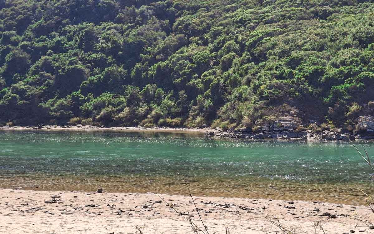
- 14.4 km/8.9 mi – walk next to the Seixe river, nice river beaches to swim
- 15km/9.3 mi – tar road all the way to Odeceixe, not much traffic, next to Seixe river
- 17.9km/11.12 mi – cross Seixe river Alantejo into Algarve
Places to stay in Odeceixe
- Budget | Parquede Campismo São Miguel +351282947145 (camping) | BohemianAntiqueGuesthouse | HostelSeixe |
- Middle price | HortadoVale | Surf Seixe Guesthouse | Casade Hospedes Margarida | Casa Luar
- High-end | Casade Hospedes Celeste | Residênciado Parque | Sol Mar
Places to stay in Praia de Odeceixe
If you prefer to stay closer to the beach you can walk 3 km/1.8 mi extra on the trail to Praia de Odeceixe, a tiny hamlet at the sea with some hotels and restaurants. Praia de Odeceixe is really beautiful. If you are walking the long stage from Odeceixe to Aljezur next day starting in Praia de Odexeice will make the stage 3 km shorter.
Carlos’s Beach Hostel | Casa Dorita | Casas do Zé
The Fisherman’s Trail itinerary
You can find a detailed trail itinerary in THIS POST
| Day 1. Porto Covo – Vila Nova de Milfontes 19 km/12 mi | Day 2. Vila Nova de Milfontes – Almograve 16 km/10 mi | Day 3. Almograve – Zambujeira do Mar 22,5 km/14 mi |
| Day 4. Zambujeira to Mar – Odeceixe 19 km/12 mi | Day 5. Odeceixe – Aljezur 22.5 km/14,2 mi | Day 6. Aljezur – Praia da Arrifana 19 km/12 mi |
| Day 7. Praia da Arrifana – Carrapateira 20 km/12,4 mi | Day 8. Carrapateira – Vila do Bispo 15 km/9 mi | Day 9. Vila do Bispo – Sagres 21 km/13 mi |
| Day 10. Sagres – Salema 20 km/12,4 mi | Day 11. Salema – Praia da Luz 12 km/7,4 mi | Day 12. Praia da Luz – Lagos 10,5 km/6,4 mi |
What to pack for hiking?
Carry enough water (you can buy more water around half way). Take cash for drinks and snacks on the way. Wear sufficient sun protection. Pack for the weather, maybe a towel if you want to go for a swim or a rain jacket if it looks rainy.
- Osprey Day pack
- SALOMON Trail Gaiters | Ankle Gaiters for Hiking
- Water bottle
- Sunscreen
- Cap
- Polaroid Sunglasses Men, Polaroid Sunglasses Ladies
- Light Quick Dry Towel
- Go Pro Hero 13
- GPS watch
Questions or Comments?
Got any questions or comments? We would love to help! All questions and comments will be answered by us personally in Buy Me a Coffee. Click below and ask away.
Feel free to support our site by buying us a coffee!
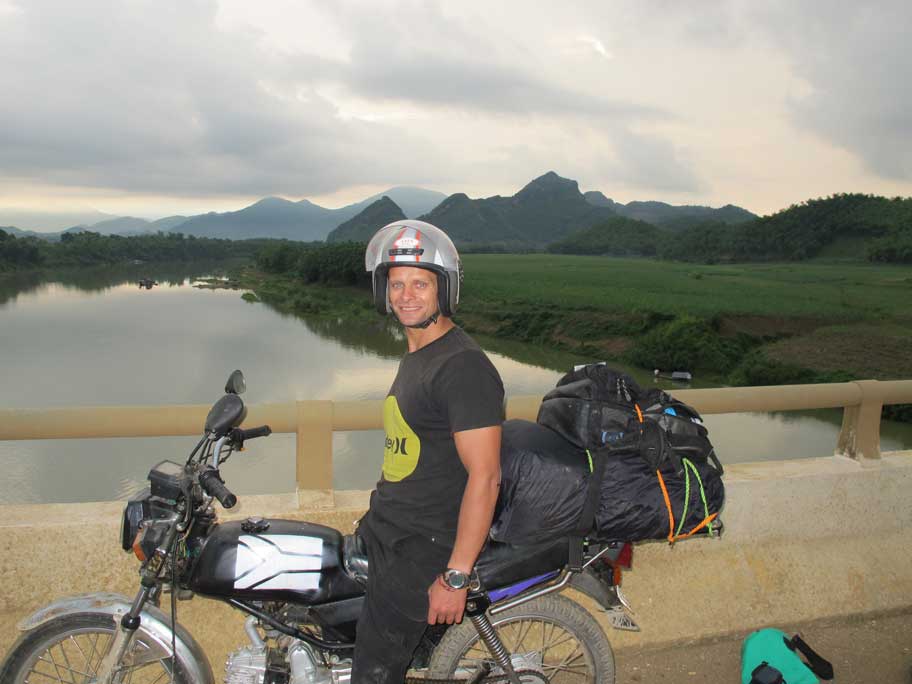
The strong half of Stingy Nomads, a nomadic aquaman that would be happy to spend all his life in the water diving, surfing and spearfishing but often has to compromise with Alya and go hiking instead. Campbell is responsible for all our marine adventures and following them with write-ups. He loves traveling, braai (BBQ in South Africa), red wine and spending the day in a wetsuit.