
The walk from Praia da Luz to Salema is a part of the Fishermen’s Trail. It’s a beautiful route along the coast past some spectacular beaches. The trail can be done as a day hike or as a part of the multi-day route. The first part from Praia da Luz to Burgau is an easy walk with very few hills, the second part is a bit more challenging.
Stingy Nomads participates in the Amazon Services LLC Associates Program and other affiliate programs. If you click on the link and purchase the item or make a booking, we will receive an affiliate commission at no extra cost. Thank You for supporting us and assisting us to produce quality, free content.
Praia da Luz to Salema route overview
- Distance – 12 km/7.4 mi
- Time – 4 hours
- Total ascent – 404 m
- Total descent – 405 m
- Difficulty – moderate
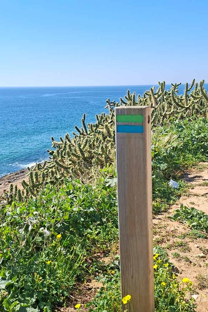
- Route markings – marked with green and blue stripes painted on poles, rocks, and walls.
- Walking route – Praia da Luz – Burgau – Salema.
Navigate from Luz to Salema
GPX file of the route
You can download our GPX file of the trail and use it on your phone or watch for navigation.
Where does the trail start?
The easiest is to start on the promenada at Luz Beach, near Habana Bar. There is a parking lot on the left (facing the town) where you can leave your car. The trail goes along the promenade out of the town. Just follow the blue and green route markers on light poles and walls.
Where does it finish?
The route finishes on the promenade at Salema Beach, at the wooden board with the map of the Fishermen’s Trail near Atlantico Restaurant. From there you can take a taxi/Uber to get back to Praia da Luz.
How to get to Praia da Luz?
If you have a car you can drive there and park at the public car parking at the beach (it’s marked on the map above). In summer try to be there early before 9 am to make sure you get a spot.
You can get to Luz from Lagos using a public bus or taxi/Uber. Public bus #4 operates the route between Lagos and Burgau and stops at the church in Luz (near the beach and the trail). An Uber ride costs 6-8 euros.
The highlights of the trail
- Praia da Luz beach and promenade
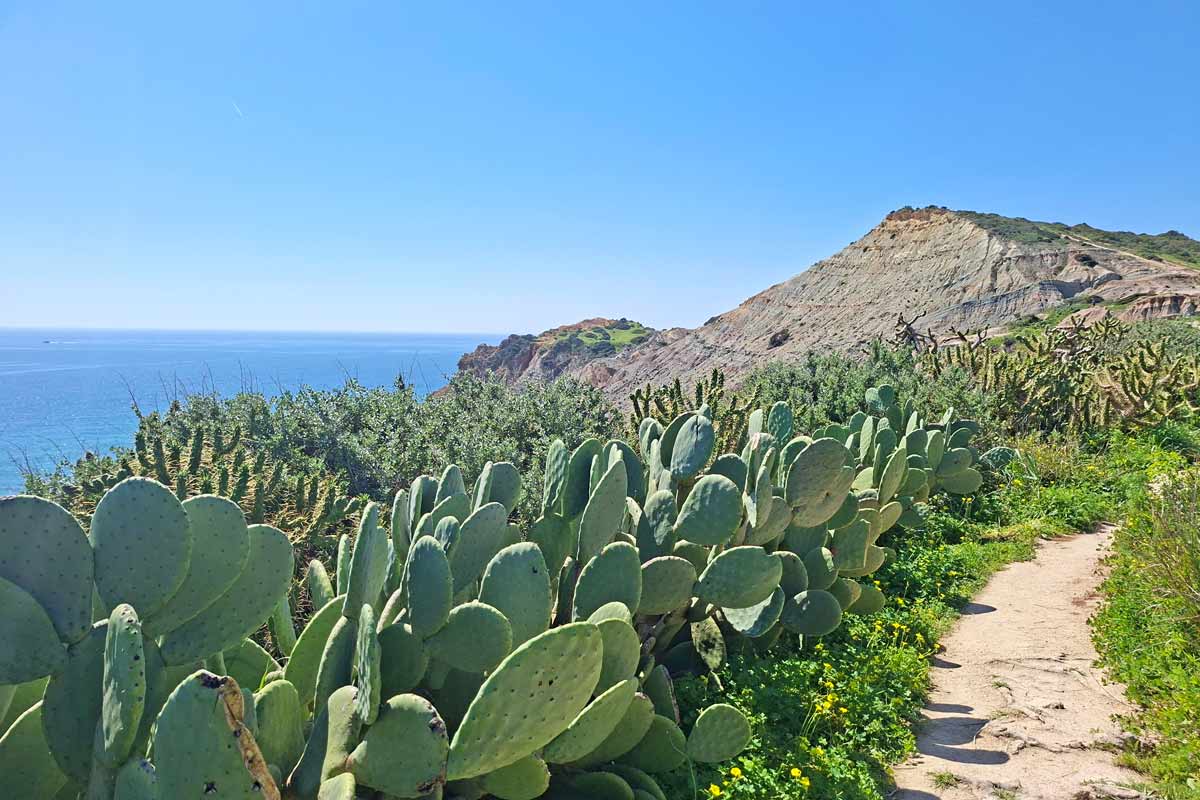
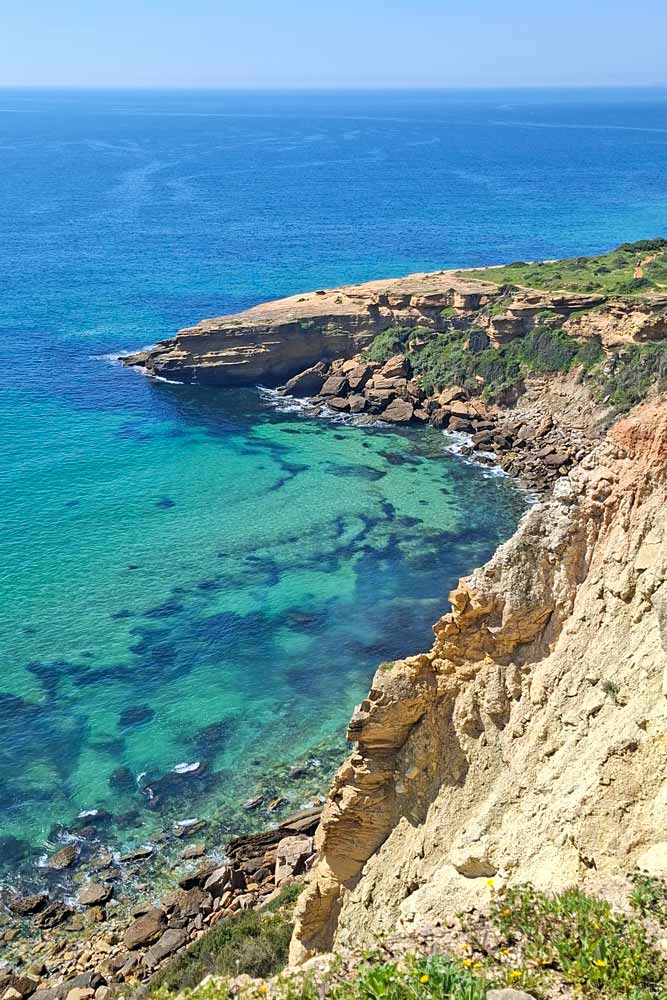
- Spectacular views of the rugged coast line and beaches from the cliffs
- Burgau beach and town
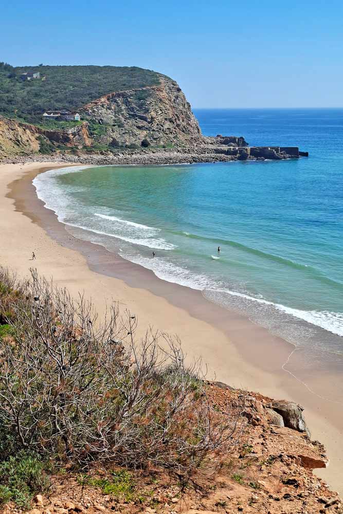
- Cabanas Velhas Beach
- Boca do Rio Beach
- Salema beach and town
The challenges of the walk
- A steep ascent with a subsequent descent at 3.5 km/2.1 mi.
- An ascent at 6.1 km/3.7 mi.
- Another ascent at 6.8 km/4.2 mi.
- A steep descent at 8 km/5 mi to Cabanas Velhas Beach.
- An ascent from Cabanas Velhas Beach to the top of the cliffs with a subsequent descent at 8.2 km/5.1 mi.
- A steep and rocky descent to Boca de Rio Beach at 9.5 km/5.9 mi.
- A river crossing (at high tide) at Boca de Rio Beach.
- A gradual descent just before Salema.
In which direction to walk?
I’ve walked the trail both ways from Salema to Luz and from Luz to Salema. The scenery is spectacular both ways from that point of view it doesn’t matter. From the practical point of view I find it’s better to walk from Salema because you get most hills in the first half of the trail not at the end of the walk. The part between Burgau and Salema has quite a lot of ascents and descents and it’s easier to walk then while you’re still fresh. The second part from Burgau to Luz is flat with one hill.
Elevation profile of the Luz to Salema trail
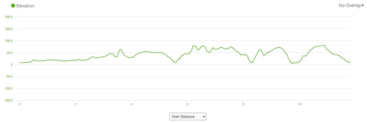
As you can see from the graph the first half of the trail barely has any hills while the second half has many ups and down.
Stops along the route
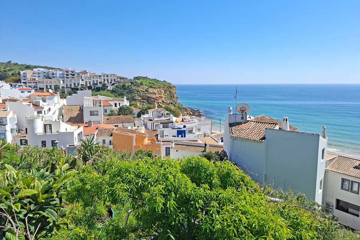
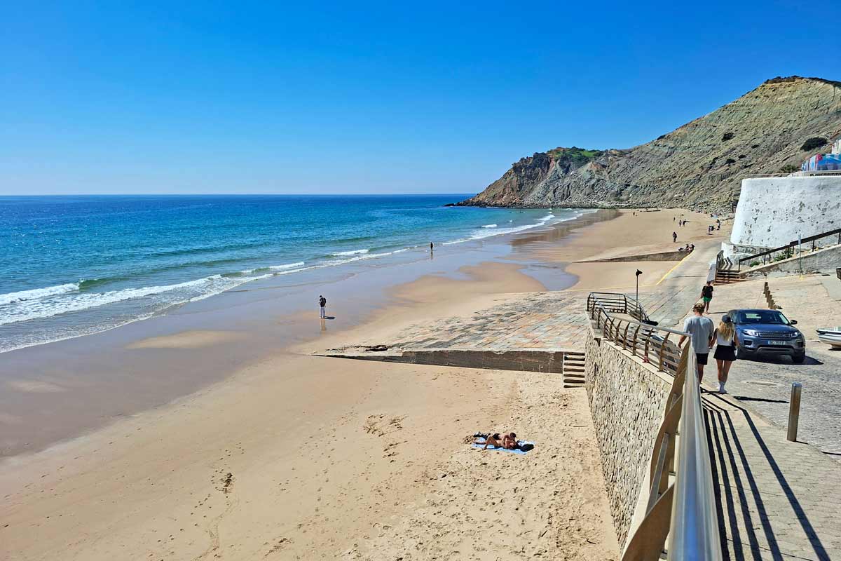
5 km/3.1 mi – Burgau, a small town with several restaurants and cafes, and a beautiful sandy beach.
8.2 km/5.1 mi – Cabanas Valhas Beach with a restaurant.
12 km/7.4 mi – Salema.
Praia da Luz to Salema route description
Part 1. Praia da Luz to Burgau
The first part of the route is easier than the second half. If you’re looking for a nice breezy walk I suggest doing the Luz to Burgau part. The route is flat with one hill all the way along the coast.
The first 1 km/0.6 mi is on the promenade through the town of Luz, past many cafes and restaurants.
1.4 km/0.8 mi – once out of Luz you continue on a footpath along the coast.
3.5 km/2.1 mi – an ascent to the top of the hill with a subsequent gradual descent.
5 km/3.1 mi – you arrive in Burgau.
Part 2. Burgau to Salema
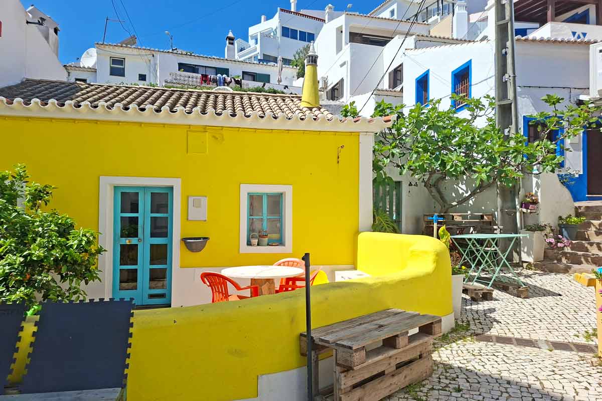
5-6 km/3.1-3.7 mi – through the town. First you go down to the beach and then up through the town to the top of the cliffs. Don’t miss a left turn at Aires restaurant (a small yellow building). From there you go up the stairs to the top of the cliffs.
6.1 km/3.8 mi – an ascent to the top of the cliffs with a subsequent small descent
6.8 km/4.2 mi – another ascent.
8 km/5 mi – a steep rocky descent to the beach.
8.2 km/5.1 mi – Cabanas Velhas Beach with a restaurant, a nice place to stop.
8.2 km/5.1 mi – an ascent to the top of the cliffs with a subsequent descent.
9.2 km/5.7 mi – the ruins of the Fortress São Luís de Almádena.
9.5 km/5.9 mi – a steep and rocky descent to the beach.
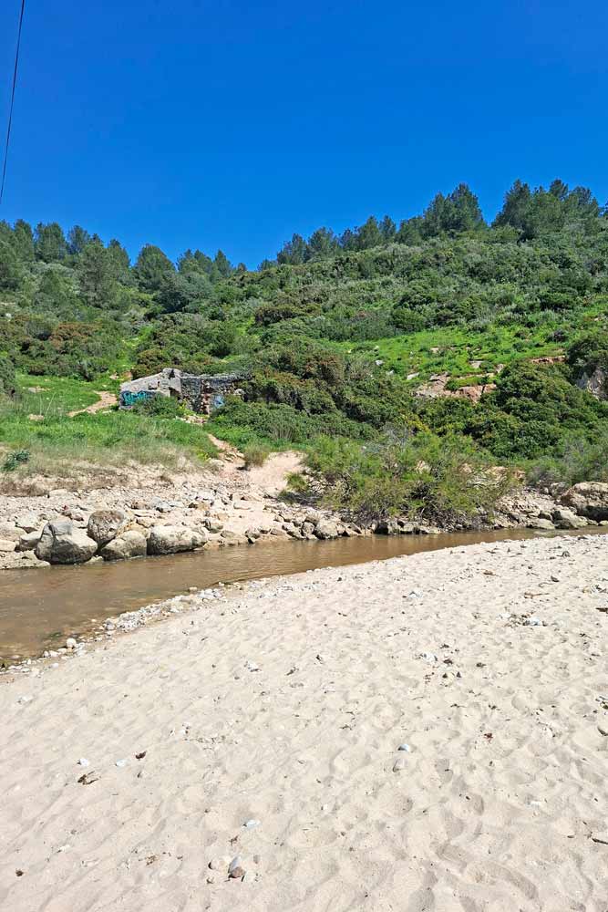
9.7 km/6 mi – a river crossing. During the high tide the water is ankle deep you have to take off your shoes to cross it. At low tide usually there is no water.
9.7 km/6 mi – Boca de Rio Beach.
Between 10 km/6.2 mi and 11 km/6.8 mi a couple of short ascents and descents.
12 km/7.4 mi – Salema Beach, the end of the route.
Where to stay in Salema?
Salema is a small place with very few budget accommodation options. Most of the places are apartments or villas that are rented for more than 2 days.
- Mid-range | Salema Eco Camp (1.4 km/0.8 mi away from the beach and the trail) |
- High-end | SalemaView Ensuite bedroom | Nau Salema Beach Village |
Questions or Comments?
Got any questions or comments? We would love to help! All questions and comments will be answered by us personally in Buy Me a Coffee. Click below and ask away.
Feel free to support our site by buying us a coffee!


The pretty half of Stingy Nomads, responsible for all our land adventures (hiking, climbing, walking the Camino) and following them write-ups. Alya loves walking since she was a child, she prefers to walk 1000 km with a backpack rather than to do a 10 000 km road trip (actually any road trip). Alya is a big fan of Latin America, the Spanish language, and dancing. Every time we go away she desperately misses our dog Chile.