
Via de la Plata is a 1000-kilometer route across Spain. It’s one of the most challenging Camino routes. The route is a perfect Camino for those seeking solitude and tranquility. Most of the route is through the quiet non-touristy part of Spain. In this post I give a detailed description of the walking stages of Via de la Plata from Seville to Merida.
Stingy Nomads participates in the Amazon Services LLC Associates Program and other affiliate programs. If you click on the link and purchase the item or make a booking, we will receive an affiliate commission at no extra cost. Thank You for supporting us and assisting us to produce quality, free content.
Via de la Plata PDFs
You can download our PDF files with walking stages and places to stay along the Via de la Plata to make you planning easier.
- Via de la Plata walking stages (Seville to Merida)
- Via de la Plata places to stay (Seville to Merida)
GPX files of the route (Seville to Merida)
You can download our GPX files for the part of the route from Seville to Merida. Check out our detailed guide on How to use Stingy Nomads GPX files to navigate with your phone.
- Via de la Plata stage 1 GPX
- Via de la Plata stage 2 GPX
- Via de la Plata stage 3 GPX
- Via de la Plata stage 4 GPX
- Via de la Plata stage 5 GPX
- Via de la Plata stage 6 GPX
- Via de la Plata stage 7 GPX
- Via de la Plata stage 8 GPX
- Via de la Plata stage 9 GPX
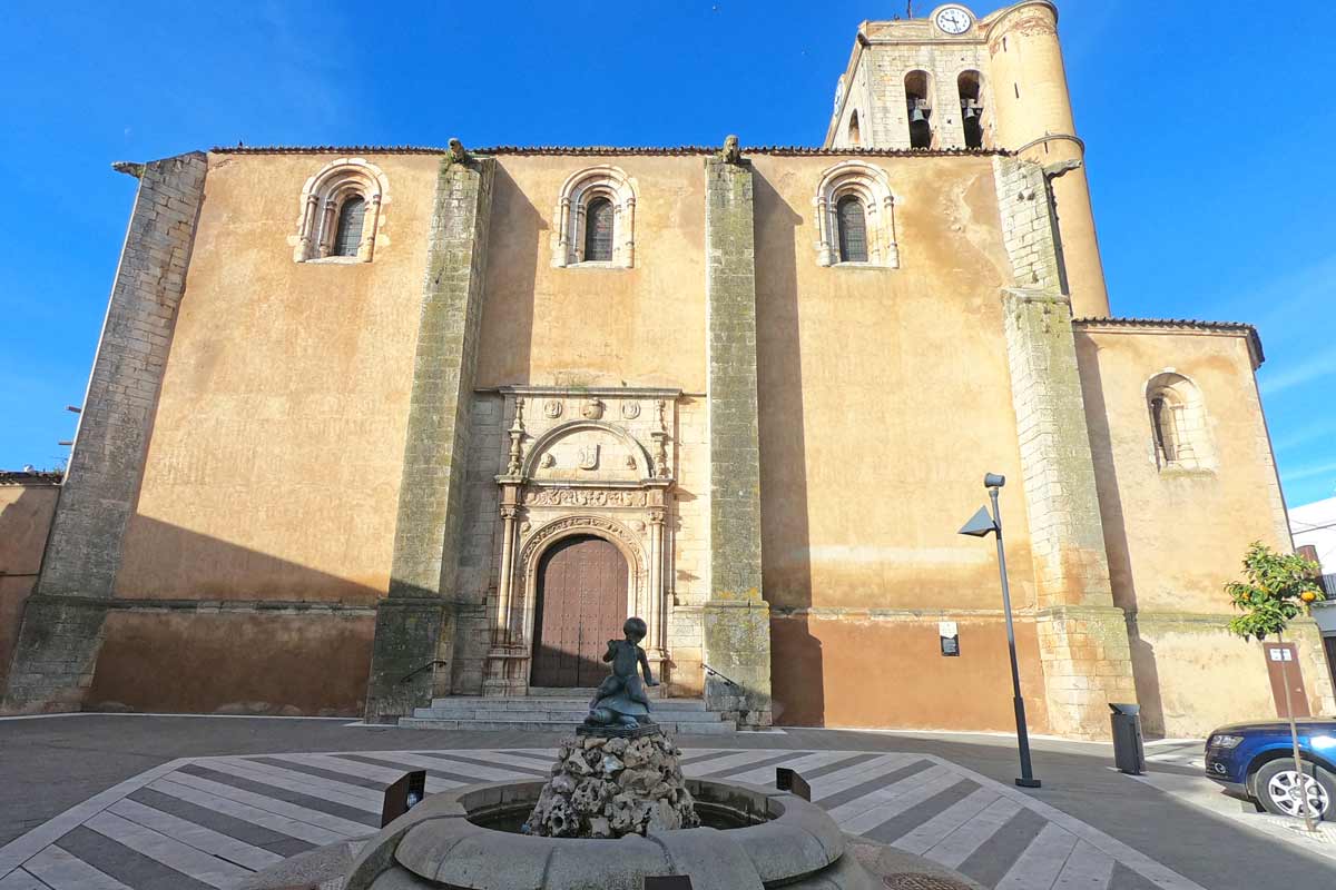
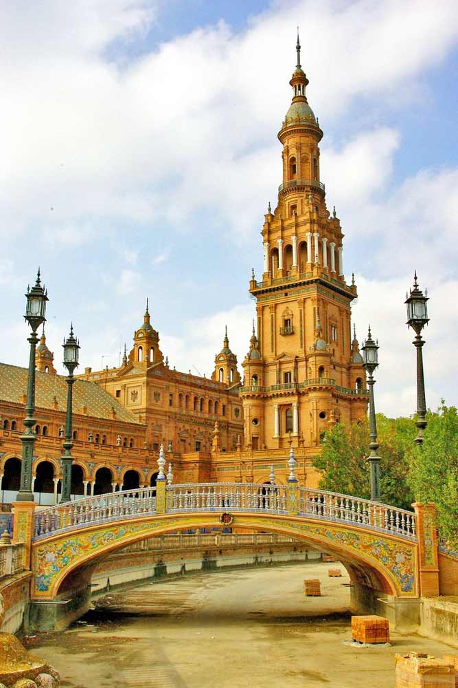
Seville, the beginning of the Via de la Plata
Seville is a beautiful city with a lot to see and to do, spending here a couple of days before starting the Camino is a great idea. My favorite way to spend time in Seville is sitting at one of the street restaurants near the Cathedral with a glass of wine and a couple of delicious tapas.
Things not to miss in the city: Plaza de España, Royal Alcázar, Cathedral, La Giralda, Torre de Oro, Parque de María Luisa, Santa Cruz barrio (neighborhood), Triana neighborhood, Plaza de Toros, Casa de Pilatos.
Seville tours & activities
There are many great tours around the city and to the nearby attractions.
- Sevilla Food Tour: Tapas, Wine, History & Traditions
- Flamenco Show with Drink
- Seville: 24/48-Hour Hop-On Hop-Off Bus Ticket
- White Villages and Ronda Day Trip from Seville
Places to stay in Seville
There is no public albergue in Seville but there are several hostels and private albergues. They are not exclusively for pilgrims anybody can stay there but most of the people staying at albergues are pilgrims.
We stayed at El Viajero en Sevilla, a small hotel in the historical center. It’s a great place, very neat, comfortable, and cozy. If we go to Seville we’ll stay here again.
- Budget | La Flamenka Hostel | The Nomad Hostel&Pension |
- Middle price | Pensión Javier | Triana Riverside |
- High-end | NH Sevilla Plaza de Armas | Casa Alhaja by Shiadu |
Note! If you arrive in Seville during the Semana Santa (a week before Easter), book your tickets and accommodation well in advance.
Via de la Plata route overview
- Total distance – 214 km/132 mi
- The time required – 8-10 days
- Starting point – Seville
- Finishing point – Mérida
- Total ascent (in 9 days) – 2976 m
- Total descent – 2766 m
- Walking surface – mostly gravel road – 160 km/99 mi; asphalt – 54 km/33 mi
- Route marking – yellow shells and arrows
- Average cost – 35€ per person per day
- Accommodation – public and private albergues, hotels
Via de la Plata walking stages (Seville to Merida)
We’ve walked only 9 first stages on the Via de la Plata, from Seville to Mérida, here you can find a detailed itinerary for these days. We’re planning to finish the route next year and will update the post after that.
Stage 1. Seville – Guillena, 23 km/14 mi
- Time – 5 hours (moving time)
- Walking on the road – 3 km/1.8 mi
- Walking on asphalt – 10 km/6.2 mi, the rest on footpath/gravel
- Ascent – 158 m
- Descent – 124 m
- Difficulty level – 2 out of 5
Highlights
- Stunning Gothic cathedral of Seville
- Triana district in Seville
- The Roman ruins of Italica, Santiponce
Challenges
- 3 km/1.8 mi of walking on the road after Santiponce.
- No places to stop or to refill water between Santiponce and Guillena, for 13 km/8 mi.


Stage 1 route description
The walk starts from the cathedral in Seville, there are a couple of yellow arrows and a shell at the corner of Avenida de la Conctitución and Calle García de Vinuesa. To our surprise it was quite easy and quick to walk out of the city, it took us about 30 min. and we didn’t go through any industrial or residential areas of the city. Most of the day the route went through the fields but there was an unpleasant walking on the road for about 3 km/1.8 mi after Santiponce.
Santiponce is the only town on the way, it’s about 9 km/5.5 mi from Seville and it’s worth stopping here and visiting the famous Roman ruins; the Roman Therms and the Roman Amphitheatre. The Amphitheater, by the way, was featured in season 7 of Game of Thrones as the Dragonpit. Unfortunately, we couldn’t visit them because it was closed on Monday. For more information on the ruins of Italica and opening hours visit the official website.
If you want to stop for lunch Santiponce is the only place on the way, don’t forget to refill your water there will be nowhere to do it till Guillena.
Guillena places to stay
Guillena is a small town with good infrastructure though we were here on Sunday and everything was closed.
| Municipal Albergue de Guillena | Albergue Luz del Camino | Hostal Francés |
Sage 2. Guillena – Castilblanco de los Arroyos, 18 km/11 mi
- Time – 4 hours
- Walking on the road – 0 km, the last 3 km/1.8 mi are on the footpath next to the road
- Walking on asphalt – 2 km/1.2 mi
- Ascent – 386 m
- Descent – 91 m
- Difficulty level – 2 out of 5
Highlights
- Walking through the forest and the fields
- Castilblanco is a charming town with traditional white houses and cobbled streets
- Communal dinner at the albergue
Challenges
- A very muddy and slippery path between 3 km/1,8 mi and 5 km/3 mi
- Nothing between Guillena and Castilblanco


Stage 2 route description
We didn’t pay for breakfast in the albergue we stopped on the way at one of the local bars S.C.A. Kibarpe, next to the supermarket Dia, they have good coffee and sandwiches, we paid 5 Euro for both.
It was a relatively short and easy walking day with a slight ascend of about 386 m throughout the day. In the beginning, you walk through Guillena town till the bridge, then cross the bridge after that turn right, away from the road, and there will be a Camino sign. The route through the town is not marked very well, here and there you see an arrow but it’s not difficult you basically just follow the main street from the albergue all the way out.
At about 3 km/1.8 mi after crossing the road you get to a very muddy path through the olive tree plantations. At about 8 km/5 mi a beautiful forest substitutes the plantations. There are no villages on the way no places to stop for coffee or food. At 10 km/6.2 mi there is a place to refill water you won’t miss it there is a big sign on the right-hand side. The last 3 km/1.8 mi before Castilblanco are on the footpath along the road.
Castilblanco de los Arroyos places to stay
A nice small town with several bars and restaurants on the main street and a beautiful church with many storks’ nests on the roof.
| Municipal Albergue | Albergue La Posada de Escardiel (+34 641 024 128) | Casa Salvadora (+34 615 500 963) |


Stage 3. Castilblanco de los Arroyos – Almadén de la Plata, 28.7 km/18 mi
- Time – 6-7 hours
- Walking on the road – 16.5 km/10.2 mi
- Walking on asphalt – 16.5 km/10.2 mi
- Ascent – 649 m
- Descent – 521 m
- Difficulty level – 3 out of 5
Highlights
- Natural Park Sierra Norte
Challenges
- Walking on the road for the first 16.5 km/10.2 mi.
- No place to stop for food or water for 28 km/17.3 mi.
- Steep but not long ascent just before Almadén de la Plata.


Stage 3 route description
I suggest making sure you have enough water before you leave Castilblanco as well as taking some snacks with you and having breakfast in the town before you leave. There is literally nothing on the way; no place to refill water, no place to buy food till you reach Almadén de la Plata.
It was quite a long day of walking. The first part was on the road after an hour or so it got quite monotonous but it wasn’t as bad as we thought, the road was not very busy. The second part, after 16.5 km/10.2 mi, is through Natural Park Sierra Norte. The scenery in the park is beautiful; green hills, trees, many flowers (in spring), and a couple of smallish rivers. Unfortunately, we couldn’t really enjoy the scenery as it was raining non-stop all the time we were in the park.
Almadén de la Plata places to stay
This town is smaller than Castilblanco, it has a couple of restaurants and shops, a square with a church, and a Jamon factory.
| Municipal Albergue | Albergue La Caja del Reloj (+34 692 552 659) | Hotel Casa Concha | Hotel El Romeral |


Stage 4. Almaden de la Plata – Monesterio, 35 km/21.7 mi
- Time – 8 hours
- Walking on the road – 2 km/1.2 mi short bit here and there on the last 8 km/5 mi
- Walking on the asphalt – 4 km/2.4 mi through the towns and a little bit along the road
- Ascent – 850 m
- Descent – 575 m
- Difficulty level – 4 out of 5 it was a long walking day
Highlights
- A beautiful walk through the countryside and forest
- The castle in El Real de la Jara
Challenges
- A long walking day, 35 km/21.7 mi and it did feel long and tiring.


Stage 4 route description
Option! If you think walking 35 km/21.7 mi in one day is too much you can split this day into two. Walk 13.5 km/8.3 mi to Real de la Jara and the next day 21 km/13 mi to Monasterio.
A second long day in a row, most pilgrims we started with walked 13 km/8 mi and stayed in Real de la Jara, many people split this day into two. At the beginning of the day, we continued walking through Natural Park Sierra Norte with beautiful scenery and many smallish ups and downs.
Luckily, today there are two stops on the route so you can put down your backpack and sit down, drink coffee, eat something, and refill your water. At Real de la Jara you leave the region of Andalusia and enter Extremadura.
The last 8 km are next to the road mostly on the footpath crossing the road here and there.
Monesterio places to stay
Don’t be confused by the name, the actual monastery is 5 km/3 mi outside the town you won’t see it unless you walk there or take a taxi. The town itself is quite big compared to most towns on the Via de la Plata.
| Albergue Las Moreras (+34 690 304 314) | Hostal DP El Pilar | HOTEL RESTAURANTE MOYA |


Stage 5. Monesterio – Fuente de Cantos, 20.6 km/12.8 mi
- Time – 5 hours
- Walking on the road – 0 km
- Walking on the asphalt – 2 km/1.2 mi through the towns
- Ascent – 291 m
- Descent – 432 m
- Difficulty level – 2 out of 5
Highlights
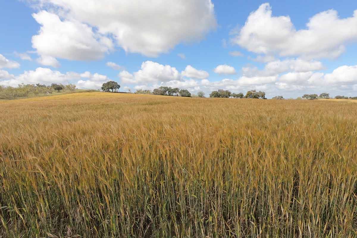
- Very peaceful area with no people, cars, or houses only fields and nature.
Challenges
- Nothing on the way for 20 km/12.4 mi you have to carry enough water with you for the whole day.


Stage 5 route description
We started the day quite late, it took us about 10 min. to walk out of the town, at the exit there is a restaurant that opens at 7 am, they have coffee or hot chocolate with churros for 3 Euros. Make sure to have enough water and there will be nothing on the way. The walk was easy and nice with light ups and downs, through a very quiet countryside with olive tree plantations, wheat fields, cows, sheep, etc. far from the road and any other disturbing noises.
Fuente de Cantos places to stay
A cozy little white town with a small square and a church on it and narrow cobblestone streets.
| Hotel Rural La Fábrica | El Zaguán de la Plata |


Stage 6. Fuente de Cantos – Zafra, 24.7 km/15.3 mi
- Time – 6 hours
- Walking on the road – 0 km
- Walking on the asphalt – the last 4 km/2.4 mi to Zafra
- Ascent – 212 m
- Descent – 288 m
- Difficulty level – 2 out of 5
Highlights
Peaceful scenery; olive tree plantations, vineyards, pasture fields, etc.
The historical center of Zafra; Plaza Grande, Plaza Chica, Convento de Santa Clara. If you happen to be here on the weekend go to one of the squares and drink a glass of wine or beer, there are many restaurants and bars here, and on weekends they are full of locals, it has a great holiday vibe.
Challenges
- 14 km in the middle of the day with nothing on the way


Stage 6 route description
It was an easy walking day through the countryside most of the time make sure to have enough water between 6 km/3,7 mi and 20 km/12,4 mi there is nothing on the way except a shelter at 15 km/9,3 mi where you can stop and rest, drink water or eat something.
Zafra places to stay
It’s more of a city place, much bigger than other stops on the way. The historical part of Zafra is nice; cobblestone streets, two beautiful squares, a cathedral, a fortress, and several small parks.
| Municipal Albergue | Albergue Convento San Francisco (+34 680 663 806) | Hostal Arias | Hostal Carmen |


Stage 7. Zafra – Villafranca de los Barros, 20.5 km/12.7 mi
- Time – 5 hours
- Walking on the road – 400 m
- Walking on asphalt – 8 km/5 mi; the first 7 km/4.3 mi from Zafra and the last 1 km/0.6 mi
- Ascent – 246 m
- Descent – 339 m
- Difficulty level – 1 out of 5 a short and easy walking day
Highlights
- Cathedral and cobblestone streets of Los Santos de Maimona
- Olive tree plantations and vineyards
Challenges
Nothing on the way for 15 km/9.3 mi between Los Santos de Maimona and Villafranca de los Barros, make sure to carry enough water as the route goes through the fields with no shadow.


Stage 7 route description
It was an easy walking day except for the very beginning, the route through Zafra is not marked very well, and everybody got a bit lost (we left first and stopped at a bar for breakfast and could see other fellow pilgrims wandering around in search of yellow arrows), in the end, we had to ask locals.
We followed the arrows to the Plaza Grande and then lost them, the same happened to everybody. I’d suggest once you’re on the Square ask around will point you the right way. You walk out of the town following Calle San Francisco you can find it on the map.
The rest of the day was very similar to the previous two walking days. After 4.5 km/2.7 mi there is a small town where you can stop for coffee, it’s the only stop on the route.
Villafranca de los Barros places to stay
A typical town with a square, a couple of churches, and many restaurants and bars. We were here on Sunday everything was closed even restaurants didn’t serve food between 4 pm and 8.30 pm because kitchens are closed at this time of the day.
| Municipal Albergue (temporary closed) | CASA PERIN – HOSTAL RURAL | Hotel Diana Centro Ciudad |
Stage 8. Villafranca de los Barros – Torremejía, 27.5 km/17 mi
- Time – 6-7 hours
- Walking on the road – 0 m
- Walking on the asphalt – 3 km/1.8 mi in the towns
- Ascent – 105 m
- Descent – 221 m
- Difficulty level – 3 out of 5, a long walking day with no places to stop for food or water
Highlights
- Beautiful sunrise on the way out of the town (if start early enough).
- Vineyards and olive tree plantations, to be honest after a couple of days this scenery started to get quite monotonous.
Challenges
- Quite a long distance with no places to stop or to refill water on the way.


Stage 8 route description
Note! There is a town Almendralejo about halfway with a couple of hotels but it’s 4 km/2.4 mi off the route to get there and then back on the Camino you’ll have to walk 8 km extra.
The walk wasn’t difficult but it’s quite long we’d strongly recommend starting walking early to skip the midday heat. We walked the Via de la Plata at the end of April and it was already quite hot after 10 am. Make sure you have enough water to last you the whole day there will be no place to refill it. The scenery was very similar to the previous days; vineyards, olive trees, fields, and not much else.
Torremejía places to stay
Another small white town with a couple of hotels, one albergue, restaurants, and supermarkets.
| Albergue Rojo Plata | Casa Trini |


Stage 9. Torremejía – Merida, 15.6 km/9.6 mi
- Time – 4 hours
- Walking on the road – 2 km/1.2 mi
- Walking on the asphalt – 5 km/3.1 mi
- Ascend – 79 m
- Descend – 175 m
- Difficulty level – 1 out of 5, short and easy walking day
Highlights
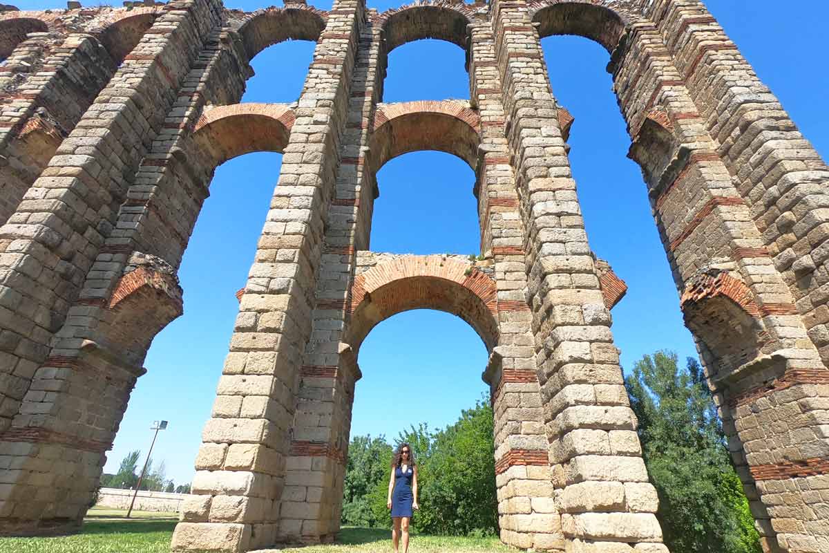
- The Roman bridge at the entrance to Merida
- Several Roman ruins in Merida; aqueduct Los Milagros, Roman Theatre and Amphitheatre, Circo Romano, Alcazaba.
Challenges
- at the beginning of the day 2 km/1,2 mi of walking on the road out of 7 km/4,3 mi of walking next to the road.


Stage 9 route description
To walk out of the town you can go left from the albergue and follow the gravel road for a little bit or go right towards the restaurant and follow the road, both routes join after about 500 m. It wasn’t the most beautiful walking day, the first half was along the road, sometimes on the road, the second half past some sort of industrial area or factories. And again nowhere to stop on the way we’d recommend having breakfast in Torremejía and carrying enough water.
Merida places to stay
It’s a World Heritage city with several impressive Roman sights. If you have time I’d suggest stopping here for 2 days if not try to start walking early in the morning to have more time to explore the city. We stayed for 2 nights here; the first night at the municipal albergue Molino de Pancaliente and the second is a guest house.
We finished the Via de la Plata in Mérida where we stayed for 2 days to have time to explore the Roman ruins. From Merida, we went to Portugal where we spent two weeks walking the Fisherman’s Trail, a spectacular coastal route in the south.
We’re planning to finish the Via de la Plata one day.
- Budget | Municipal Albergue | Deluxe Hostels & Suites Merida |
- Middle price | La Flor De Al-Andalus | Hostal Emeritae |
- High-end | Parador de Mérida | Hotel Ilunion Mérida Palace |
Questions or Comments?
Got any questions or comments? We would love to help! All questions and comments will be answered by us personally in Buy Me a Coffee. Click below and ask away.
Feel free to support our site by buying us a coffee!


The pretty half of Stingy Nomads, responsible for all our land adventures (hiking, climbing, walking the Camino) and following them write-ups. Alya loves walking since she was a child, she prefers to walk 1000 km with a backpack rather than to do a 10 000 km road trip (actually any road trip). Alya is a big fan of Latin America, the Spanish language, and dancing. Every time we go away she desperately misses our dog Chile.