
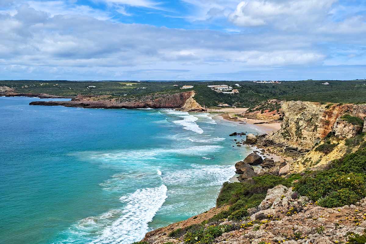
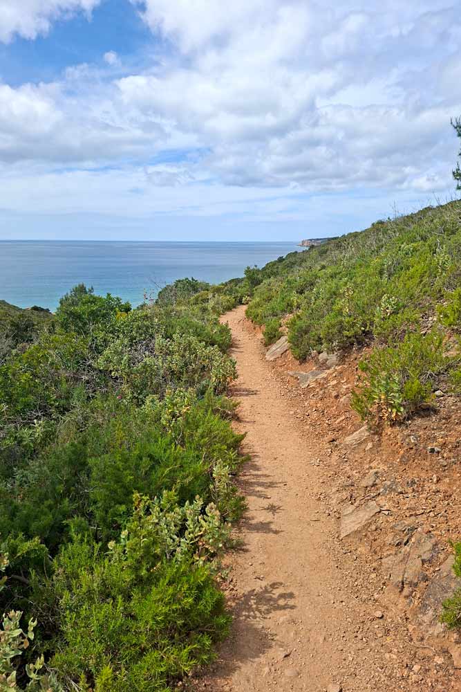
The Salema to Sagres coastal route is a part of the Fishermen’s Trail, a multi-day hike along the coast in southern Portugal. The trail can be walked as a day hike or as a part of the longer route. The scenery along the route is spectacular; rugged cliffs, unspoiled beaches, and breathtaking lookout points.
Stingy Nomads participates in the Amazon Services LLC Associates Program and other affiliate programs. If you click on the link and purchase the item or make a booking, we will receive an affiliate commission at no extra cost. Thank You for supporting us and assisting us to produce quality, free content.
Salema to Sagres route overview
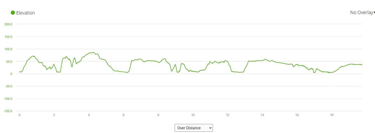
- Distance – 20 km/12.4 mi
- Time – 5-6 hours (moving time)
- Total ascent – 593 m
- Total descent – 567 m
- Difficulty – moderate
- Route markings – marked with green and blue stripes painted on light poles, rocks, and walls.
- Walking surface – 17.5 km/10.8 mi – footpath/gravel road; 1 km/0.6 mi – sand (beach); 1.5 km/0.9 mi – cobbled stones.
- Walking by the sea – 14 km/8.6 mi
- Walking route – Salema – Zavial Beach – Ingrina Beach – Martinhal Beach (Sagres) – Tourism Information Office in Sagres.
GPX file of the route
You can download our GPX file and use it for navigation on your device.
Where does the trail start?
The easiest is to start walking at the west point of the promenade at Salema Beach next to Atlantico Restaurant. There is a wooden board with the map of the trail. From there you can see route markers (blue and green stripes) on the light poles and walls. They will take you out of the town to a footpath along the cliffs.
Where does it finish?
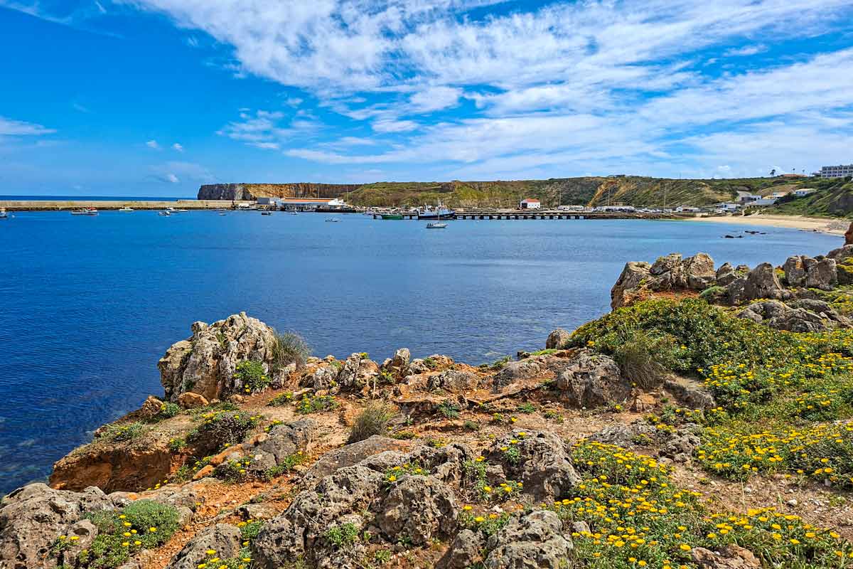
At the information kiosk in Sagres at Jardim de Sagres Square (Mareta Beach). There is a wooden board with the map of the trail. A bus stop is right there. You can get a bus back to Lagos or Salema.
How to get to Salema?
You can get to Salema by bus #47 from Lagos, Sagres, or Vila do Bispo. The bus journey takes around 30-40 minutes. Check the timetable here.
The highlights of the Salema to Sagres route
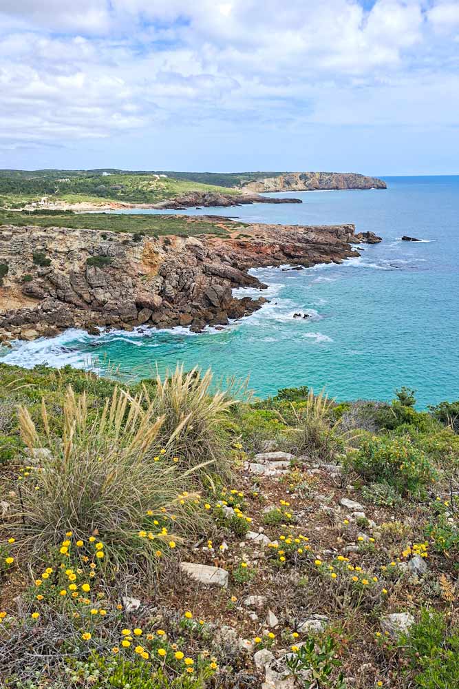
- Spectacular coastal scenery from the top of the cliffs.
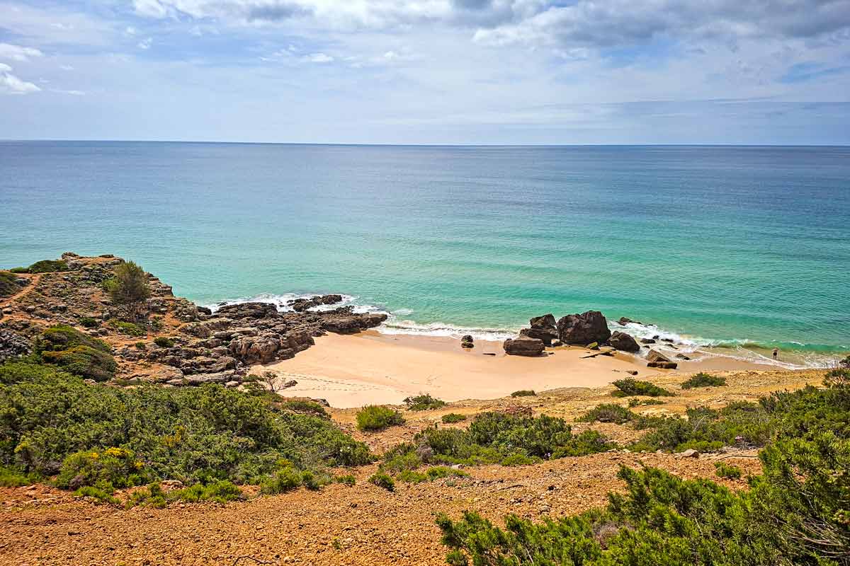
- Several secluded small beaches surrounded by the limestone cliffs.
- Wild flowers along the cliffs in spring time.
- Zavial Beach, a popular surf beach surrounded by the cliffs.
- Ingrina Beach, a small beach nice for swimming.
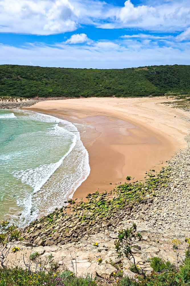
- Martinhal Beach, a long beautiful beach east of Sagres with a couple of restaurants.
The challenges of the trail
- The first 10 km/6.2 mi from Salema to Ingrina Beach has many steep ascents and descents.
- No place to refill water for the first 10 km/6.2 mi. Make sure you carry enough water.
In which direction to walk?
I’ve walked this route both directions from Salema to Sagres and from Sagres to Salema. I prefer to walk it from Salema because the part of the route between Salema and Ingrina Beach has many steep ascents and descents. It’s better to walk it at the start of the day while you’re still fresh and before it gets too hot if you walk the trail in summer.
Elevation profile of the trail
Stops along the route
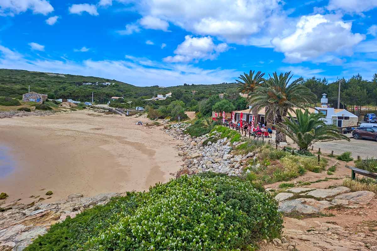
9.3 km/5.7 mi – Zavial Beach, a beach with a restaurant, a toilet (inside the restaurant) you can ask to use even if you don’t order anything, and an ATM (the restaurant accepts only cash).
10 km/6.2 mi – Ingrina Beach, a smaller beach with a restaurant and a toilet. This restaurant is more of a local place (cheaper) than the one at Zavial.
17.3 km/10.7 mi – Martinhal Beach, a couple of restaurants.
Salema to Sagres route description
Part 1. Salema to Ingrina Beach
0-0.6 km/0-0.3 mi – through the town.
0.6-3.5 km/0.3-2.1 mi – along the cliffs.
2.3 km/1.4 mi – Praia Santa beach.
2.3 km/1.4 mi – a steep ascent from the beach to the top of the cliffs.
3 km/1.8 mi – a steep descent with a subsequent ascent.
3.5-6 km/2.1-3.7 mi – the trail goes away from the coast. It goes around the cliffs through the fields on a gravel road.
6.1 km/3.7mi – beach
6.3 km/3.9 mi – a steep ascent from the beach to the top of the cliffs.
6.4-8.6 km/3.9-5.3 mi – an easy flat walk on the top of the cliffs with spectacular views.
8.6 km/5.3 mi – a descent
8.7 km/5.4 mi – a gradual ascent
9 km/5.5 mi – a steep descent to Zavial Beach
9.1 km/5.6 mi – Zavial Beach, restaurant, toilet, ATM
9.2 km/5.7 mi – a steep ascent to the top of the cliffs.
10 km/6.2 mi – Ingrina Beach, restaurant, toilet.
Part 2. Ingrina Beach to Sagres
12.2 km/7.5 mi – Barranco Beach
13 km/8 mi – a long gradual ascent
13.2-15.7 km/8.2-9.7 mi – the trail goes inland (you can see it from time to time), through the fields, a flat and easy walk.
15.7 km/9.7 mi – the trail is back by the sea.
16.9 km/10.5 mi – a steep descent.
17.3-18.3 km/10.7-11.3 mi – Martinhal Beach, a wide sandy beach with a couple of restaurants.
18.3-20 km/11.3-12.4 mi – through the town of Sagres.
20 km/12.4 mi – the information office in Sagres.
Where to stay in Sagres?
Sagres is a popular tourist destination unlike in Salema here you can find accommodation on different budget from hostels to spa hotels.
- Low-end | Sagres Natura | Sagres Sun Stay – Surf Camp & Hostel |
- Mid-range | Casa Sarguito | Tonel Apartamentos Turisticos |
- High-end | Sagres Time Apartamentos | Residencia Julio |
Questions or Comments?
Got any questions or comments? We would love to help! All questions and comments will be answered by us personally in Buy Me a Coffee. Click below and ask away.
Feel free to support our site by buying us a coffee!


The pretty half of Stingy Nomads, responsible for all our land adventures (hiking, climbing, walking the Camino) and following them write-ups. Alya loves walking since she was a child, she prefers to walk 1000 km with a backpack rather than to do a 10 000 km road trip (actually any road trip). Alya is a big fan of Latin America, the Spanish language, and dancing. Every time we go away she desperately misses our dog Chile.