
The West Coast Trail is a strenuous 75 km multi-day beach and forest hiking trail in the Pacific Rim National Park Reserve on the coast of Vancouver Island in British Columbia, Canada. A large part of the trail is spent hiking on miles of extensive, white sandy beaches separated by spectacular indigenous forest.
The reputation for being a tough hike is well deserved and this coastal trail can be brutal when there is a lot of rain with slow progress over difficult terrain, through dense forests including pools of mud, ladders, bridges, and cable cars.
The West Coast Trail was originally called the Dominion Life Saving Trail and was built to facilitate the rescue of shipwreck survivors along the dangerous coast of the Graveyard of the Pacific, today it is known as one of the best hikes in the world.
In this article, you will find all the information needed to plan a hike on the West Coast Trail, all about our hike; a detailed itinerary, transport, and packing.


Table of Contents
West Coast Trail Hike Information
- Official Distance – 75 km/ 47 miles
- Measured Distance (Garmin Fenix5) – 88.15km/54miles according to my GPS
- Time required – 6 to 7 days (5 or 6 nights)
- Starting and Endpoint – Gordon River to Bamfield
- Total ascent (elevation gain in 6 days) – 1813 m
- Total descent (in 6 days) – 1878 m
- Trail Markings – Clear Yellow Signs, Orange Markings, Pink Ribbons
- Walking surface – a mix of sand and rocks on the beach, footpaths with surface varying between dirt and knee-deep mud.
- Total cost – $CAD517 ($391)
- Accommodation – camping
- Food – carry food for the duration of the trail
This is a moderate to strenuous hike in the Pacific Rim National Park along the southwest coast of Vancouver Island in British Columbia, Canada. The exact distance will vary slightly, depending if you walk on the beach or hike on inland trails.
I hiked the route in 6 days, and 5 nights which is a common way to complete the entire trail, some people do opt for an extra night.
The trail hiking route stretches from the Gordon River trailhead, close to the town of Port Renfrew in the south, to Bamfield in the north. The trail is hiked by west coast trail hikers in both directions, logistics and whether you want to start or finish with the difficult part of the trail are the main considerations. The world-famous West Coast trail meanders through a spectacular mix of solitary rainforest, long sandy and rocky beaches, and biodiverse tide pools, offering panoramic views and an unreal variety of fauna and flora. Keep your eyes on the ocean and you might spot grey whales, killer whales, seals, or sea lions, in the forest, keep a lookout for black bears, bald eagles, and cougars, and don’t skip the fantastic tidal pools inhabited by starfish, sea urchins, barnacles, blue mussels, anemones, sea cucumbers, and plenty more interesting animals.


The amazing Vancouver Island is filled with amazing attractions and activities, the beautiful gardens and harbor of Victoria, the beaches and surfing of Tofino, and awesome whale watching and orcas from many different places on Vancouver Island. Check out our Best Things to Do on Vancouver Island for some fantastic activities and places not to miss when coming here!
West Coast Trail Maps (GPX files).
The GPX files below are the tracks I created hiking the West Coast Trail with a Garmin Fenix 5 – 2019. This is an additional resource, use the latest official maps for navigation on the West Coast Trail.
See our detailed guide on How to use Stingy Nomads GPX files to navigate with your phone.
Highlights of hiking the West Coast Trail.
The GPX files below are the tracks I created hiking the West Coast Trail with a Garmin Fenix 5 – 2019. This is an additional resource, use the latest official maps for navigation on the West Coast Trail.
- The wildlife on the trail was amazing to see bears, deer, otters, and even orcas from up close, this blew me away.
- Hiking for kilometers on beautiful beaches every day makes this the hike of a lifetime.
- Walking in wonder through the spectacular old-growth forest of the Pacific Rim National Park.
- Camping on the beach, making big bonfires on the sand with new friends!
- Unreal sunsets and morning coffees, I will recommend packing proper coffee and an Aeropress!
- Scrambling over the boulders and logs and walking between Thrasher & Owen Point was a challenge!
- River crossings with the cable cars were fun, find a buddy to pull you across, this is much easier as a team effort!
- The breathtaking Tsusiat Falls is an awesome swim spot after a long day of hiking.
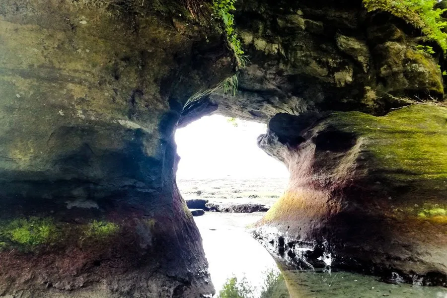
- The spectacular sea caves at Owen Point.
- Climbing up and down many ladders.
How hard is hiking the West Coast Trail?
For an experienced hiker, I would say the trail is moderate to tough. Climbing more than 70 ladders, walking through heavy rain in the mud, river crossings, and kilometers on the beach carrying your tent and all your food and gear for a week is not easy. The weather plays a huge role and on dry days it was much easier than walking in the rain and mud. It is not impossible to hike this trail if it is your first time hiking a multi-day backpacking trip but is not recommended, the Juan de Fuca trail is more suitable.
The West Coast Trail Trailheads
The southern trailhead is at the mouth of the Gordon River at the Pacheedaht campground near the town of Port Renfrew on the southwest coast of Vancouver Island. To get to the trailhead you walk from the Pacheedacht campground (5 min) and take a ferry crossing included in the registration fee.
The northern trailhead is at the Pachena Bay campground 5.5km from the town of Bamfield on the central west coast of Vancouver Island. You can walk or order a taxi, from the Pachena Bay campground the staff can phone a taxi for you to town.
How to do The West Coast Trail
Which direction to hike The West Coast Trail
The trail can be hiked either way; from south to north starting at the Gordon River Trailhead close to Port Renfrew and ending at Bamfield or the other way around.


Does it make a difference in which direction you hike?
You can see from the statistics provided that ascend and descend are about the same, so the uphill and downhill will be the same irrespective of which direction you hike.
So what is the best way to hike the WCT? Well, the Southern Part is tougher! the trail from Gordon River to Culite Cove is definitely much more challenging than the northern part from Culite Cove to Pachena Bay with many hills, ladders, and other obstacles, also when it rains this part of the trail is very muddy, making it slow hiking. I chose to do the difficult part first. The northern part is flatter with less mud and ladders.
Logistics – If you drove your own car and it is waiting in Port Renfrew it is great if you are hiking north to south, arriving at your car at a good time, and driving to the ferry crossing.
Ferry crossing times at Gordon River: 8:45, 11:30 ( after morning orientation), 13:30, 14:30, and the last ferry at 15:30


Time required to hike the West Coast Trail
Hiking the full West Coast Trail takes 5 to 7 days. I walked the trail from the Gordon River trailhead (Port Renfrew) in the south to the Pachena Bay trailhead (Bamfield) in the north in 6 days and 5 nights walking 3 to 7 hours per day. I walked most parts possible to walk on the beach. If you are fit it is possible to complete the trail in 5 days/4 nights, you will however need to walk 5 long days to do so and since many of the beach sections can only be walked at low tide, doing the trail in 5 days, you will probably miss many of the beach walks being forced by the tides to walk the forest paths, I will not recommend this.
To give you an idea of what is possible, the record for running the trail is 9 hours and 32 minutes!
To complete the trail you should be fit and either be an experienced hiker/camper or go with an experienced crew. It is possible to hike a shorter version of the West Coast Trail. A mid-point entrance at Nitinat Narrows that is only accessible by water from Nitinaht Village, allows you to hike a shorter portion of the West Coast Trail. Traveling south the shorter trail extends from Nitinaht Narrows to Gordon River for a total of 42 km which can be comfortably hiked in 5 days/4 and nights. Traveling north from Nitinat Narrows to Pachena Bay is the shortest option available to hike the West Coast Trail at 33 km in total.
Another shorter, cheaper, and easier option is to hike the Juan de Fuca trail also starting outside Port Renfrew, I compare the trails later in the article.


West Coast Trail Booking
West Coast Trail reservations in 2023 will only start on 13 March. – Parks Canada is currently changing the reservation system.
To avoid disappointment it is important to book early. Spots are usually booked months ahead. The West Coast Trail is open from May 1 – Sept 30. Even though bookings start the second they open cancelations and random open spots do happen with a bit of luck. In 2020 I only booked about 2 weeks ahead, so keep an eye on the website! Make a reservation and pay at Parks Canada Pacific Rim.
See our Guide to Reserve the West Coast Trail for a detailed guide to planning and booking the trail.
West Coast Trail Transportation
Organizing transport is a bit of a mission since the trail is not circular, you need transport to the starting point and again from the endpoint. The trail can be reached by public transport or with your own vehicle.
You can get around Vancouver Island by bus, but the easiest way is to rent a car. We like to use Rentalcars, this site compares all the main rental agencies giving you the best deal online. There are some amazing things to do in Vancouver if you have a couple of days before coming to Vancouver Island.
The West Coast Trail Express provides a shuttle bus service in season, May 1 to September 30, picking up and dropping off passengers at Victoria, Port Renfrew, Gordon River, Pachena Bay, Bamfield, and Nanaimo.
The Shuttle Bus tickets are not cheap, at the time of writing the price is $CAD60 from Victoria to Port Renfrew/Gordon River and $CAD 120 from Bamfield/Pachena Bay to Victoria. If you do book the return shuttle there is a 20% discount on the return trip ($CAD 24).
The shuttle service is a good option if you do not have a car, it is important to note that if you take the shuttle back from either side of Pachena Bay or Gordon River you will probably not make it back to the Swartz Bay ferry terminal in time to catch the last ferry back to Vancouver.


If you have a car, you can park at the Gordon River trailhead, there is parking at the Pacheedaht First Nations Reserve near the Gordon River trailhead. Parking is $5/day, pay at the Pacheedaht Campground office. Nobody parks on the northern side at the Pachena Bay trailhead since the gravel road to the trailhead is not good and difficult to navigate, the two most common options are:
- to walk south from Pachena Bay finishing the hike at your car at Gordon River, you take a shuttle bus Pachena Bay to Gordon River ($95) and start walking south, remember it is compulsory to attend the WCT orientation before you start your walk, these take place at 10:00 and 14:00 daily between May 1st and September 30th, following the orientation there is an included ferry crossing to the trailhead.
- To walk north from Gordon River and end at Pachena Bay, take a shuttle bus with West Coast Trail Express back to your car at Gordon River.
You can also take a boat to Bamfield here is how; take a public ferry from Horseshoe Bay in Vancouver to Departure Bay on Vancouver Island, and from here an Island Link Bus to Port Alberni, The Lady Rose Marine Services runs a freight ship that transports some passengers a few days a week between Port Alberni and Bamfield. Go by taxi from Bamfield to Pachena Bay trailhead.
Getting to Vancouver Island
To get from Vancouver to Vancouver Island making use of BC Ferries is the most common way. Regular buses service the ferry terminals on both sides or you can board the car ferry with your vehicle. Ferries depart from Tsawwassen (near Vancouver) to Swartz Bay (Near Victoria) Ferry Schedule on a regular basis, from Tsawwassen to Duke Point (near Nanaimo) and from Horseshoe Bay (near Vancouver) to Departure Bay (in Nanaimo). I enjoyed the ferry trip to Tsawwassen, it takes about 1h30min, and food and coffee are available on the ferry, you sail close to the islands with good views, and you can even see whales with some luck!
A fast and exciting way to get to Vancouver Island is by transfer with a small seaplane, this scenic flight takes only 35 minutes. – Coal Harbour in Vancouver (Canada Place) to Victoria.


Get to Vancouver Island by Seaplane
Best Time of the Year to Hike the West Coast Trail
The West Coast trail is open from May 1st to September 30th, and only 30 people are allowed to start hiking the trail each day, check the Parks Canada Website. The popular trail is fully booked for most of the season so there will be more or less the same number of people on the trail at all times.
In May and June there will likely be a lot of rain, so be prepared for wet weather. In June you have the longest daylight giving you nice long days. Mid-July to early August is the driest period, it is just so much more fun to hike if it is dry, walking in wet shoes, pitching a tent in the rain, and being in the rain and mud just gets miserable. The dry season is a great time to walk, this is the season with the most young people on the trail (summer holidays). I walked in September, which is a good time, but you can get some rain, also after the season the trail is a bit worn following the season (ladders, platforms, and paths take some strain).
Role of Tides on the West Coast Trail
It is amazing that large parts of the West Coast trail can be hiked on the beach, walking on the sand looking for animals in the ocean was one of my favorite parts. Many of the beaches may be underwater at high tides, there is however always an alternative trail in the forest. To not miss out on some spectacular parts of the trail plan your days with a tide table to walk on the beach. Sticking to the forest you are going to miss out on seeing orcas, whales, seals, and more. The entrances from the beach to the forest trail are clearly marked with red buoys and there are signs that show at which tides certain beaches may not be accessible. A tide table from the Port Renfrew and Bamfield area will show you when and how high the tides will be. At the orientation, you will receive a map and a tide table.

The following beaches can only be passed when the tides are lower than indicated below. We found the tide info in the table below on the official BC trails map.
Maximum tide height for walking on the beach
| Beaches | Day | Beach Length (km) | Passable at tide height below m/ft |
| Thrasher Cove to Owen Point | 2 | 4.0 | 2.4m/8ft |
| Beach from Owen Point | 2 | 2.5 | 1.8m/6ft |
| Walbran Creek to Vancouver Point | 3 | 2.0 | 2.7m/9ft |
| Kalder Creek to Bonilla Point | 3 | 2.0 | 3.0m/10ft |
| Farting Beach (Carmanah Lighthouse) | 3 | 700m | 2.1m/7ft |
| Dare Beach | 4 | 2.5 | 2.1m/7ft |
| Tsusiat Point | 4 | 2.1m/7ft | |
| Klanawa River to Trestle Creek | 5 | 2.0 | 2.7m/9ft |
| Tscowis Creek to Darling River | 5 | 2.5 | 2.7m/9ft |
Campsites on the West Coast Trail
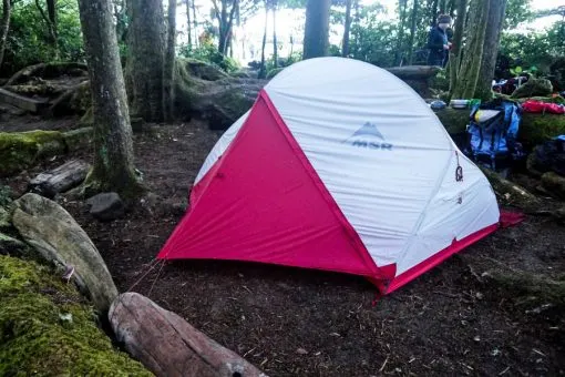
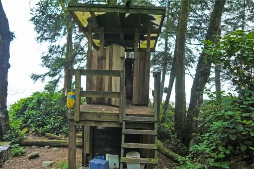
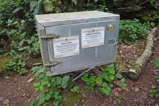
The 13 official campgrounds on the West Coast Trail are all located on the coast. Campsites do not have to be reserved. You can camp anywhere along the trail; you don’t have to camp in a designated campsite, campsites work on a first-come, first-serve basis. The official campsites all have certain facilities; toilets, a bear-proof ‘bear cash’ for food and rubbish storage, and access to fresh water from a little creek. At most campsites it is possible to camp on the beach, just make very sure you are above the high tide mark! Some of the campsites are in the forest, close to the beach. When it was raining I preferred pitching my tent in the forest over camping on the beach, getting less wet sand into my tent!


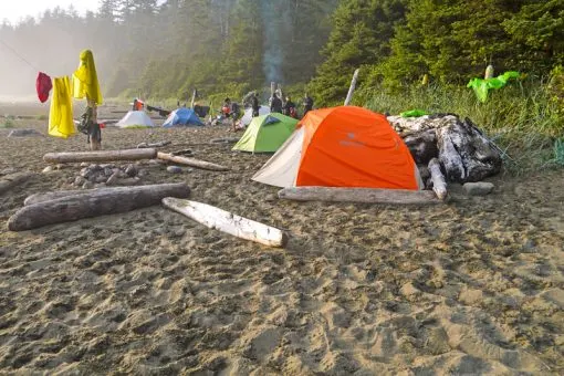
We made a big fire on the beach every night! Campfires are allowed on the West Coast Trail, but only on the beach. There is plenty of wood to make a fire, if you go during the rainy season some firelighters might make life easier. On rainy days drying all my stuff next to the fire was awesome, trying to get that smoke smell out of some of my clothes after the hike was not easy!


My favorite campsite on the trail was Tsusiat Falls where we had a big waterfall making for a great bathing spot, we saw some whales and orcas from where we were camping on the beach. Our first campsite on the south side, Thrasher Cove, offers a great sunrise.
There are two different paid campsites on First Nations Reserves; Ditidaht Comfort Camping near Tsuquadra Point and cabins and tents at Nitinaht Narrows.
If you do the shorter itinerary you can start or end your trip with a little more comfort by booking the Ditidaht First Nation’s Comfort Tents at Tsuquadra Point. You will stay in canvas wall tents with a wood-burning stove with firewood, cots, a table and chairs, and an outdoor deck with great views of the Pacific Ocean. The Ditidaht First Nation maintains these facilities. If you start or end at Pachena Bay you can book a night at Huu-ay-aht First Nation’s Pachena Bay Campground, owned and operated by the Huu-ay-aht First Nation.
Toilets on the West Coast Trail
There are toilets at each of the 13 official campsites. Toilets are sustainable, long drop, compost toilets on a platform with a ladder. After using you throw in some wood chips that keep the smell down and help in the composting. Don’t throw anything besides body fluids and your toilet paper in the toilets. The facilities were well maintained, but not as fancy as the long drop toilets in the neighboring Juan de Fuca trail, this trail was free to do. We were very impressed by hiking the Juan de Fuca the toilets had hand sanitizer and toilet paper. There is no toilet paper on the West Coast Trail, remember to pack your own.


Bears on the West Coast Trail
The West Coast Trail is in Bear country, it is mainly black bears that live in this area. Bears hibernate in winter and from mid-March through summer they leave their dens to find food. There is a lot of pair scat on the trail and you have a good chance of seeing them, for most tourists, this is an exciting prospect! I only ran into one black bear on the trail, it was on the beach and I had to wait about 20 minutes for the bear to go back into the forest. I have often heard that a mom with cubs is dangerous, statistics however prove this theory passed as fact wrong, solitary males are responsible for the biggest portion of the few bear attacks that take place. Off course, these animals can be dangerous, but there has only been a handful of bear attacks in BC over the last 20 years. You have a much bigger chance of getting killed in a car accident on the way to the hike. Put your food and garbage in a bear-proof container (bear cache) at the campsite. Don’t leave your garbage there, you are supposed to carry it with you.
What to do if you see a bear (regional parks) – stay calm, speak to the bear in a calm voice, back away slowly, don’t run – the bear is faster than you, take out bear spray and know how to use it, if attacked use bear spray and fight back!


Food on the trail
Packing food for this trail was a pleasure since we had access to a hiking store selling awesome dehydrated camping meals in Vancouver, a bit more pricey, but light, filling, and delicious! everything you want from camping food.
- Breakfast – 2 packs of instant oats, coffee
- Lunch – a protein bar (68 grams)
- Dinner – Dehydrated meals x4 – A dehydrated meal (2 servings) each is a good meal for one person after a long day of hiking. X1 noodles and tuna.
I am a serious coffee junkie and made awesome coffee twice a day with my trusty Aeropress.
To boil water for coffee and prepare meals I carried a little gas stove and one 450-gram propane canister.


Drinking Water on the West Coast Trail
There are many water sources along the way and carrying one water bottle per person should be sufficient. Every camp on the west coast trail had a river or at least a little creek with running water close to the camping area. It is recommended by the official government website that drinking water is boiled, treated, or filtered before drinking, do this if you want to be safe. I carried a Lifestraw filter bottle, which is great, fill the bottle and drink through the powerful filter straw. We also had an MSR filtration pump, which works well, but hard work to filter the water. Chlorine tablets are easy to use, this is cheaper but tastes terrible. My opinion is that the water is good quality, running water with slight discoloration due to tannins from foliage. The official site says to sterilize the water, so to be safe this is probably the way to go. Don’t get drinking water directly downstream of a busy campsite.
Accommodation
There are plenty of accommodation options to suit your budget in Port Renfrew and Victoria.
Victoria
- Ocean Island Inn – good price, in the city center, good rating
- The Bedford Regency Hotel – a bit more luxury, in the city center, good rating
Port Renfrew
- On a Budget – You can camp at Port Renfrew if you are on a budget.
- Trailhead Resort (economy cabins)
- Wild Coast Chalets (good rating, 400m from the town center)
West Coast Trail Cost
The West Coast Trail 2023 prices for the 6-day/5 night hike. $CAD 579.50
FEES 2023
- Registration – $CAD184 (payable upon registration)
- Break up West Coast Trail Overnight Use Fee: $160 and two ferry crossing fees, Gordon River: $28 and Nitinat Narrow: $28, reservation fee is $25.75
- Pacific Rim Park Permit – $CAD 52.50 payable at the orientation
- Food – $CAD20 per day pp – $120
- Transport – $CAD60 + $CAD120 = $CAD156 with return discount
- Bear spray – $CAD55
- Stove Gas – $CAD12
West Coast Trail Itinerary
Maps and elevation profiles were generated with a Garmin Fenix 5 GPS Watch
Day Zero – Vancouver to Victoria
Take a ferry from Vancouver (Tsawwassen Ferry terminal) to Victoria (Swartz Bay Ferry terminal). Take a public bus from Swartz Bay to Victoria. Overnight in Victoria.
Day One
Thrasher Cove to Camper Bay
Port Renfrew, Gordon River Access, Thrasher Cove


- Starting point – Gordon River Trailhead
- Finishing point – Thrasher Cove
- Trail Marker 75km to 70km
- GPS Distance – 6.8 km
- Forrest walk
- Total Time – 2 h 55 min
- Moving Time – 2h
- Total ascent – 405 m
- Total descent – 416 m
Highlights of the Day
- Starting the trail and climbing that first ladder.
- Arriving at the beach at Thrasher Cove and going for a swim (yip it is chilly).


At about 9 am I arrived at the West Coast Trail Information Center with the
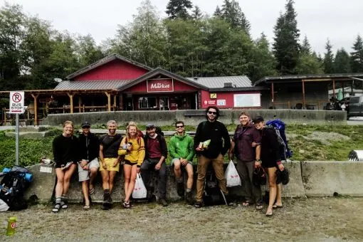
West Coast Trail Express from Victoria. The information center is located at the Pacheedaht Campground 5km after passing through the town of Port Renfrew. If you are driving from Victoria it is easy to find, just follow the highway signs to Sooke and/or Port Renfrew, from there are clear signs marking West Coast Trail.
Important – orientations are held at 10:00 and 14:00 daily and you are not allowed to start without attending this one-hour orientation. It was helpful, with lots of handy info. Following the orientation make your way over to the ferry that leaves at 8:45, 11:30 (to tie in with morning orientation), 13:30, 14:30, and the last ferry at 15:30. I almost missed the 11:30 ferry doing who knows what, after the orientation walk to the ferry! 🙂
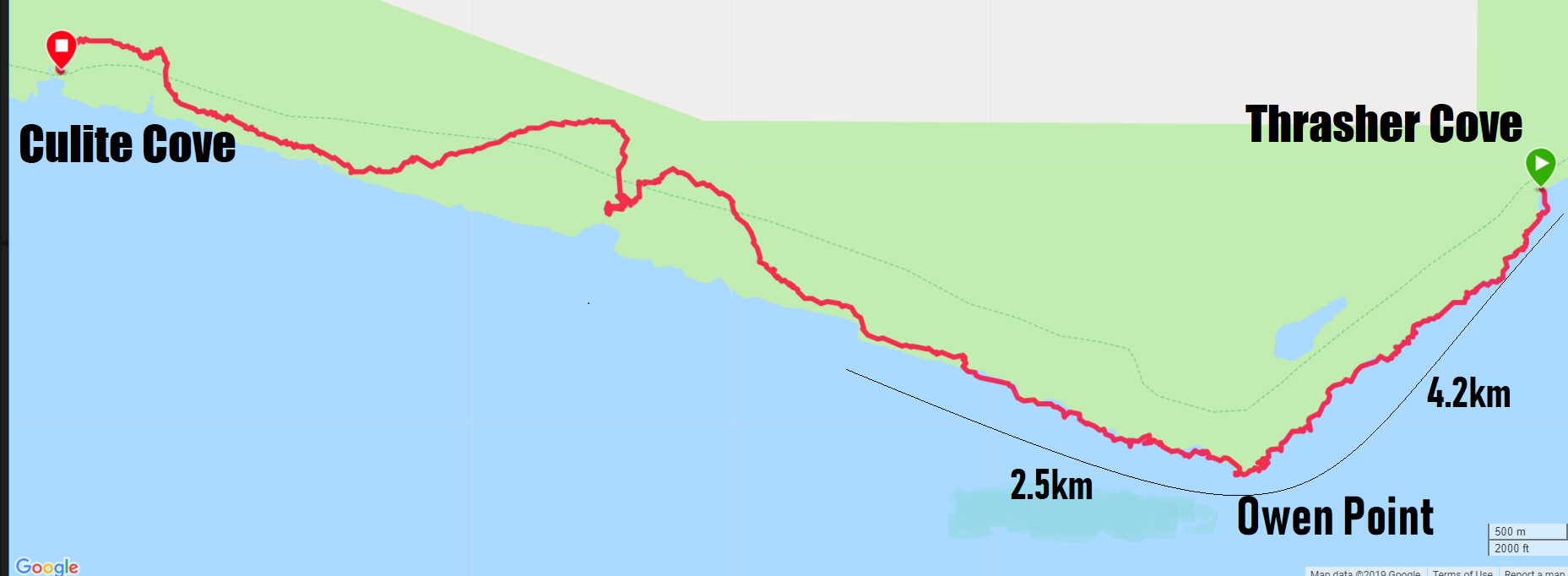
The trail kicks off with a ladder followed by a forested section with no ocean views until you get to Thrasher Cove. It is a good warm-up and you will get an idea of what the next three days are going to be like. This part was not too muddy. The last km to the camp was a steep downhill. Thrasher Cove is a nice campsite on the beach, first day to get some sand in my tent. The site was busy with campers heading north and south, it was nice talking to hikers on their last day! The campsite was a bit packed, but I managed to squeeze my tent in. It is a short day to Thrasher Cove, but the next 9km to Camper Bay is quite tough and slow. Continuing on the forest path is possible, but you are going to miss out on the caves on the beach at Owen Point. The sea caves can only be walked at low tide. If you are going to skip walking to Owen Point on the beach and continue to Camper Bay in the forest, I think walking this 15km on day one is not too hard.
Day Two
Thrasher Cove to Cullite Cove
Thrasher Cove, Owen Point, Camper Bay, Cullite Cove

- Starting point – Thrasher Cove
- Finishing point – Cullite Cove
- Trail Marker 70km to 57km
- GPS Distance – 16.90km
- Beach walk – 7km
- Total Time – 7 h 30 min
- Moving Time – 4h 38m
- Total ascent – 323 m
- Total descent – 324 m
Highlights of the Day
- The sea caves at Owen Point
- Orcas very close to the rocks
- The longest stretch of ladders up and down with Cullite in the middle!

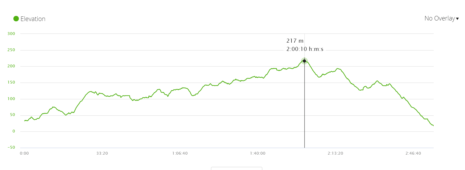
Thrasher Cove to Cullite Cove (16.9 km). This was the toughest day for me, the first 4 km to Owen Point and the sea caves took 4 hours. It is slippery and challenging climbing over big boulders, and logs and walking over rocks covered in seaweed, barnacles, and mussels. After leaving the sea caves there was a nice flat stretch next to the ocean on the rocks. I saw a pod of orcas here, they were very close to the rocks I could clearly see their faces and even hear the water exciting their blowholes! Unfortunately getting my camera out took a bit longer! The remaining 9 km or so to Cullite Cove was also slow in thick mud walking on a rainy day with a couple of ladders. I must admit in the last 5km up to Cullite Cove I did think once or twice ‘I wish I stopped at Camper Creek’. There is a handful of ladders that takes a while to climb down to Cullite. This was a small campsite and my least favorite. Thrasher to Cullite was a long day taking 7 hours, there were a couple more hikers doing this same stage so it is very doable. I arrived a bit late at Cullite and did not find a nice spot to pitch my tent, the small site was packed, and the beach here is covered in big rocks, not great for camping, it was just very full. If you arrive early enough to pick a spot there are some spots with nice views. I would recommend that you take the beach way, not the forest to Owen Point, the sea caves and orcas I saw on this route were a definite highlight on the West Coast Trail!
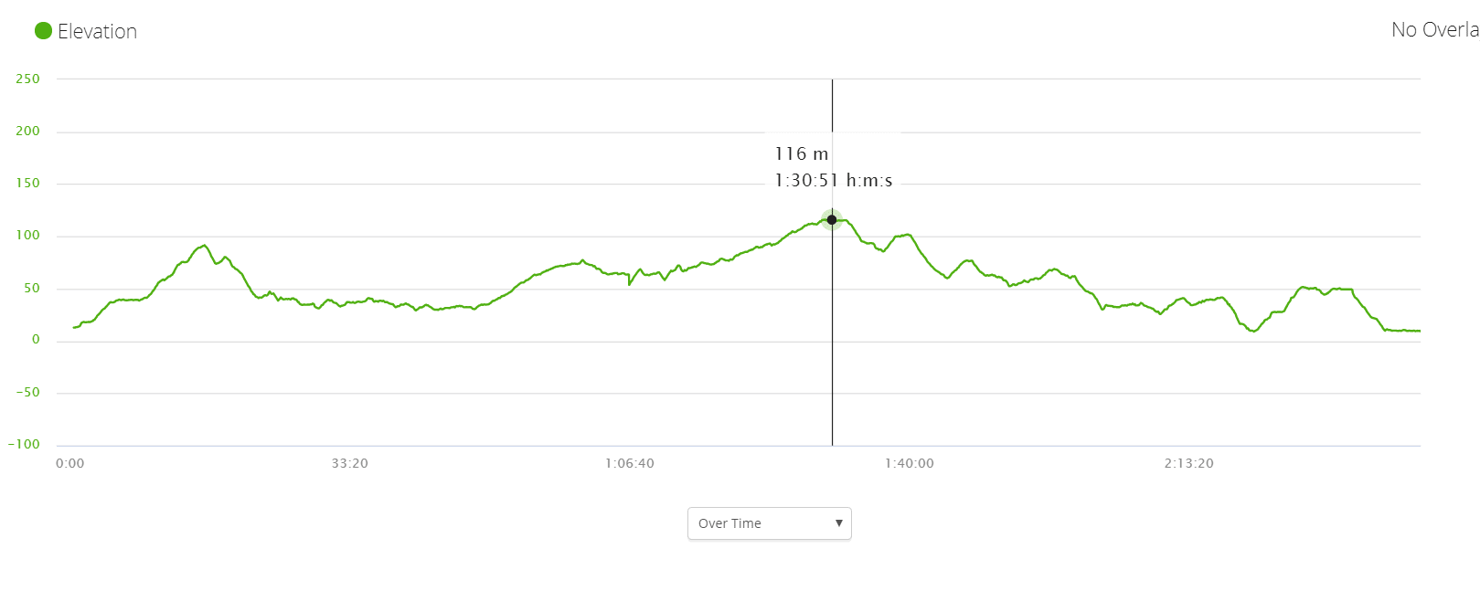
Day Three
Cullite Cove to Cribs Creek
Cullite Cove, Walbran Creek, Bonilla Point, Cribs Creek


Starting point – Cullite Cove
Finishing point – Cribs Creek
Trail Marker 57km to 42km
GPS Distance – 19.6km
Beach walk – 10km
Total Time – 6 h 37 min
Moving Time – 4h 57m
Total ascent – 351 m
Total descent – 266 m
Highlights of the Day
Long beach walk
Nice waterfall at Bonilla Point
First cable car crossing


It was a long day that started tough and messy, but with a lot of beach walking, the sun coming out and some great views turned into a great day! Getting out of Cullite Cove/Cullite Creek campsite kicked off with a steep climb, 6 ladders. There is a cable car at the start of the day, but I did not use it, the water was shallow and I managed to jump from rock to rock across. It was a rainy day for me and another tough first six kilometers with pools of mud, from Walbran Creek I was very happy, the sun came out and about 10km most of it walking on the beach to Cribs Creek. About 5km from Walbran Creek at Bonilla Point there was a very nice waterfall, this is a good campsite and was a great place to stop for lunch.
I used my first cable car at Carmanha Creek, I ran into a lady that crossed with me and we had some help from other hikers, the cable cars are fun when they are flying down to the middle, from there it is hard work to pull yourself across and much easier if you have help from another team! When you leave Carmanha Creek there is a spot called Chez Moniques around km44 that sells burgers and beer, it was unfortunately closed when we passed here. I had to do a little bit more through the forest and passed the Canadian Coast Guard Lightstation Carmanah Point. Cribs Creek is not a very well-rated campsite, but I liked it with its soft sand, and lots of space and it is the last campsite before the ferry crossing and the crab shack.
Day Four
Cribs Creek to Tsusiat Falls
Cribs Creek, Dare Point, Nitinaht Narrows (ferry crossing), Tsusiat Falls


- Starting point – Cribs Creek
- Finishing point – Tsusiat Falls
- Trail Marker 42km to 25km
- GPS Distance – 19.9km
- Beach walk – 11km
- Total Time – 5 h 51 min
- Moving Time – 4h 51m
- Total ascent – 318 m
- Total descent – 336 m
Highlights of the Day
- A long walk on nice, firm sand
- Otters
- Whales
- Best Beach campsite
- Great Waterfall for swimming

My longest day, but great hike! I walked for 11km on nice firm sand and the 8km in the forest was not too muddy. Today’s walk was really beautiful on the rocks and the sand, we spotted a couple of whales and saw 5 sea otters from very close. At Nitinaht Narrows, I stopped at the crab shack for a beer and lunch. The ferry service is from 09:30 to 16:30 and is included in the registration fee. Lunch and beer is not and it is pricey! A crab goes for $CAD25, a beer for $CAD8, and a melted cheese for $CAD8, I did not care too much. The campsite at Tsusiat Falls is a favorite for good reason, there is a lot of space on the beach and the waterfall is amazing, the water was not freezing and made for the best swim on the trail! Tsusiat Point is only passable at tides below 2.7m, make sure about this on the beach walk, we almost missed the cut-off and were scrambling over the rocks with a rising tide!
Day Five
Tsusiat Falls to Michigan Creek
Tsusiat Falls, Tsocowis Creek, Darling River, Michigan Creek


- Starting point – Tsusiat Falls
- Finishing point – Michigan Creek
- Trail Marker 25km to 12km
- GPS Distance – 13.3km
- Beach walk – 8km
- Total Time – 3 h 50 min
- Moving Time – 3h 20m
- Total ascent – 160 m
- Total descent – 190 m
Highlights of the Day
- Black Bear on the Beach
- Orcas
- Humpback Whale
- The long cable car ride
- Walked most of the day on the beach


This was a short day and a really nice one. 8km of the 13km was on the beach and I saw a variety of animals. A black bear made me wait for about 20 minutes on the beach while it was scavenging, it was a great chance to sit and watch it. I thought Michigan is a great campsite, you can camp on the beach or in the forest, but still with a nice beach view.
I had a long cable car ride that was fun, see the video below. I camped in the forest since I tried to get the minimum sand in my tent on the last night. The view from our camp was great and we saw orcas and whales. We made a massive bonfire on the beach. I got to Michigan early, but it became busy later since it is the last campsite before the Pachena Bay trailhead.
The cable cars were interesting, you have a fun ride across the river until about halfway through when you come to a stop and pull yourself across. This is hard if you are alone. If you are two teams helping each other to pull the cable car across makes it much easier! There are 4 cable cars on the trail, I only used two, the water level was low enough to skip across the river on rocks with the other two rivers
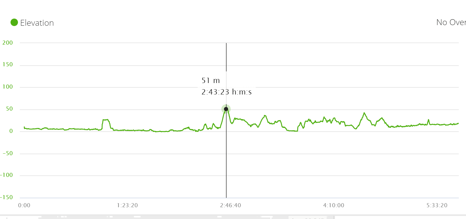
Day Six
Michigan Creek to Pachena Bay
Michigan Creek, Pachena Bay


- Starting point – Michigan Creek
- Finishing point – Pachena Bay
- Trail Marker 12km to km zero
- GPS Distance – 11.76km
- Total Time – 2 h 40 min
- Moving Time – 2h 30m
- Total ascent -356 m
- Total descent – 346 m
Highlights of the Day
- Getting a taxi to Bamfield
- Hamburger and a cold beer

Some mud and obstacles, but an overall easy day, everybody was now just walking to finish. The turn-off to the Pachena lighthouse is located about 2.5 km from Michigan Creek. A nice lighthouse with a beautiful lawn in the middle of the forest. In season you can spot whales from here. Pachena Beach is a beautiful place to end, 5km from the town of Bamfield. You can walk or ask at the parks office that they call a taxi to take you to Bamfield. The Trailbus stops at both Pachena Bay and Bamfield, but I finished more than 3 hours before the bus came and it was great to sit and wait in a restaurant!
West Coast Trail or Juan de Fuca Trail?
The West Coast trail and Juan de Fuca trail are two multi-day coastal hiking trails starting very close to one another outside the town of Port Renfrew and running in opposite directions on the west coast of Vancouver Island, British Columbia, Canada. Since the two trails are so close to each other on the same coast I thought they would be almost identical, but they are not.
The two trails both have one end close to the town of Port Renfrew but do not share a trailhead. The West Coast trail starts at the Gordon River trailhead outside Port Renfrew on its southern end stretching north for 75km to the town of Bamfield. The Juan de Fuca trail starts at the Botanical Beach trailhead outside Port Renfrew making its way south for 47km next to the coast to the China Beach trailhead.
I hiked the two trails a week apart, both offered spectacular scenery.
- A longer trail with plenty of obstacles the West Coast trail was much more challenging than the Juan de Fuca. Make sure you are physically in good shape and mentally prepared for a week of mud and rain, it is very possible.
- The West Coast trail offers a lot more walking on the beach than the Juan de Fuca. The Juan de Fuca walked 5.2 km on the beach 11% of the trail, compared to the West Coast trail with 48% walking on the beach, 38km out of 75km total.
- More animals on the West Coast trail than on Juan de Fuca, I saw black bears, orcas, whales, sea otters, and deer on the West Coast, but we did not see any of these on the Juan de Fuca, it is, however, possible to see them on both trails.
- Juan de Fuca is a mix of forest and beach campsites, On the West Coast trail you can camp on the beach every night.
- The Juan de Fuca is much cheaper at a total cost of $CAD150 compared to the West Coast trail at $CAD517
- The Juan de Fuca trail is open all year, while the West Coast trail is only open in season.
- The West Coast trail has to be booked long in advance with limited spaces, the Juan de Fuca no booking is necessary.
- Unlike the West Coast trail which has a fixed distance and trailheads, there are many starting and ending options for the Juan de Fuca, planning a trail that suits you.
More Hiking Options
There are some amazing hiking options in British Columbia, check out the Best Hikes in Vancouver post for some amazing day hikes and multi-day trails around this beautiful city. Challenge yourself by doing the Grouse Grind, a steep hike up Grouse Mountain in Vancouver city center. Garibaldi National Park near Whistler has more than 90 km of well-marked trails in the mountains. The hike to Garibaldi Lake and the Black Tusk are two of the challenging hikes in the park. Hiking to the peaks of the Stawamus Chief in nearby Squamish is another fantastic route not to miss. Going more north in Canada, the hiking in Banff National Park in Alberta is spectacular, with many amazing trails for all skill levels.
Packing List for the West Coast Trail
You will carry your tent, food, and all gear and supplies needed for this 6-day hike. Since the trail can be challenging, what you pack and how you carry it will play a big role in the success of your hike and in how much you actually enjoy your time on the trail. You will almost certainly get some rain on the way and a lot of rain is possible. Climbing over obstacles, up and down many ladders, and hiking on mud and sand with a backpack is tiring. For me, the two most important considerations when packing is keeping your pack light and waterproof! See our Complete Guide to Pack for the West Coast Trail.
Questions or Comments?
Got any questions or comments? We would love to help! All questions and comments will be answered by us personally in Buy Me a Coffee. Click below and ask away.
Feel free to support our site by buying us a coffee!
Like this post? Pin it!


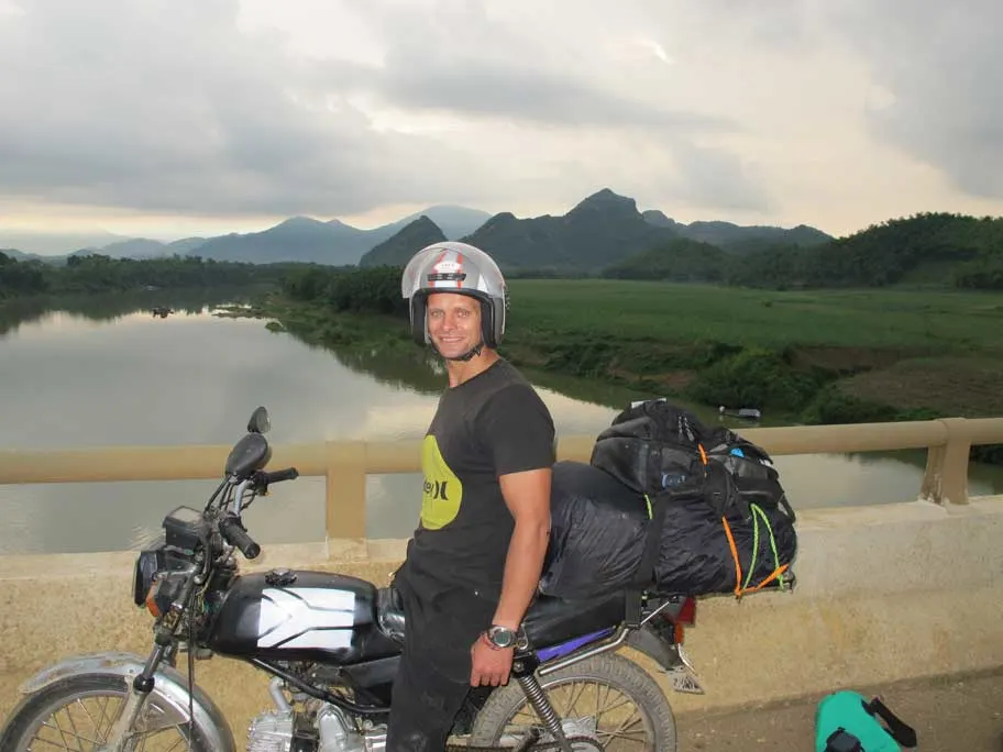
The strong half of Stingy Nomads, a nomadic aquaman that would be happy to spend all his life in the water diving, surfing and spearfishing but often has to compromise with Alya and go hiking instead. Campbell is responsible for all our marine adventures and following them with write-ups. He loves traveling, braai (BBQ in South Africa), red wine and spending the day in a wetsuit.
Kevin
Wednesday 1st of March 2023
"nobody parks at the Pachena Bay trailhead since the gravel road to the trailhead is not good and difficult to navigate"
Is this still the case? Any updates on that route? Is it still best to avoid even with a 4x4? Logistically, it may be the best option for transportation in and out with one car.
I can't seem to find updated info on that. Thank you so much for this guide. It has been a valuable resource for me. Cheers to you!
Stingy Nomads
Monday 6th of March 2023
Hello Kevin, thanks for reading. As far as I know, this is still the case. You will be able to drive it, but it is slow driving with very little sign for directions. I think taking the bus from Port Renfrew to Pacheena Bay is still the best way to go. Safe Travels!
Sebastian Arndt
Sunday 22nd of May 2022
I always love your hike reports since they provide me with all the necessary information. I just found a free spot for the 25th June on the West Coast Trail. Only this day is available. Is that enough to book the trail or do I need to have the whole 5 days I want to spend on the trail displayed in green?
Stingy Nomads
Monday 23rd of May 2022
Hello Sebastian, as I understand it, the available dates are according to your specifications, so if you picked your group size and the amount of days you want to hike, the available starting days are according to those criteria. A green day means the whole trail is available to hike if your group books to start on that day according to your criteria. Under backcountry experience select 'entry points' As you make the booking you should be able to see for what dates, group size and entry points you are making a reservation before making a payment. Enjoy the trail!
Kent Warnica
Sunday 22nd of August 2021
Inspired to me to get new boots : work em in and do it
candace
Wednesday 14th of April 2021
fabulous
Natascha
Friday 5th of June 2020
The first time I heard about this trail - but it looks amazing. I love long distance walks along the coast! And I love camping at the beach! So this walk seems perfect! Hopefully flights and travel will be back to normal soon.
Stingy Nomads
Sunday 7th of June 2020
Hello, Natascha! The West Coast Trail is an amazing route with stunning scenery and diverse wildlife. If you like walking along the coast and camping on the beach you'll definitely enjoy the trail. We can't wait when we can go hiking and camping again! Hopefull it happens soon! Stay safe!